NJ weather: Foggy and wet Thursday, turning icy and colder Friday
The Bottom Line
A slow-moving cold front will drive a large variety of weather conditions through New Jersey over the next 36 hours. From warm to cold. From foggy to clear. From wet to icy.
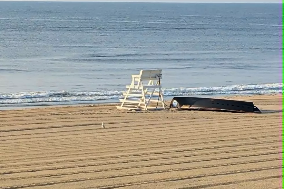
As you might guess, the ice is the most precarious weather situation we'll talk about here. This is not a snow storm. Freezing rain and sleet can get messy in a hurry, making both driving and walking conditions slick and treacherous.
In this forecast, I want to focus on two things. First, the timeline, so you can plan your Thursday and Friday accordingly. Then, running down my biggest concerns, ranging from ponding to icing. There is some fuzziness here, as the exact precipitation type and impacts will depend on the exact temperature at the time. Still, I'm staunchly avoiding hyperbole here, just painting a realistic picture of how this potentially messy situation will play out.

Timeline
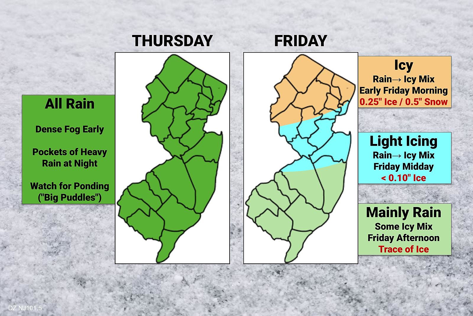
—Thursday Morning... The intrusion of warmer, wetter air (in contrast to the cold snow cover on the ground) has caused some dense fog to form across NJ to start Thursday. Visibility may dip below a quarter-mile through late morning.
—The Rest of Thursday... Scattered light to moderate rain will sweep through the state throughout the day. Nothing crazy, nothing heavy, just rain. Umbrellas up.
—Thursday Evening (after about 7 p.m.)... Rainfall will become steadier, more widespread, and heavier overnight. Temperatures should spike into the 50s around Midnight.
—Friday Early Morning (after about 5 a.m.)... Temperatures will start to tumble in North Jersey, forcing a transition from plain rain to icy mix (freezing rain, then sleet). Slippery spots are likely. Winds may also gust over 20 mph as the cold arctic air returns.
—Friday Midday (after about 10 a.m.)... Freezing line will drift south of I-78 toward I-195, potentially bringing icy mix into Central New Jersey.
—Friday Afternoon (after about 2 p.m.)... Eventually, the southern half of New Jersey will fall below freezing too. It will happen very close to precipitation ending, so little to no ice accumulation is expected.
—Friday Night... Temperatures will bottom out around 20 degrees. A "flash freeze" is possible, where all puddles and wet surfaces freeze solid.
—Saturday... Back to the freezer. It will be sunny, dry, breezy, and cold. High temperatures will only reach the upper 20s or so.
Big Concerns
—Fog... Fast Traffic is already reporting numerous accidents across New Jersey , as drivers go too fast given the poor conditions. Visibility will be low throughout the state throughout the morning. A Dense Fog Advisory is in effect until 10 a.m. (NE NJ) or 11 a.m. (most of the state).
—Ponding... Heavy rain is expected Thursday night through early Friday morning. On the order of 1 inch (south) to 2 inches (north). Big puddles are likely. Especially given the massive snow melt about to take place. And especially since many storm drains are still blocked by snow and ice.
—Icy Mix... While I'm still not comfortable calling this a legit "ice storm," light to moderate ice accumulations are expected Friday due to freezing rain and sleet. (Very little snow is going to fall here.) The most precarious section of the state will be to the north, along and above Interstate 78. That's where I highlight the chance for about a quarter-inch of ice. (It doesn't really sound like it, but that's a lot.) Colder Sussex County could see even a bit more than that, along with some sleet and snow accumulation on top. Between I-78 and I-195, light icing (less than a tenth of an inch) could make things suddenly slick. And I wouldn't rule out some late-day slippery spots in South Jersey, although this storm system will be mainly a rainmaker there. A Winter Weather Advisory covers six counties in northern NJ: Sussex, Warren, Morris, Passaic, Bergen, and Essex.
—Flash Freeze... A hard freeze will settle in Friday night. Temperatures will drop below 32 degrees before the abundant puddles and wet surfaces from the earlier rainfall have an opportunity to fully evaporate or drain. So they will freeze into solid ice. And, in case you were unaware, ice is very slippery.
The Extended Forecast
We had been watching a nearby storm system in the Sunday night to Monday time frame. All models continue to show it diving well south of New Jersey, so I'm now comfortable calling it a "miss".
In fact, several near-misses are expected throughout next week. But it looks like a pretty quiet week overall. The arctic chill lets up by midweek, with highs in the seasonable lower 40s. The next opportunity for a big chill and bigger storm wouldn't come until next weekend.
Ice is serious business. Be smart, keep vigilant, and stay safe out there. Remember you can always catch the latest weather and traffic info on the radio, every 15 minutes, around the clock.
Dan Zarrow is Chief Meteorologist for Townsquare Media New Jersey. Follow him on Facebook or Twitter for the latest forecast and realtime weather updates.
ICE IS NOT NICE: The science of sleet and freezing rain
7 New Jersey candle scents we need
Gallery Credit: Kylie Moore
New Jersey's smallest towns by population
Gallery Credit: Michael Symons
More From New Jersey 101.5 FM