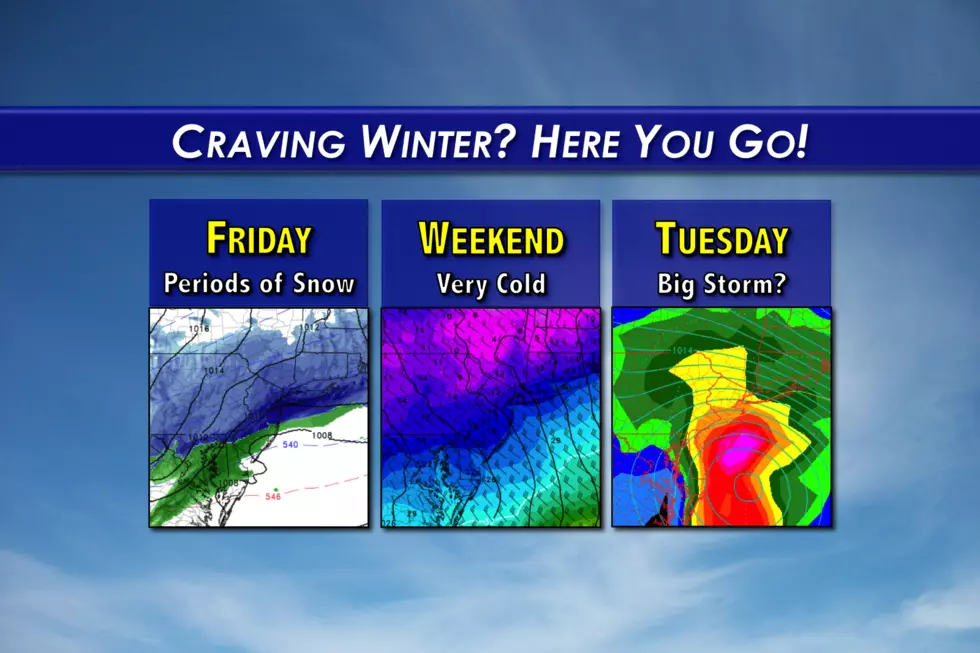
Snowy Friday, very cold weekend for New Jersey
A Winter Weather Advisory continues until early Monday afternoon, before frigid temperatures settle in for this second weekend of March.
Snow
Oh, hello Mr. Winter. It's good to see you again. The last time New Jersey experienced over an inch of snow was over a month ago, February 9. Mother Nature is giving the Garden State one heck of a winter blast, with snow and bitter cold throughout the forecast.
Friday's snow storm was late to arrive, but it's still on the way. And it's still looking like a snowy, wintry Friday, even though the early part of the commute has fared better than expected.
As of this writing, snow is filling in from northwest to southeast across New Jersey. Bursts of moderate to heavy snow will be possible through Friday late Friday, obscuring visibility and causing some quick accumulation. The fastest, biggest accumulations will be found on cold, grassy surface. Treated roads should remain mostly clear, as above-freezing temperatures will make road salt incredibly effective.
As a rule, I do not issue snowfall forecast maps once a winter weather event has begun. I'm still thinking we'll see accumulations of 2 to 4 inches for North Jersey, 1 to 3 inches for Central Jersey, and 0 to 1 inch for South Jersey. Some mixing with rain will be possible, especially south of Interstate 195.
A Winter Weather Advisory continues through early afternoon Friday for the northern half of New Jersey, from Mercer and inland Monmouth counties northward. An advisory is a "heads up" to potential travel issues caused by a low-end winter storm.
Snow will taper to showers through Friday afternoon, with skies beginning to clear after about 3 p.m.
Cold
Behind the snow will come the bitter, piercing cold. Thermometers will fall from the 40s to the 30s through Friday afternoon. And then we'll hit rock bottom around 20 degrees by Saturday morning. A stiff breeze will add a bite to the cold air, with wind chill ("feels like" temperature) values expected to dip into the single digits overnight.
You thought last weekend was cold? This weekend might be even colder! So much for an early Spring...
High temperatures on Saturday will be limited to around 30 degrees — yes, that means much of New Jersey will be stuck in the 20s all day. It will be blustery, with a brisk northwesterly wind persisting for at least the first half of the day. Skies will flip-flop between sun and clouds.
Sunday will be cold too, with highs only in the lower 30s statewide. That's almost 20 degrees below normal for mid-March, by the way. North Jersey looks mostly sunny, while clouds will plague the skies of South Jersey. As we end up on the northern fringe of a storm system, I can't rule out a few snow showers in far South Jersey sometime Sunday.
Monday stays cold, but otherwise quiet during the day. Partly to mostly cloudy skies will accompany high temperatures in the lower to mid 30s.
More Snow?
For several days now, forecast models have shown a significant winter storm in the Monday night to Tuesday time frame. I think it's time to start taking this potential seriously, as the chance of heavy snow and high winds is rising for New Jersey.
It's still too early to trumpet numbers and details, as there remains a great deal of uncertainty regarding this forecast. Double-digit snow totals are on the table. Damaging wind gusts are on the table. Coastal issues are on the table. However, I need to see a lot more consistency from model-to-model and run-to-run before putting together a more exact timeline and/or snow map for this system.
Is this "significant winter storm" a guarantee? Not quite. There's still a chance that the coastal storm tracks further east, keeping the greatest forcing off the Jersey Shore. I'm concerned about temperatures too, which may be too warm to sustain all snow (especially for southern and coastal NJ).
When will we know? By Saturday morning, we'll begin to piece together the forecast details, and I should then be able to elaborate on our "best case" and "worst case" scenarios. By that point, we'll be beyond Friday's snow. (My general policy is to only "work" one winter storm at a time.) And we will have a couple more model runs under our belt to assess the various solutions.
I don't want to get you too excited (or panicked) yet. But this one looks like one to watch, folks!
Dan Zarrow is Chief Meteorologist for Townsquare Media New Jersey. Follow him on Facebook or Twitter for the latest forecast and realtime weather updates.
More From New Jersey 101.5 FM


