

NJ weather: Quiet, cooler, and pleasant to start the week
The Bottom Line
Over the last week, New Jersey's weather ranged from unseasonably warm to incredibly wet. We do have some changes ahead for this last week of April, as temperatures cool to below-normal. Still comfortable though.
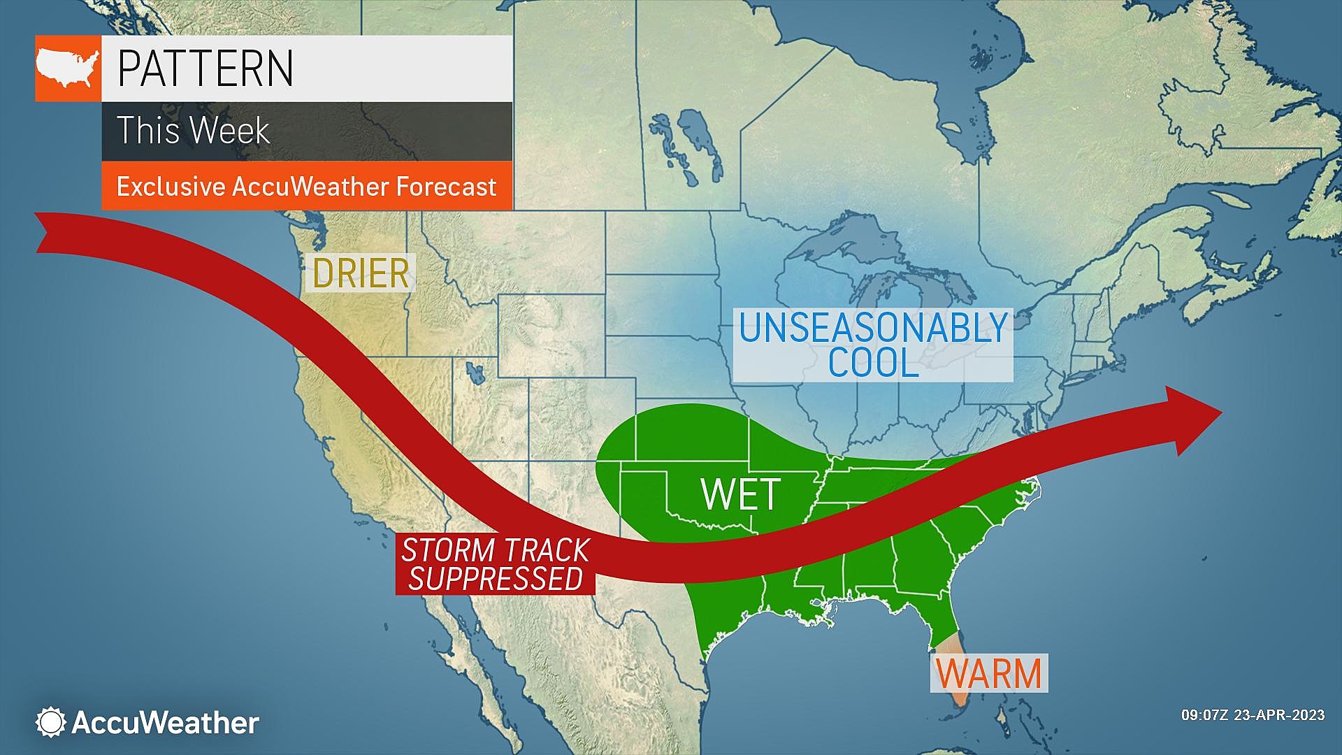
Hopefully we can keep the rainy weather momentum going, as we teeter on the precipice of drought. (Just over 7 percent of NJ — to the northeast — is in "Moderate Drought" as of last week.)
Rain chances coming up this week: Wednesday night, Friday, and Sunday.

Monday
It will be a pleasant and comfortable day, although temperatures will run about 5 degrees below seasonal normals. Technically, it will be our coolest day in about a week.
40s in the morning, near 60 in the afternoon. Cool enough that you'll be reaching for a jacket.
Skies will be bright on Monday, with sunshine and some fair weather clouds popping up. Dew points are dropping into the 30s, which means the air is nice and dry.
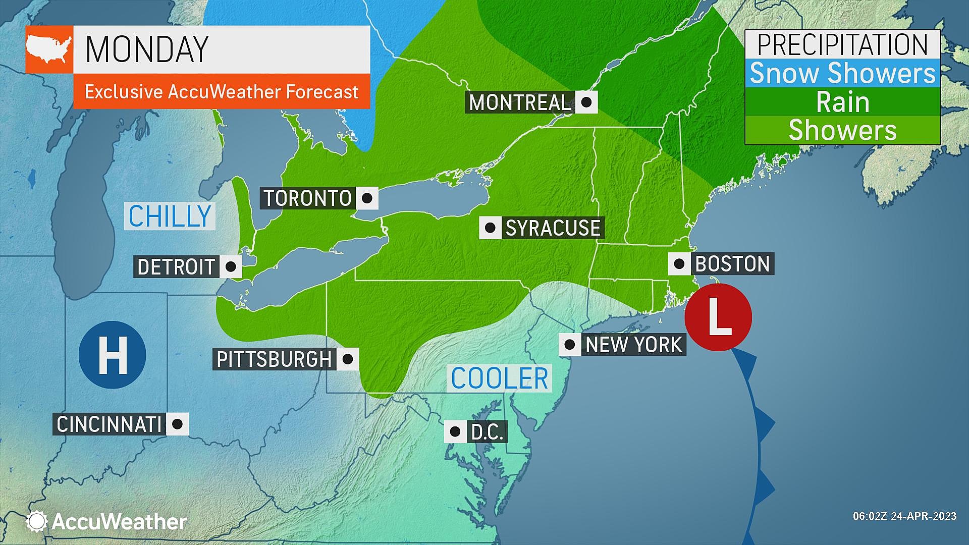
A couple forecast models paint a light shower — a sprinkle — over NJ's southern coast around midday Monday. There might be a few raindrops, but I think you can safely skip the umbrella. The forcing is too light and air too dry for anything steady or soaking.
Monday night will be quiet and chilly, with low temperatures averaging 40 degrees across the state. If skies are clear enough and winds are light enough, patchy frost may develop in the coldest corners of the state.
Tuesday
Almost a copy-paste of Monday.
The only differences are 1.) a completely dry forecast, and 2.) a lighter northwesterly breeze. That could allow for a more prominent sea breeze and marine influence along the Jersey Shore.
High temperatures should still be close to 60 degrees. Expect mostly to partly sunny skies.
Wednesday
Once again, Wednesday's high temperature will aim for 60-ish. But there will be some notable sky changes.
Clouds will increase through Wednesday morning. And then the arrival of a storm system Wednesday afternoon and evening will introduce spotty rain showers to the Garden State.
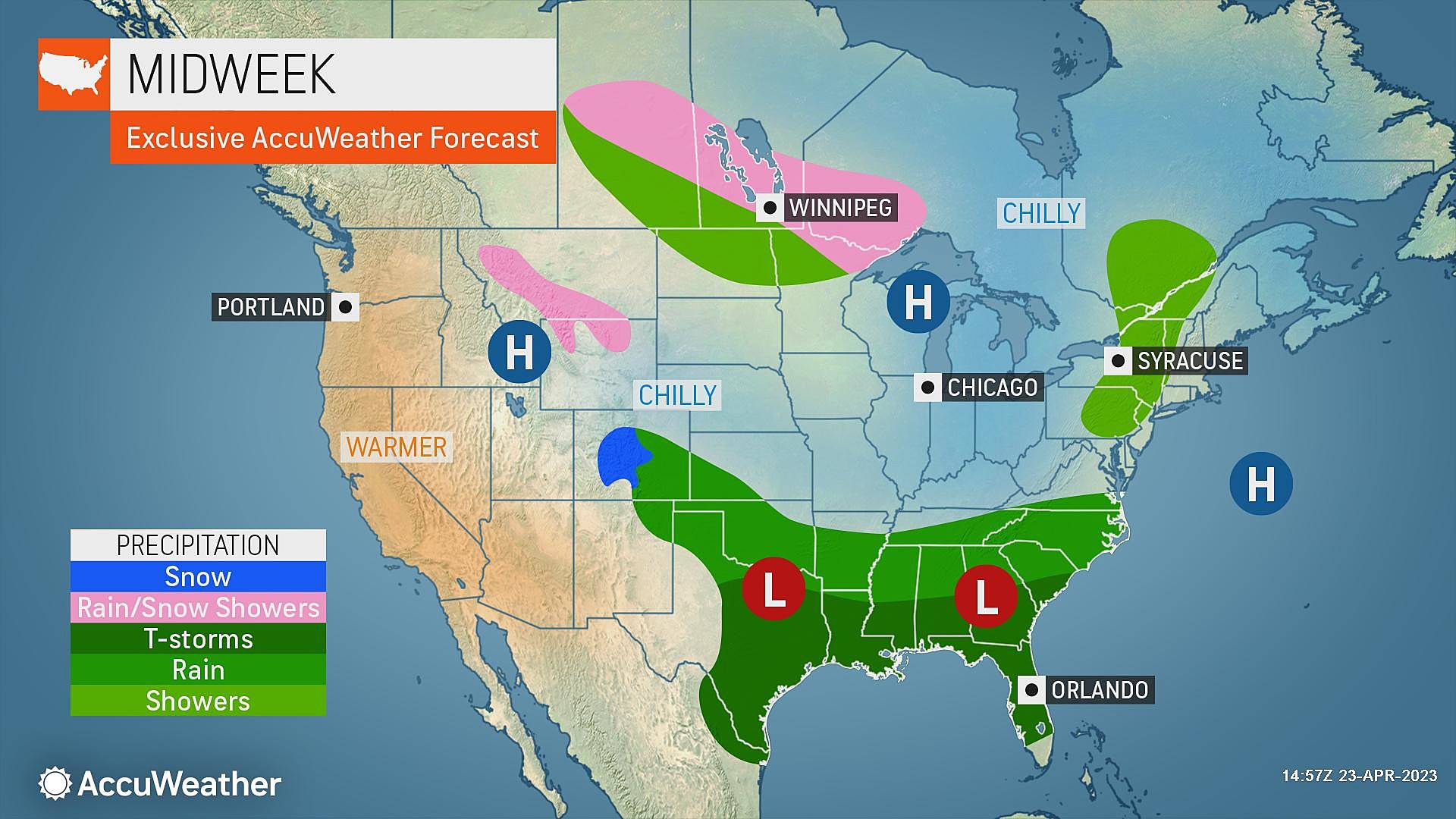
Everyone in the state will probably get wet at some point through Wednesday night. But rainfall totals will be light. The threat for thunderstorms, flooding rains, severe weather, etc. should be very low here.
Thursday
Showers may linger into Thursday morning. Then skies stay a bit cloudy and murky, with only peeks of sun during the day. Highs warm to about 60 to 65 degrees. However, the cool spot in NJ will be the Shore, as the light breeze blows off the ocean.
Most of Thursday looks fine. Another rain chance may develop starting around sunset, as our next storm system drives in. Guidance suggests the wettest period of weather will hold off until Friday.
Friday & Beyond
There are still a lot of question marks surrounding Friday's storm system: 1.) Will it impact all of NJ, or just the southern half? 2.) Will it rain all day, or be more on-and-off? 3.) How will rain and clouds affect temperatures?
At the moment, I'll say Friday looks cloudy, breezy, wet, and cool with highs only in the 50s.
Saturday stays rather "blah" but mainly dry. Highs should push back toward the "status quo" 60-degree mark.
And then Sunday warms into the 60s, before a strong cold front arrives late-day. That will be our next chance of a widespread soaking. If it's warm enough — i.e. if enough energy builds in the atmosphere — there could be some severe weather and flooding concerns to talk about there.
Dan Zarrow is Chief Meteorologist for Townsquare Media New Jersey. Follow him on Facebook or Twitter for the latest forecast and realtime weather updates.
The 30 best rated schools in New Jersey
Gallery Credit: Erin Vogt
The 30 worst rated schools in New Jersey
Gallery Credit: Erin Vogt
More From New Jersey 101.5 FM


