

Mixed weather news for the weekend for NJ: Some showers, some sun
The Bottom Line
As we have discussed all week, there is only one "speed bump" in this forecast. And that is Saturday, which turns a bit unsettled. There will be clouds and two waves of showers around. But there will be extended periods of dry weather too.
Every other day for the next week looks reasonably pleasant. Temperatures will flip-flop between the cool 60s and the seasonably warm 70s.

Friday
Before I jump into the forecast, let me express some special excitement. The Jersey Shore Report is back, baby!
Friday will be a little cool to make it a beach day. But OK weather overall.
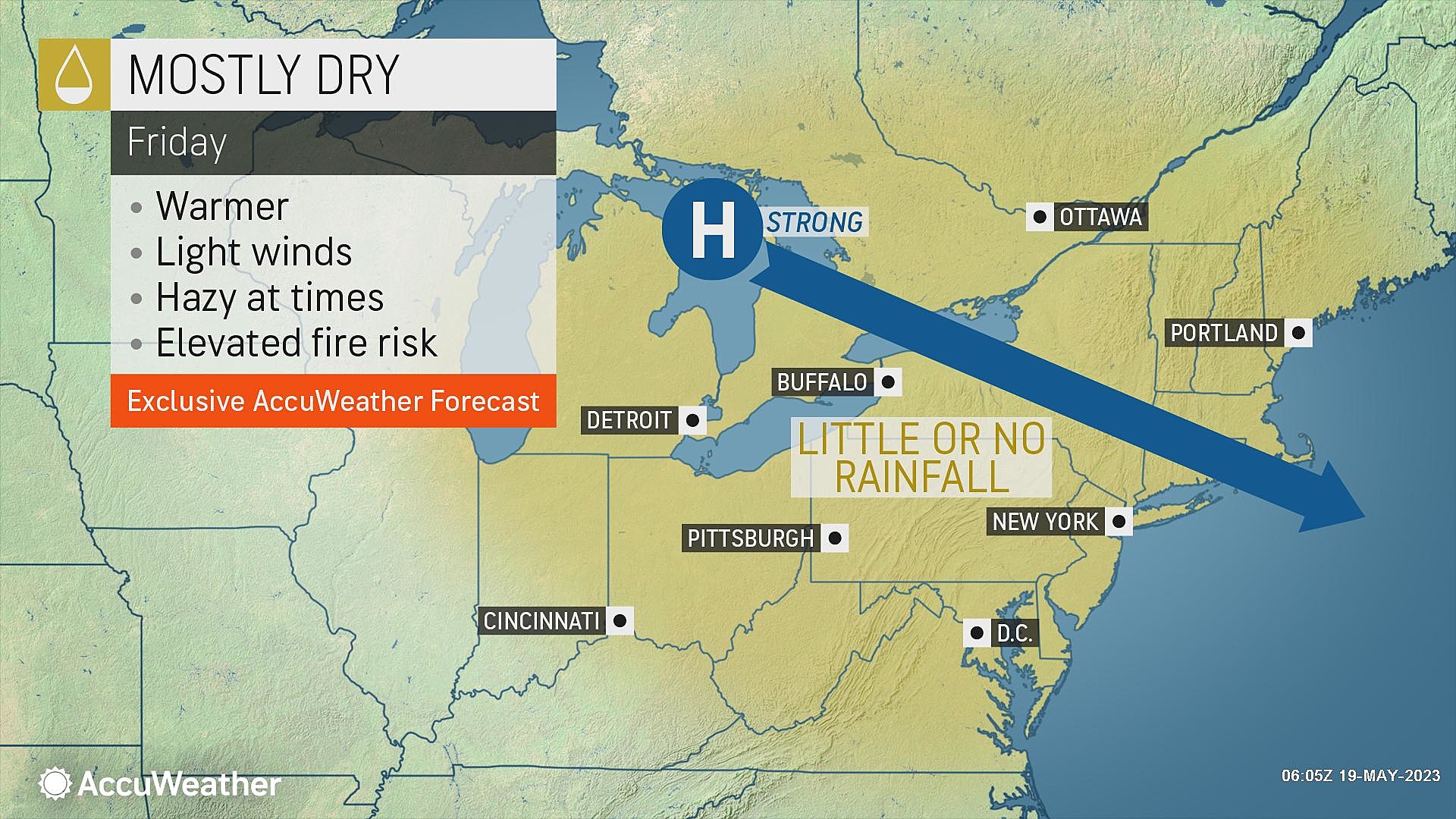
Clouds are streaming in from the south Friday morning. So we lose the brilliant blue sky. But it will still be a bright day, with alternating periods of clouds and sun. (Probably brighter to the northwest, greyer to the southeast, in general.)
An approaching coastal storm system will switch our wind direction, to blow out of the southeast. That is an on-shore breeze — therefore, a cool breeze for NJ's beach towns.
So the Shore will be the cool spot in the state today, struggling to reach the 60s. Farther inland, we will make a run for 70 degrees.
I can't rule out a sprinkle clipping the coast at some point Friday afternoon. But most of New Jersey will stay completely dry Friday.
Friday night looks quiet and comfortably cool, with lows in the mid 50s.
Saturday
Two storm systems will potentially produce two rounds of showers in New Jersey on Saturday:
1.) The aforementioned coastal storm system will push a band of rain along the eastern edge of New Jersey between daybreak and lunchtime Saturday.
2.) A cold front will push a round of spotty showers from northwest to southeast from about dinnertime through midnight. This band of rain may fizzle quite a bit before reaching the coast.
So everyone has the possibility of getting wet on Saturday, mainly early and late. But rainfall will be limited, no more than one or two tenths of an inch.

In between raindrops, it will be mostly cloudy. And it will feel pretty humid, as dew points surge into the 60s.
High temperatures will be highly dependent on cloud cover and rainfall. Along the coast, we'll probably see mid 60s. Farther inland, mid 70s are a possibility.
Sunday
Easily the nicer day of the weekend.
Skies will become mostly sunny Sunday morning, as we stay dry all day.
High temperatures will push into the warm mid 70s. Even the Jersey Shore could hit 70s, if the northwesterly breeze is strong enough. (Barrier islands excluded — it is almost always cooler there in the springtime.)
Monday
A few extra clouds will come into play, but our weather will stay beautiful for another day. High temperatures will once again aim for the 70s. 80 is a possibility to the southwest.
The Extended Forecast
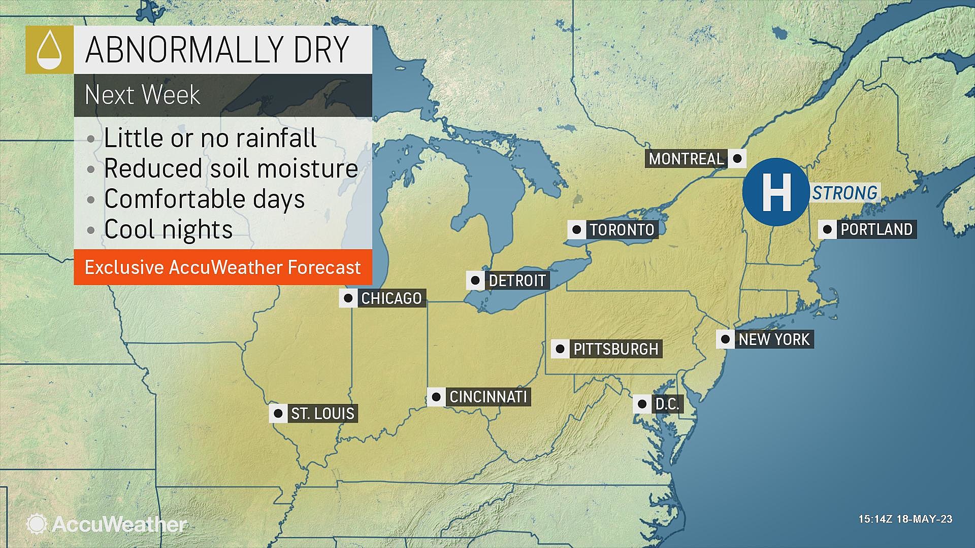
All week, I have discussed the possibility of a backdoor cold front introducing clouds and cooler temperatures for next week. And that still seems to be in the cards for Tuesday and Wednesday, as temperatures could get stuck in the 60s again along the Shore.
What happens after that is very much up in the air. The GFS model spit out some heavy, healthy rain next Thursday. But that is a new development, not backed up by any other model run at this point, so I do not put much stock in it.
Of course, how late next week plays out will have a big impact on our Memorial Day Weekend weather. Will it be springlike? Or summery? That will obviously be a big focus on our weather forecasting efforts next week — stay tuned.
Dan Zarrow is Chief Meteorologist for Townsquare Media New Jersey. Follow him on Facebook or Twitter for the latest forecast and realtime weather updates.
CHECK OUT: All the free beaches in New Jersey
Best coffee shops & cafes near NJ beaches
Gallery Credit: Jordan Jansson
More From New Jersey 101.5 FM


