
Two waves of stormy weather for NJ Thursday, as humidity ramps up
UPDATE as of 3 p.m. Thursday...
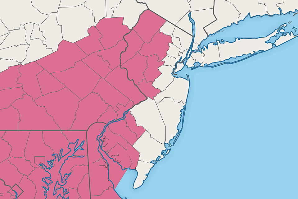
The Storm Prediction Center and National Weather Service have issued a Severe Thunderstorm Watch until 9 p.m. Thursday for 10 counties in western New Jersey: Sussex, Warren, Morris, Somerset, Hunterdon, Mercer, Camden, Gloucester, Salem, and Cumberland counties.
(Why not Burlington County? Likely a technicality in the way they drew the watch box.)
A watch is a formal heads-up that severe weather is expected to occur. Potential dangers include damaging wind, hail, and tornadoes.
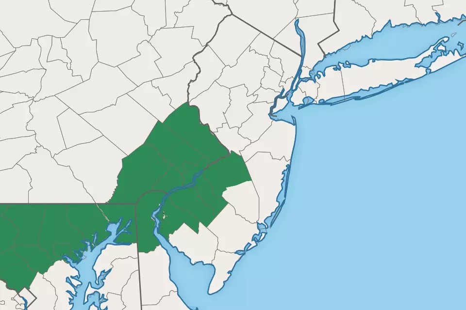
In addition, a Flash Flood Watch is posted until 10 p.m. for part of four counties in southwestern New Jersey: northwestern Burlington, Camden, Gloucester, and Salem.
This watch highlights the area most likely to see drenching rain. Since the soil is already saturated from Thursday morning's scattered rain, additional rainfall could lead to rapid ponding and flooding issues.
Storms will roll in from the west in the 4 o'clock hour, with the risk for strong storms lasting through about 9 or 10 p.m. Areas east of the two watch areas could still see some impactful thunderstorms later Thursday evening - but past sunset, they should weaken somewhat.
Please exercise extra vigilance and common sense when out and about Thursday evening.
ORIGINAL POST from 6:17 a.m. Thursday...
It's another potential severe weather day for New Jersey, as several rounds of thunderstorms come to visit. There is going to be a notable change in the air too, as humidity surges. That will lead to downright summerlike conditions through the first weekend of June, with rising temperatures on the way too.
I'm technically on vacation. But the weather never sleeps - so I've pieced together some quick bullet points about Thursday's thunderstorm threat. Here's what you need to know:
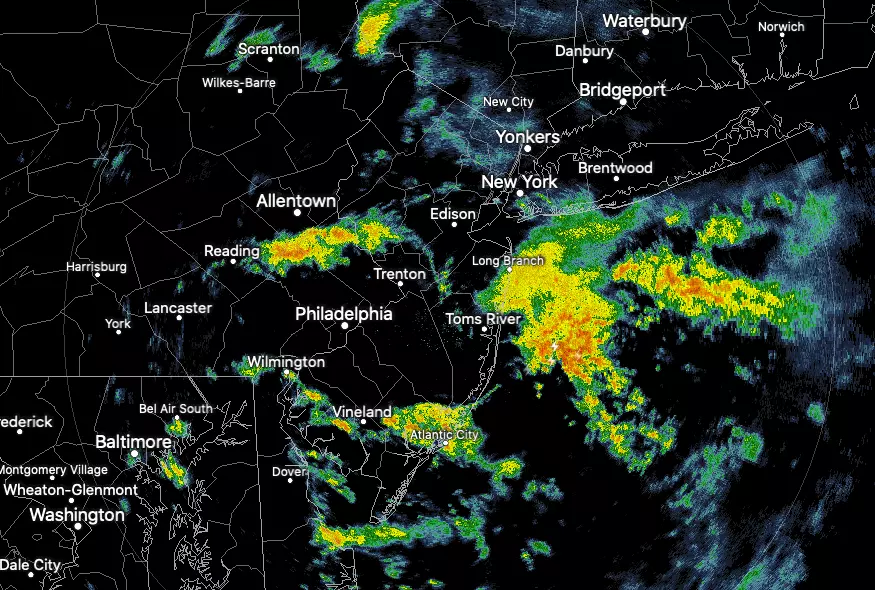
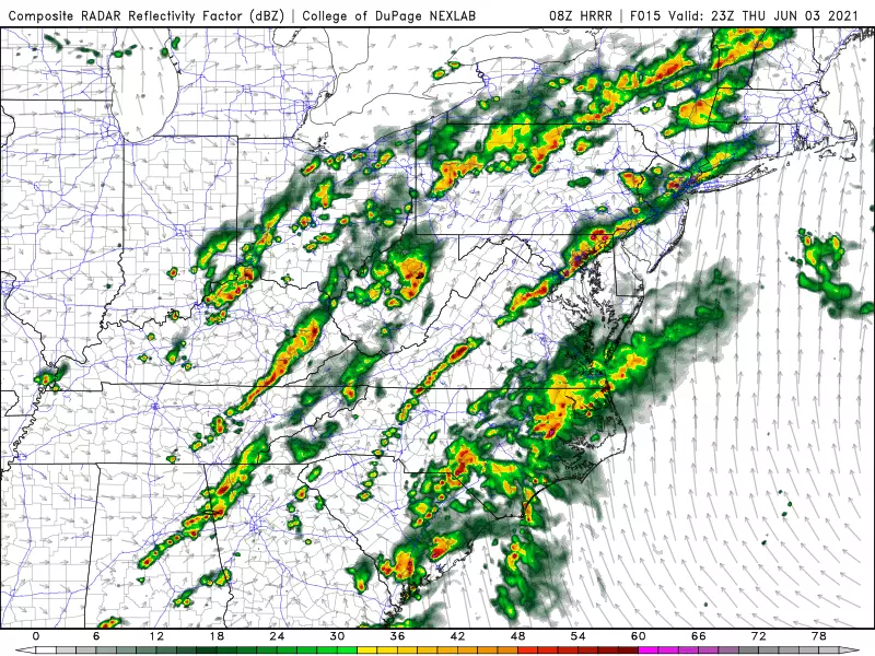
—Round 1 is on-going as I type. Scattered showers and thunderstorms will produce pockets of moderate to heavy rain through about 10 a.m.
—The middle of the day, from late morning through mid-afternoon, will be quiet. High temperatures are forecast to reach the mid 70s - typical for early June, and fairly similar to the past couple of days.
—Dew points will surge into the mid 60s or so too. That's not quite steamy or tropical. But it will be noticeably more uncomfortable than recent days. I don't see the air drying out any time soon, so humidity will be here to stay.
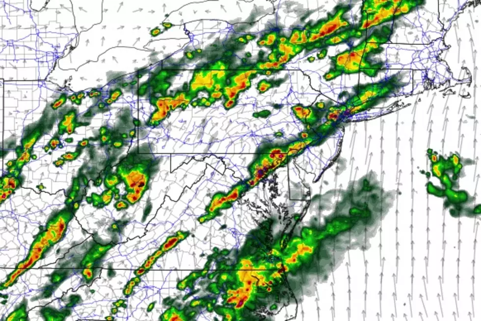
—Round 2 will start up around 4 p.m. A broken line of strong thunderstorms will crash into the state from the west. The potential for dangerous weather will continue until about 10 p.m. Thursday evening.
—Heavy rain and gusty winds will be our primary concerns from these late-day storms. Lightning is always a potential danger in thunderstorms, by definition. Hail is a possibility. And there will be enough "twisting" action in the atmosphere to warrant a slight chance for a tornado Thursday afternoon/evening too.
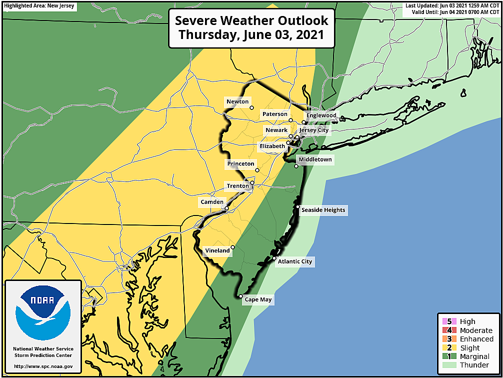
—The greatest chance for severe weather will be along northern and western New Jersey, as storms first arrive. This is a matter of timing - once sunset arrives, storm intensity will generally start to fade. Storms should also weaken a bit as they approach the slightly cooler, more stable air near the coast.
—Stay alert to changing weather conditions as thunderstorms roll in. A "watch" is almost a certainty for part of the state late Thursday - that's your formal heads-up that hazardous weather is impending. If a "warning" is issued for your area, it's time to stay inside a sturdy building until the threat passes.
—Rain will linger through about mid-morning Friday, let's say about 10 a.m. There is a chance for one more round of showers and thunderstorms Friday afternoon, but model guidance is very divided about that possibility for now.
—The resultant "cold front" won't be very cold at all. Friday will be a warm and sticky day, with high temperatures coming close to 80 degrees. Skies will probably stay mostly cloudy.
—Ready for some heat? I sure hope so. The sun will come out this weekend, as thermometers surge well into the 80s on Saturday. We'll push to 90+ for Sunday and beyond - likely our first heat wave of 2021.
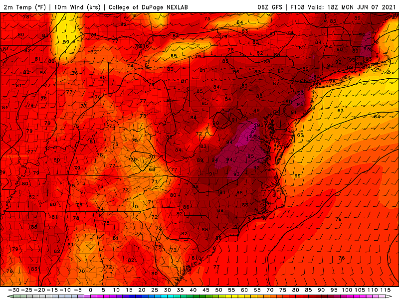
Dan Zarrow is Chief Meteorologist for Townsquare Media New Jersey. Follow him on Facebook or Twitter for the latest forecast and realtime weather updates.
How to start your first garden
Gallery Credit: Judi Franco
CHECK OUT: All the free beaches in New Jersey
More From New Jersey 101.5 FM


