

NJ’s weather forecast is all about humidity, both very low and very high
The Bottom Line
Of the last 14 days, 11 had temperatures of 90+ degrees somewhere in New Jersey. A hot stretch of weather that has finally broken.
Friday will be a beautiful weather day, thanks to delicious dry air.
Saturday will be less beautiful, as humidity and clouds build back in. We will see rain eventually, but I think it holds off until late-day.
Sunday will not be beautiful. Tropical humidity. And the risk for a few strong thunderstorms.
Monday brings us back into beautiful weather territory, as humidity plummets once again to start July.
Let's dig into the details more closely, so you can plan your weekend and beyond.

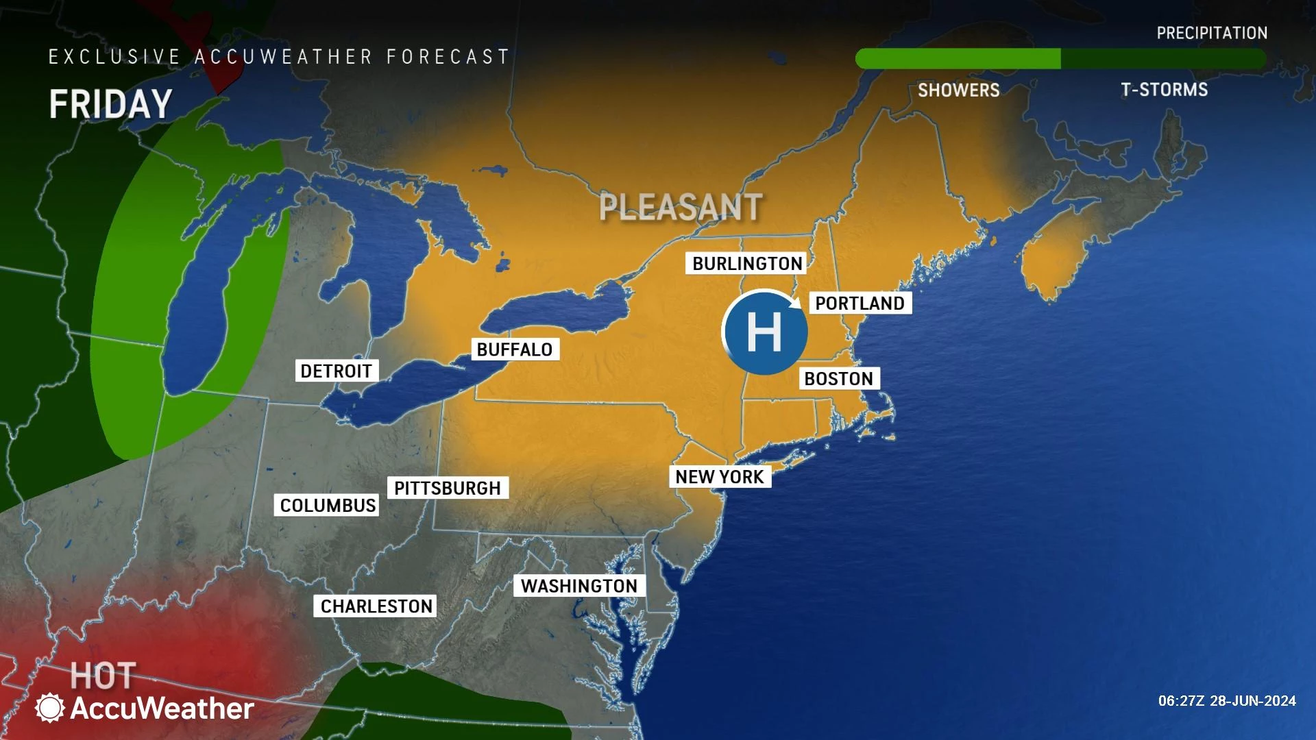
Friday
Drop dead gorgeous.
New Jersey's current air mass is ridiculously dry. Dew points are hovering around 50 — that is very rare for summertime.
Dry air allows for cooler overnight temperatures. So it is a comfortable start to the day, with 40s (!!!) in the northwest hills, 50s across North Jersey, and 60s for the southern half of the state.
Expect lots of sunshine, with occasional fair-weather clouds through Friday afternoon. Along with a light breeze and completely dry weather.
High temperatures will reach about 80 degrees, give or take. Yes, that means some parts of the state — specifically north and coast — will be stuck in the 70s. Is that too cool for a beach day? No way — the sunshine will make it feel wonderfully warm.
Friday night stays quiet and dry. Not quite as cool as Thursday night, as clouds and humidity start to increase. But it will be seasonable, with a low in the mid 60s or so.
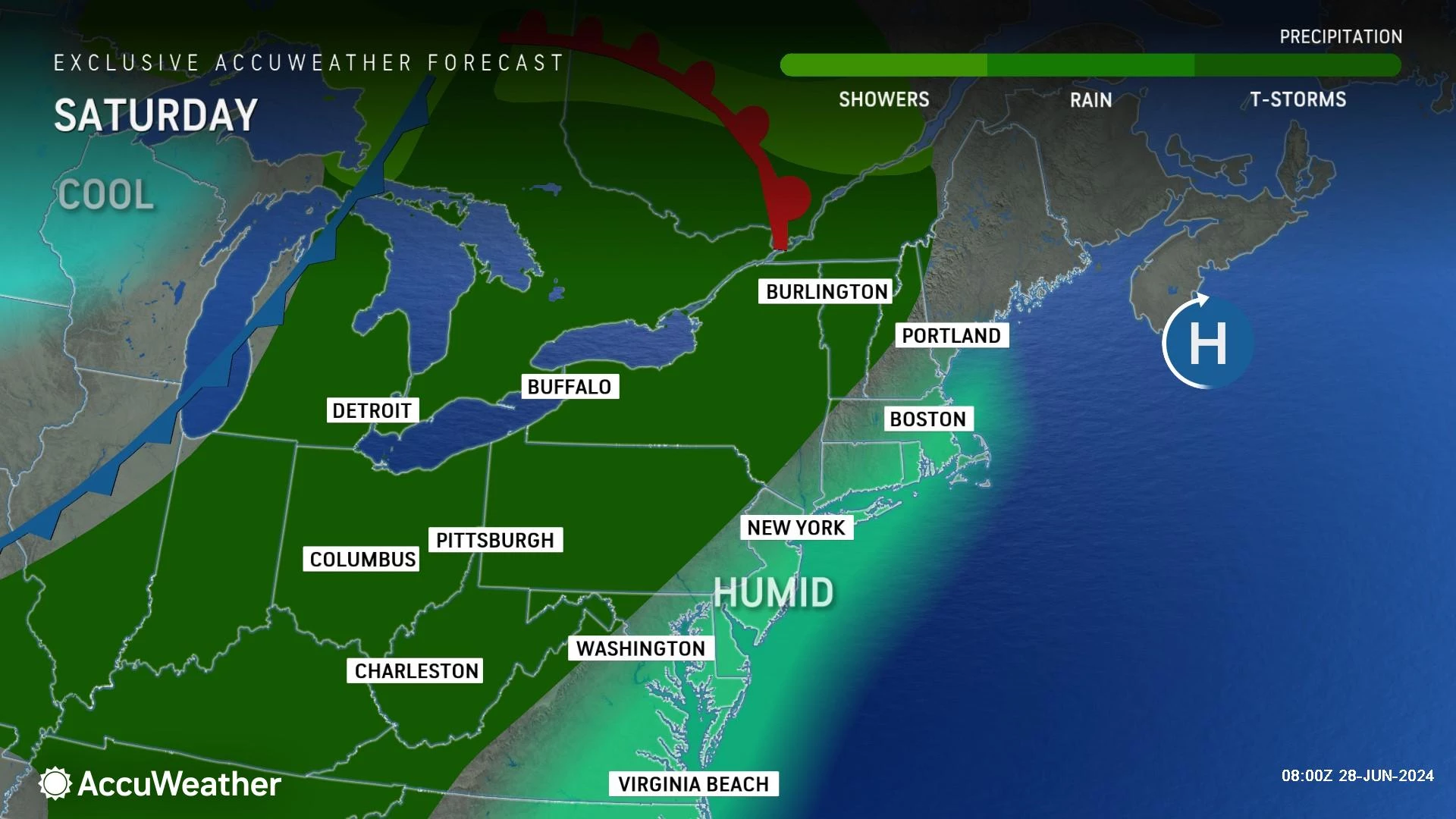
Saturday
Unsettled, but mainly dry.
Saturday will turn warmer, noticeably more humid, and breezier than Friday. We will see a mix of clouds and sun overnight. (Leaning heavier on the cloud cover — that is why I list it first.)
High temperatures should end up around 80 to 85 degrees. Even some beaches could probably be on the warm side due to that stiff southerly breeze.
Now let's talk about the return of rain. Yes, everyone in NJ is probably going to get wet at some point this weekend. But it's not a huge widespread soaker.
The first batch of spotty rain may push into northwestern New Jersey around 4 p.m. Saturday. That means the vast majority of the daytime hours will stay dry. Furthermore, raindrops will spread south and east slowly — likely holding off for most corners of New Jersey until Saturday night.
I am concerned about downpours developing in our humid atmosphere Saturday night. (That is why I am calling it "spotty rain" instead of "spotty showers".) But that's about it — a bit of beneficial rain, mainly occurring during the evening overnight hours.
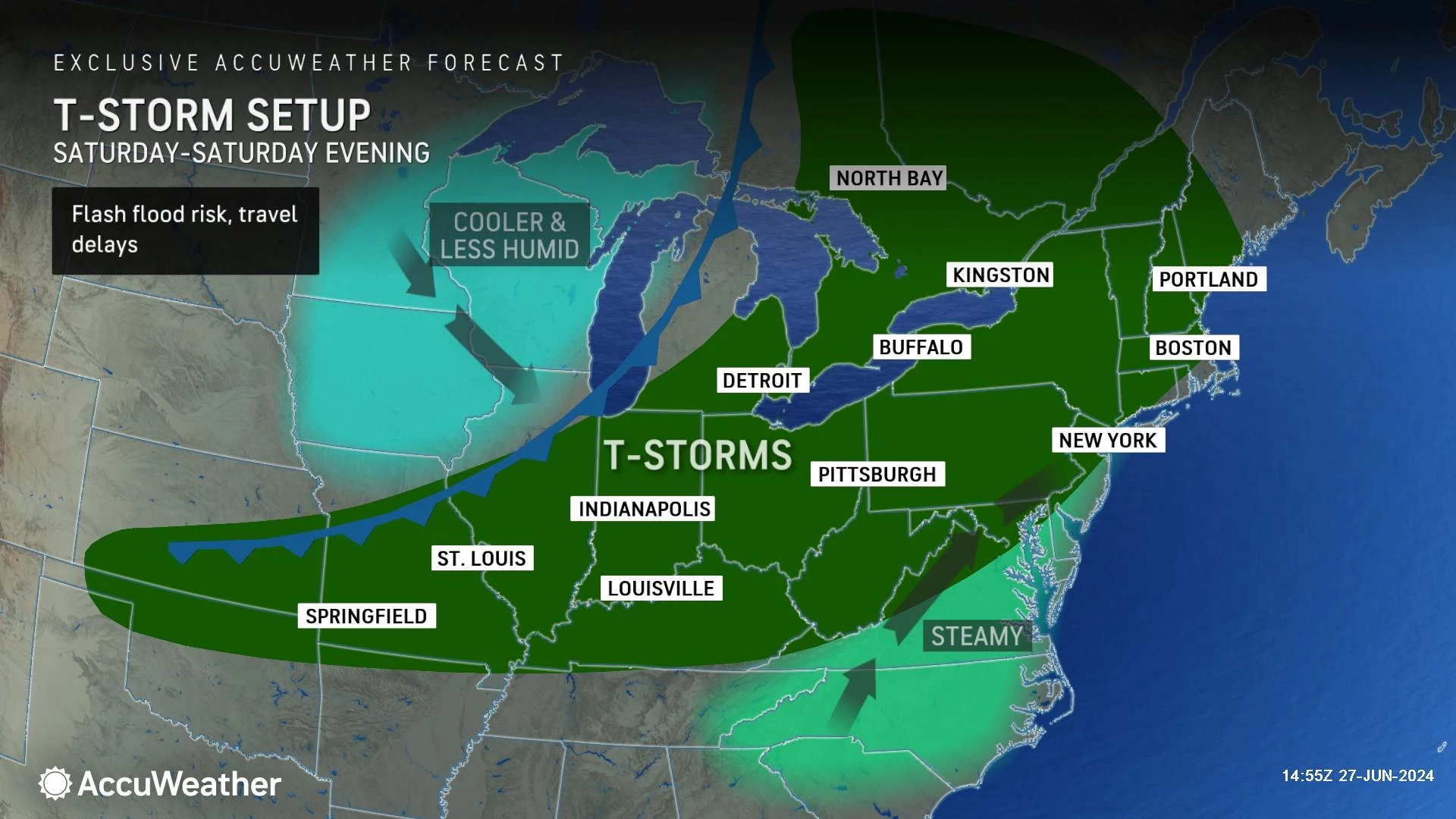
Sunday
Tropical.
Humidity levels are going to get pretty ridiculous on Sunday. I have seen forecast dew points as high as 76 — that is some soupy, moist air.
In addition, high temperatures will shoot toward 90 degrees.
Given the steamy atmosphere, it should be no surprise that we have to talk about a few thunderstorms on Sunday. I think there will be two opportunities for wet, stormy weather. First, in the early morning, a continuation from the overnight convection. And then in the midday and afternoon hours, as a cold front approaches from the west.
Severe weather is possible on Sunday, specifically the threat of damaging winds and flooding rains. Third time in a week we've had a "Slight Risk" on the SPC severe weather outlook. 'Tis the season.
Outdoor activities may be tricky at times on Sunday, both because of the storm threat and the high humidity. It is not a washout, but you should keep plans flexible and keep a close eye on the sky.
By Sunday evening (maybe even late afternoon), the effects of that cold front should take hold. Temperatures and humidity levels will drop, skies will clear, and rain chances go away. It should be a comfortable overnight, as we dip to around 60 degrees by daybreak Monday.
Monday
Back to beautiful.
Monday looks very similar to Friday, with low humidity, sunny skies, dry weather, and comfortably warm temperatures. Highs should reach the lower 80s. A great way to kickoff July.
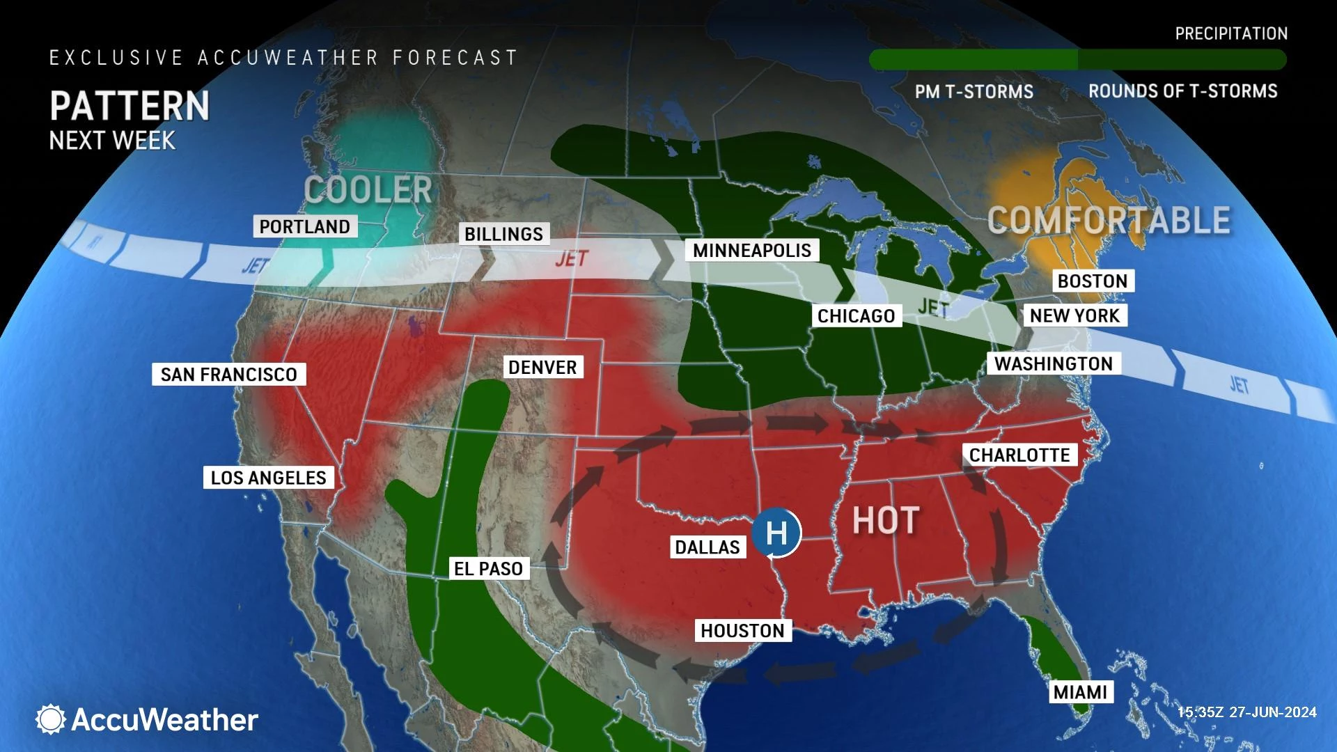
The Extended Forecast
Tuesday looks good too, mostly sunny and lower-mid 80s.
Wednesday will bring in some clouds and warmer temperatures, leaning toward the mid-upper 80s.
And then things a little hotter and more unsettled starting on Thursday, which is the 4th of July. I think we'll see some 90s out there. And some spotty showers and thunderstorms around. Nothing widespread or organized. But we will have to watch the timing and geography of potential storms, as they could try to interfere with your BBQ or fireworks plans.
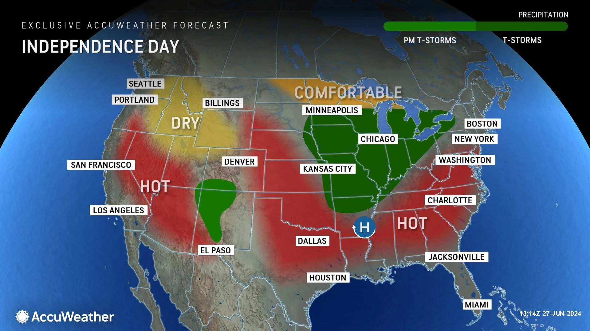
The threat for steamy, stormy weather will probably last through next weekend too. Again, something to watch as it gets closer.
The Best Flavors of Summer at the Jersey Shore
Dan Zarrow is Chief Meteorologist for Townsquare Media New Jersey. Follow him on Facebook for the latest forecast and realtime weather updates.
18 Amazing Summer Day Trips That Aren't Too Far From New Jersey
Gallery Credit: Chris Coleman
More From New Jersey 101.5 FM


