

NJ weather: Warm and summery this weekend, drought concerns rise
Bottom Line
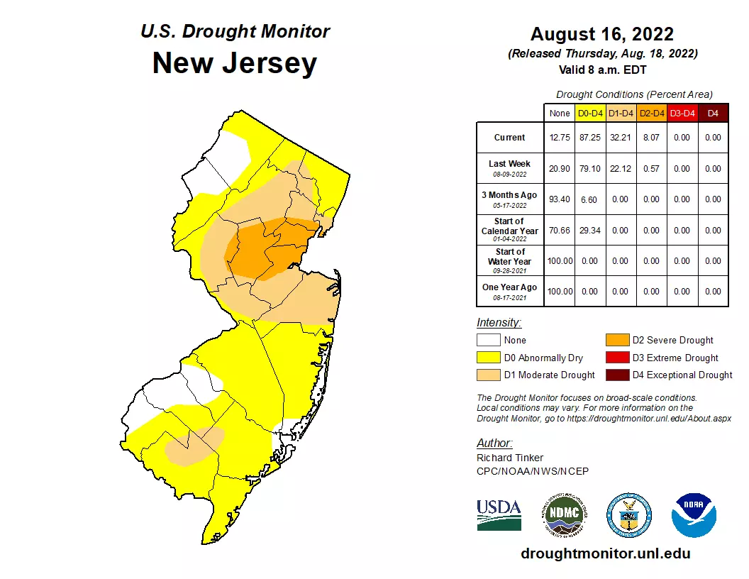
We are firmly in the back half of August now. And, as the latest Drought Monitor indicates, concerns continue to grow over the dry conditions. With just over 8 percent of New Jersey now classified in "Severe Drought," it is now the state's worst drought since early 2017.
We do have two chances of rain in the forecast. The first, this weekend, has almost completely fizzled. We might see some sprinkles Saturday morning — but don't hold your breath.
I like what I see for early next week though. A storm system will soak the Desert Southwest, Southern Plains, and Gulf Coast this weekend, before swinging our way early next week. An inch of rain would not be a "drought buster" — but it would help us from digging deeper into this rainfall deficit hole.

Friday
We often look to the dewpoint as our summertime "muggy meter" — that measure of atmospheric moisture is directly related to how "sticky" or "steamy" the air feels. This week, dew points have been in the dry, comfortable 50s. For Friday, they'll bump up to around 60. So you might notice a hint of extra stickiness in the air. And humidity levels will go up more this weekend, although we will stay away from thick, tropical conditions.
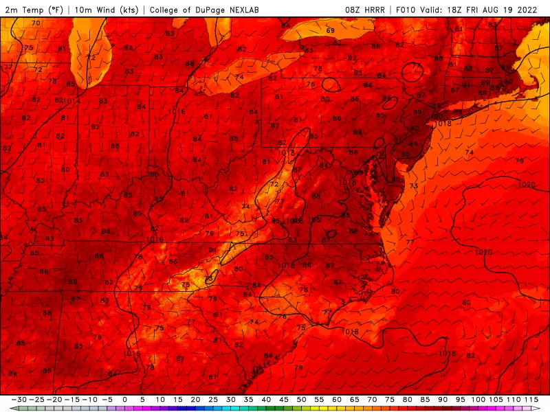
Friday picks up where Thursday left off: Sunny and warm. Cloud cover will increase starting in the afternoon. And high temperatures will be a hair warmer, around 90 degrees across the interior of New Jersey. Closer to the coast, we'll top out near 80. (Nice beach day alert!)
Some forecast models pop up an isolated shower around sunset Friday. But there's very little forcing for that (despite our warm and semi-humid atmosphere). So I have opted for a dry forecast.
Friday night will be mostly cloudy, but quiet. Low temperatures will dip into the upper 60s.
Saturday
We had been watching a storm system set to "kiss" the Jersey Shore to start the weekend. It's still there, but rain has mainly trended away from New Jersey.
Therefore, a sprinkle is possible Saturday morning, especially near the coast. But that's it — precipitation probably won't be measurable, and most of the state will stay completely dry.
The rest of Saturday looks partly sunny and seasonably warm. Inland high temperatures will shoot for the mid 80s Saturday afternoon. As I mentioned above, you might feel a touch of humidity in the air, but nothing extreme.
Sunday
Clouds will probably win out over sunshine on Sunday. But I'm going for a dry forecast during the daytime hours. Because of that cloud cover, high temperatures will be held to the lower 80s.
Our next storm system will approach Sunday evening, presenting a chance of rain.
Monday
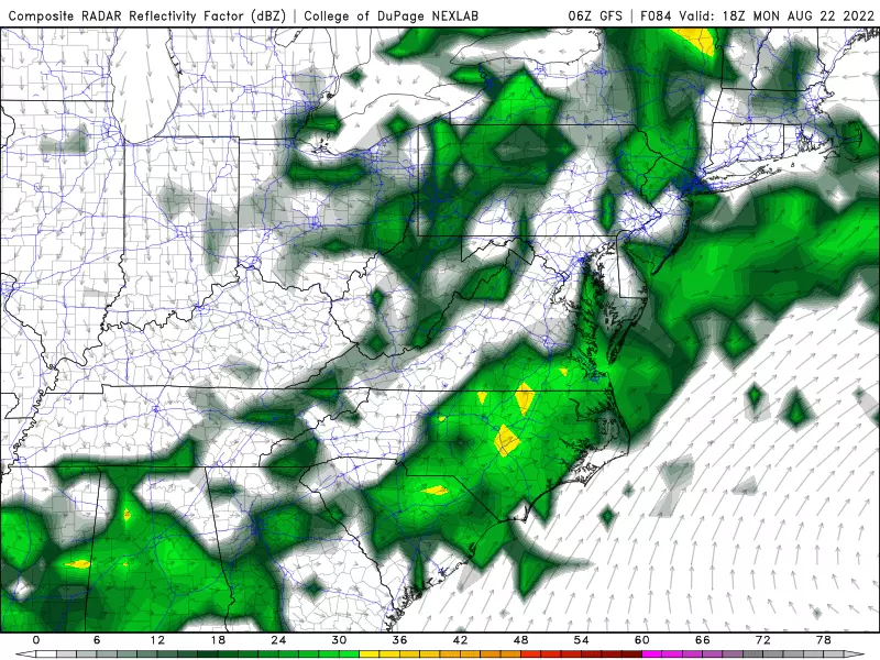
I like what I see. A batch of wet weather is aiming right for New Jersey on Monday, hopefully set to water the grass and fill up reservoirs a little bit.
It looks like two batches of scattered rain will swing through Monday: One in the morning, one in the afternoon and early evening. So raindrops will be on and off.
Rainfall totals are forecast to end up between a half-inch and an inch across most of the state. Higher totals are possible if the air is rich enough to support some downpours, pushing totals up to 1.5 to 2.0 inches. Flooding and severe weather are not concerns.
As long as the rainy solution plays out, Monday will be cloudy and cooler. High temperatures will be limited to the upper 70s.
The Extended Forecast
An additional batch of showers is possible around midday on Tuesday, and then our weather completely dries out and warms up again. Despite that batch of wet weather, I strongly suspect rainfall totals will end up (considerably) below normal for August. In fact, I'd bet more on extreme heat and humidity returning by the end of the month.
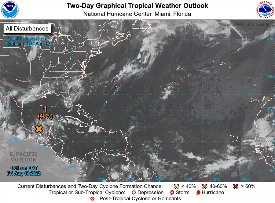
One more note. The tropics have been fast asleep this summer. There has not been a named tropical system in the Atlantic basin in over six weeks (Colin dissipated on July 3rd). There is one system under investigation near the Yucatan Peninsula of Mexico. And we are coming up on the climatological peak of the Atlantic hurricane season, in early September. We'll be watching, of course.
Dan Zarrow is Chief Meteorologist for Townsquare Media New Jersey. Follow him on Facebook or Twitter for the latest forecast and realtime weather updates.
15 Iconic Stops Along The Jersey Shore
Gallery Credit: Gianna
New Jersey's 10 Wackiest Phobias
Gallery Credit: Diana Tyler
More From New Jersey 101.5 FM


