
NJ weather: Rain Wednesday night turns to ‘nuisance’ snow Thursday
UPDATE as of 4 p.m. Wednesday...
The National Weather Service has issued a Winter Weather Advisory for 16 of New Jersey's 21 counties, in effect from early Thursday morning through midday. (The advisory technically runs 3 a.m. to 11 a.m. for most of the state, and 5 a.m. to 1 p.m. for the northeast corner.)

Advisories are all about treacherous travel. And that's exactly what's expected across the state Thursday morning, as initial rain transitions to accumulating snow. The flip from rain to snow will progress from north to south between about 4 a.m. and 10 a.m. Thursday. (So by about daybreak — 7 a.m. — we'll transition from "mainly rain" to "mainly snow" across the state.)
Plan accordingly, and be prepared for a slower-than-usual commute due to snow-covered roads and/or reduced visibility.
ORIGINAL POST from 6:48 a.m. Wednesday...
The Bottom Line
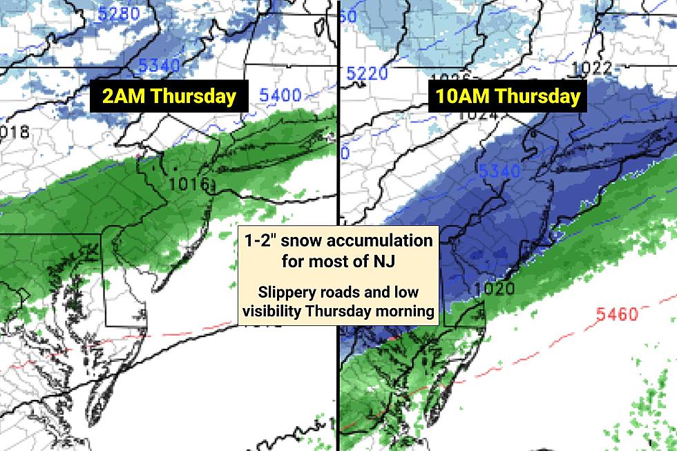
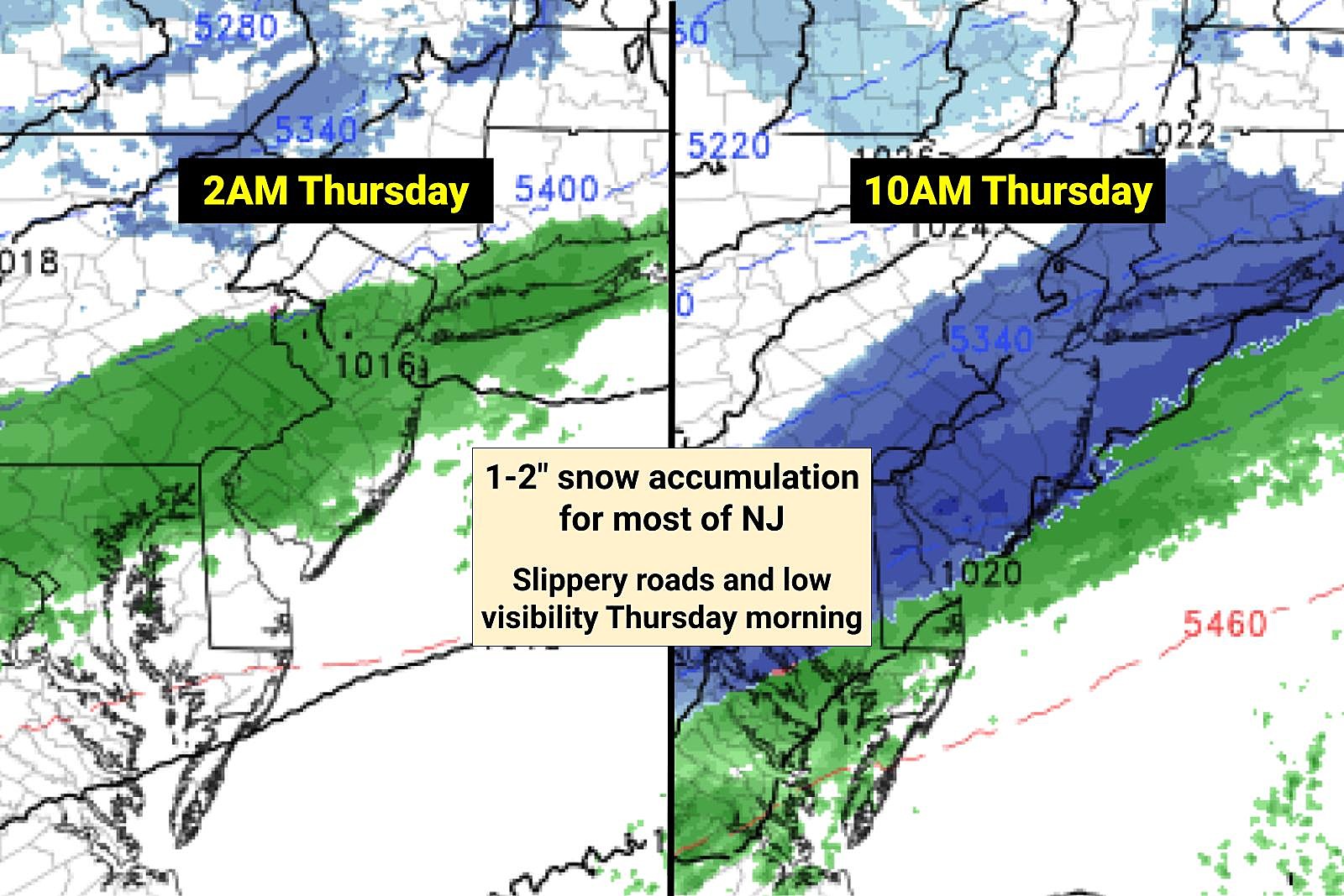
Our next storm system is less than 24 hours away. And most of New Jersey is facing an inch or two of snowfall. By itself, that's not a huge deal. But timing is a problem here, with slippery roads and low visibility coinciding with Thursday morning's commute.
We plunge into the deep freezer again late Thursday into Friday.
And models are leaning hard toward only a glancing blow for a coastal storm system to start the weekend. But it's still worth watching, and there could still be some snow accumulation in NJ.
Wednesday, Part 1: A Nice Day
After those westerly winds stopped whipping Tuesday night, temperatures dropped like a stone. On this Wednesday morning, we're seeing teens across a swath of interior New Jersey. Most locales will start the day in the 20s.
Wednesday is looking like the nicest, warmest day of the week. (In fact, it may be our warmest day until sometime in February - so soak it up!) High temperatures should push to around 45 to 50 degrees Wednesday afternoon, under partly sunny skies. Winds will probably increase to the "breezy" category again, peaking around 20 mph. We will stay dry during the daytime hours.
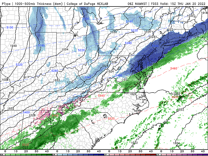
Wednesday to Thursday: Rain to Snow
--Background... A slow-moving cold front will drive in a period of precipitation from late Wednesday evening to midday Thursday. Rain will likely change to light to moderate snow, leading to potentially messy conditions for the AM rush hour.
--Start... First raindrops will arrive no sooner than 10 p.m. Wednesday to 2 a.m. Thursday.
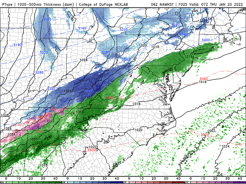
--Brunt... The heaviest precipitation bands will fire up between about 3 a.m. and 9 a.m.
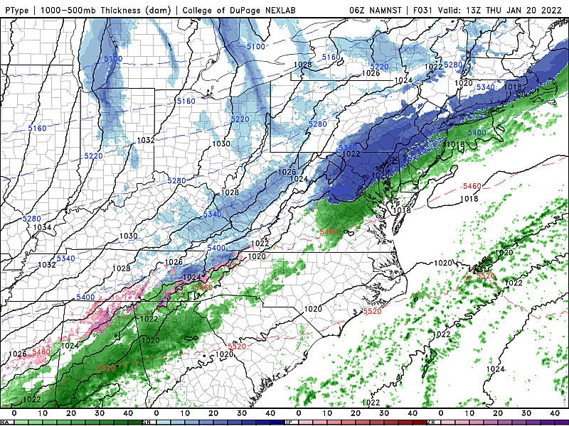
--Changeover... As temperatures drop overnight, rain will change to snow. (There might be a period of wintry mix in the middle.) The transition will happen in far northwestern New Jersey around 3 a.m. Most of inland NJ around daybreak (6 to 8 a.m.) Even the southern coast will go all-snow by around 9 or 10 a.m.
--End... Final flakes should fly around midday Thursday, wrapping up between 11 a.m. and 2 p.m.
--Snow Totals... An inch or two of widespread snow accumulation seems like a good bet. Those totals should end up a bit lower in far NW NJ (where dry air will be an issue) and SE NJ (which will change raom rain to snow last). If the rain-snow transition isn't "clean" - if there is some sleet or freezing rain in the middle - a trace of ice is a possibility too. Note: I do not draw a snow forecast map for minor winter weather events like this one, with snow totals below "advisory-level" (3-ish inches).
--Advisories... None at this time.
--Confidence... It's worth noting that some raw model forecasts are running higher, on the order of 3 to 4 inches. Such a forecast would be dependent on heaviest snow bands setting up - it's going to be hard to hit that mark given the overrunning cold/dry air and the soon-to-be wet ground.
--Impacts... It's all about the Thursday morning ride to work/school. Roads will be slippery. And road crews may have difficulty managing this degree of snowfall - pre-brining will be washed away by rain, and plows really can't hit the road with only 2 inches of accumulation. But again, overall, it will be a minor winter storm - no prolonged impacts, no wind, no coastal flooding.
Thursday, Part 2: Another Arctic Blast
Behind the raindrops and the snowflakes and the cold front will be the arrival of yet another arctic air mass. Temperatures are going to tumble throughout the day Thursday, from lower-mid 30s in the morning, into the 20s by the afternoon. As usual, the wind will add a bitter bite to the cold air.
By Friday morning, we'll bottom out in the single digits in the coldest parts of the state, with teens for the rest. Wind chills may dip as low as zero.
Friday: Deep Freeze
When our first big arctic blast of the season arrived early last week, I remarked how it was New Jersey's coldest day in almost three years. Then it happened again late last week. And now we're taking another visit to the arctic. With no sustained warmup in sight, this January is going to end up as one of New Jersey's coldest calendar months in quite some time.
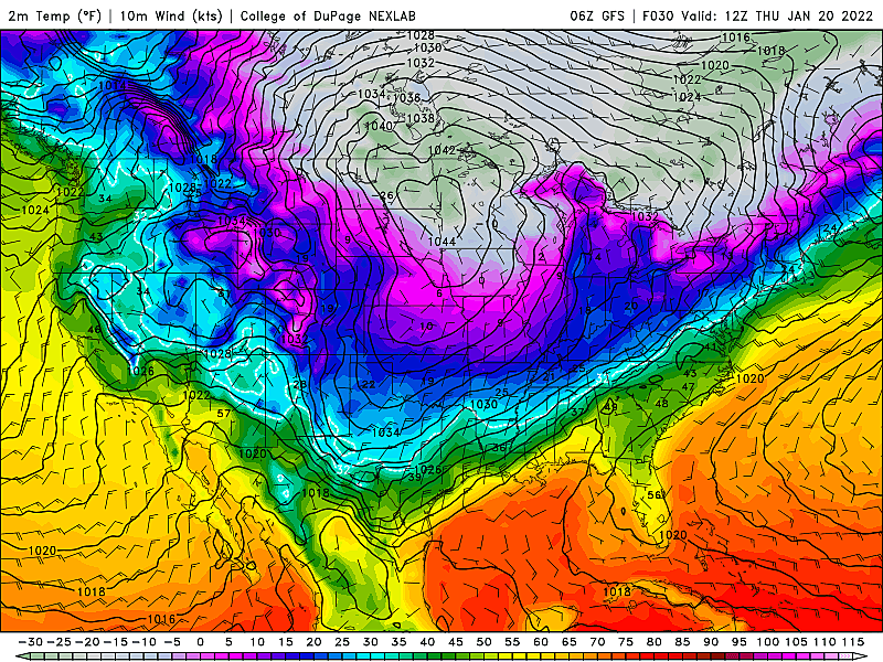
We'll be stuck below freezing all day Friday, with high temperatures only in the mid 20s. Skies will be bright and sunny for most of the day, although late-day clouds may build.
Wintry Woes this Weekend?
In previous entries of the CMDZ weather blog, we have discussed a coastal storm system that was ominously threatening the east Coast early this weekend. In the Friday night to Saturday time frame.
The last few model runs have conglomerated on a "mainly out-to-sea" solution, with only a glancing blow for New Jersey.
So the current forecast is for some light snow along the southern coast early Saturday morning. Could that wiggle back toward the coast and become more impactful? Sure - it's still three days away. Could it shift even farther out to sea, becoming even more of a nothing-burger? Absolutely - this bloc of cold air is an important driving factor in the eastward momentum.
As long as that storm system is a red herring, the weekend will be cold and calm. Highs near 30 on Saturday, bumping into the mid 30s on Sunday.
And it looks like temperatures will stay at or below normal for much of next week too. That means any subsequent storm system that comes along could be a snowmaker for NJ. Nothing additional is catching our attention at the moment, but we'll keep you posted.
Dan Zarrow is Chief Meteorologist for Townsquare Media New Jersey. Follow him on Facebook or Twitter for the latest forecast and realtime weather updates.
Inventions you probably didn't know are New Jersey born
Gallery Credit: Judi Franco
7 things you forgot about how great New Jersey is
Gallery Credit: Judi Franco
More From New Jersey 101.5 FM


