Latest update on Hurricane Erin: Flooding concerns grow for NJ
The Bottom Line
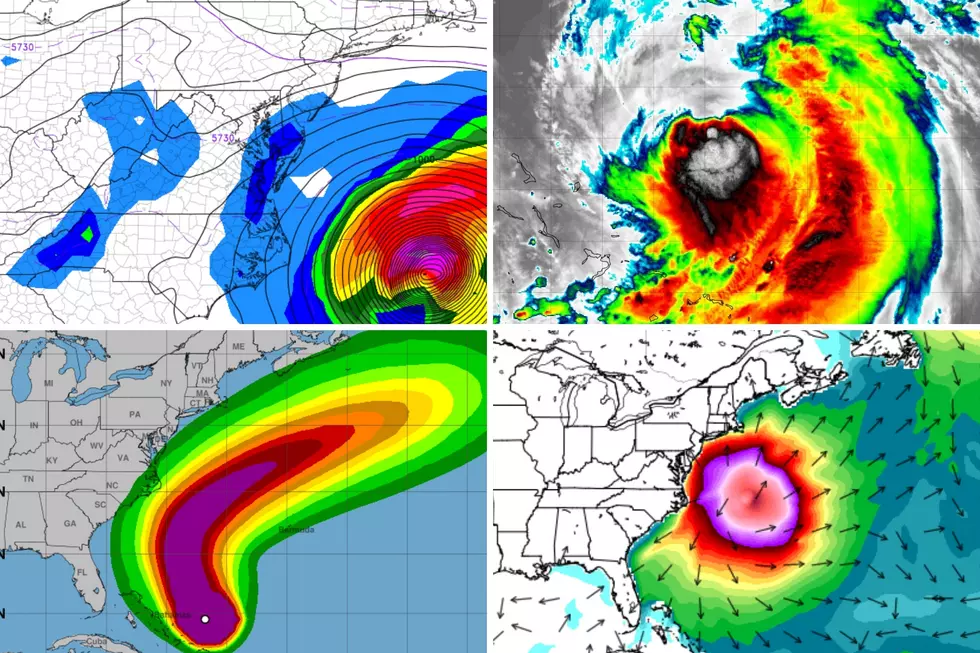
We have been watching Hurricane Erin since it was a baby tropical wave a week and a half ago. And now, we are less than 36 hours from the storm's peak impacts reaching New Jersey.
The forecast message remains the same. Erin is not making landfall. We are not going to see anything near tropical storm or hurricane force impacts. For most of New Jersey, this will manifest as simply a "blah" period of weather. But there will be some serious issues to watch, especially for those along the Jersey Shore.
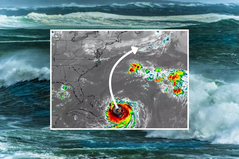
As of 5 a.m. Wednesday morning, Hurricane Erin is about 700 miles south of New Jersey. Now a category 2 hurricane with maximum sustained winds of 100 mph. The only real change to the forecast is the intensity — Erin has been battling dry air and wind shear, and is now no longer expected to regain strength to "major hurricane" status. Honestly, that does not change my thinking for New Jersey's impacts at all since the storm track and size forecast remains the same.
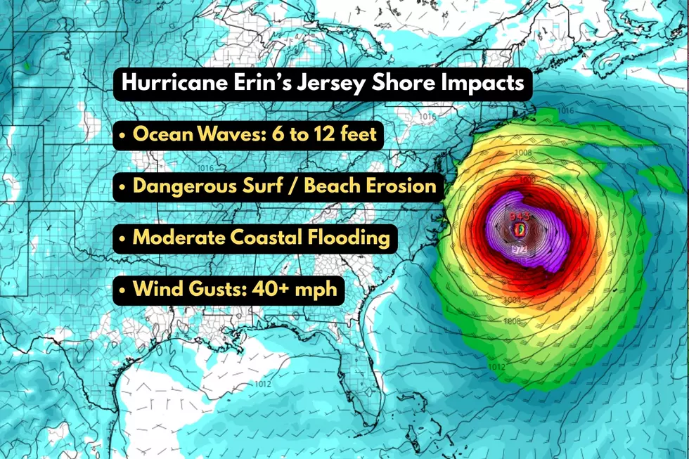
Rather than run through every little consideration, aspect, and nuance of the storm, I want to focus this post on the five main Erin headlines specific to New Jersey:
1.) Wednesday's precursor rain event
2.) High surf, rip currents, and beach erosion
3.) Coastal flooding and storm surge
4.) Gusty winds, especially along the coast
5.) Beautiful weather but rough ocean after the storm
Let's dive in to the latest details so you know what to expect, and can plan (or not) accordingly.

Wednesday: Clouds, Humidity, Showers
Even beyond the rough surf and rip currents, Erin's indirect impacts have already begun here in New Jersey. And there is one special concern tied to Wednesday's rain chance and an influx in tropical moisture.
Wednesday morning is comfortably cool again, with most temperatures in the 60s. Radar is lighting up with spotty showers across the southern half of the state.
A warm front — driven largely by Hurricane Erin's circulation — will push more humid air northward through New Jersey as Wednesday goes along. It will not become steamy or "tropical" necessarily, just noticeably stickier again.
Skies will become mostly cloudy or overcast. Temperatures will top out in the 70s. (Likely lower 70s to the north, mid-upper 70s to the south.)
Outdoor activities Wednesday may be challenging at times, as spotty showers pass through the state. By the afternoon, the chance for a thunderstorm will kick in too.
In general, rainfall totals will stay below a quarter-inch. However, if a piece of our atmosphere taps into Erin's tropical moisture, there will be the opportunity for a localized heavy downpour. (The European model in particular has painted isolated pockets of 2+ inches of rainfall around the region.) It is not a guarantee, only a possibility. Never underestimate the rainfall potential of tropical moisture. And never attempt to drive, walk, or swim through flooded areas. The best opportunity for such a downpour would likely be Wednesday evening.
Wednesday night will become increasingly breezy. Low temperatures will dip into the mid 60s or so. Highs on Thursday will barely reach 70.
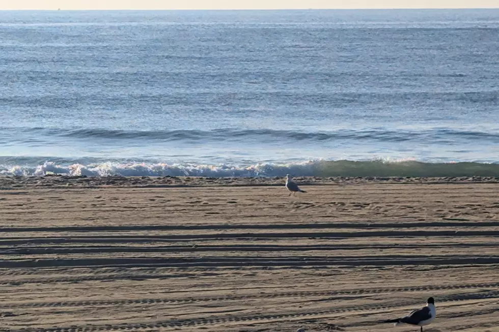
High Surf: Wave Heights up to 12 Feet
The ocean is already angry. Officials caution that rough surf rip currents are a huge danger this week. Some beaches are even closed for the duration. The waves are incredible to watch, but please stay out of the ocean.
Wednesday's Jersey Shore Report shows ocean wave heights around 5 to 8 feet battering the beaches. That will likely increase to 6 to 12 feet on Thursday. Yes, I have increased the max potential wave height to 12 feet, based on the latest model guidance.
This is serious business, folks. Not just putting swimmers and surfers in danger, but also causing major beach erosion. I fear the summer season may be over for some shore towns as a result of this storm's wave action.
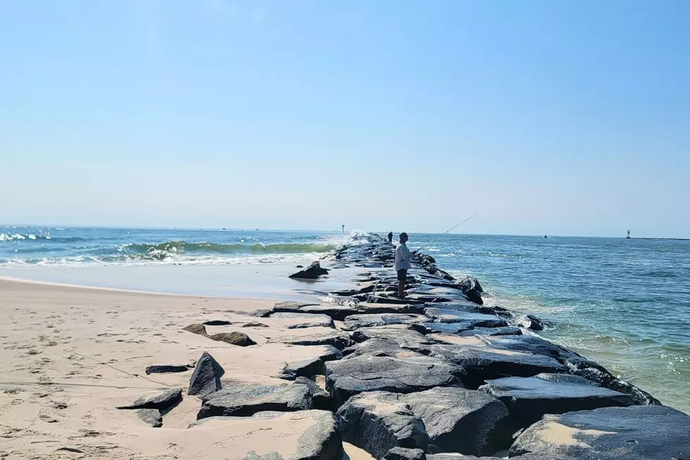
Moderate Coastal Flooding: 2 to 3 Foot Storm Surge
The newest storm concern — and perhaps now the greatest of them all — is the threat for coastal flooding at high tide. Erin's powerful winds will push 2 to 3 feet of storm surge toward the Jersey Shore. Combined with the current New Moon phase, and tidal waterways will be running exceptionally high. A Coastal Flood Watch has been issued by the National Weather Service, which will almost certainly become a warning if this forecast holds.
The tide forecast along the Jersey Shore, including the Atlantic Ocean, back bays, Raritan Bay, and Delaware Bay now calls for widespread moderate category flooding during Thursday evening's high tide cycle. The forecast for the southern coast specifically comes very close to major flood stage. That means water inundation may necessitate road closures and may cause damage to vehicles and property.
Ocean high tide will be around 7 p.m. Thursday. Back bays will crest a few hours later.
Minor to spotty moderate tidal flooding will likely happen again during Friday morning's and Friday evening's high tide cycles as well. Until the big waves subside and the back bays are able to drain, water levels will remain high.
Wind Gusts: Over 40 mph
Near the center of Hurricane Erin, in the eye wall, sustained winds will be around 100 mph as the storm passes by. On the northwestern edge of the storm's wind field, we are looking at 30 mph wind gusts for most of New Jersey. And the immediate coast could see regular 40+ mph gusts, peaking from midday through the afternoon on Thursday.
That is not high enough to qualify as "damaging" winds. But it is the low end of advisory criteria. Enough to cause driving difficulties, blow around your garbage can, bring down tree branches, and cause sporadic (not widespread) power outages. Flight delays are possible at area airports too.
After the Storm: Lingering Rip Currents
Once Erin passes by our latitude, the storm will accelerate out to sea. Skies will clear quickly Thursday night. And our weather will be dropdead gorgeous for Friday and Saturday — sunny, warm, and not too humid.
However, there is one more sneaky storm impact lurking at the end of the week that may catch many off-guard.
As beautiful weather returns just in time for the penultimate weekend of the summer season, I'm sure New Jersey beaches will be busy. However, the residual coastal impacts of Hurricane Erin will remain.
Wave heights on Friday will still reach about 4 to 6 feet, raising a high risk of rip currents. The ocean will still be downright dangerous.
Saturday will be a bit better, with ocean waves in the 3 to 4 foot range. And then Sunday finally calms down to 1 to 3 feet.
Meanwhile, minor coastal flooding problems will remain through at least Friday evening too.
Don't be ignorant. Don't be complacent. No matter how bad you want to dive in the water, please follow all lifeguard instructions, posted flags, and official signs. The ocean will always be stronger than you.
25 costliest hurricanes of all time
Dan Zarrow is Chief Meteorologist for Townsquare Media New Jersey. Follow him on Facebook for the latest forecast and realtime weather updates.
The complete list of names for the 2025 Atlantic Hurricane Season
Gallery Credit: Dan Zarrow
More From New Jersey 101.5 FM