NJ weather: First weekend of summer stays hot, ends with a bang
The Bottom Line
Friday will be hot. Saturday will be hot. Sunday will be hot. Early next week, we will briefly transition from hot to very warm.
As heat and humidity kick up another notch heading into the weekend, we now exceed "typical summertime heat" and are approaching the danger zone. With inland highs well in the 90s and humidity ramping up, the heat index (that "feels like" or "apparent" temperature) will flirt with 100 degrees for the next three days. You really have to take care of yourself in such sweltering conditions.
We also have to add a daily thunderstorm chance to the forecast. Isolated stuff on Friday and Saturday. And then a round of widespread strong storms to end the weekend Sunday evening.
Yes, our weather will turn more bearable and more comfortable early next week. But do not expect much of a cooldown until the second half of next week.

Friday
You can already feel a difference in the air Friday morning, as it is a little bit stickier than previous early mornings. Unfortunately, we have lost that "nighttime reset" — as humidity increases, so will overnight low temperatures. No more 60s, we only bottom out in the 70s going forward. That is not cool or refreshing in the slightest.
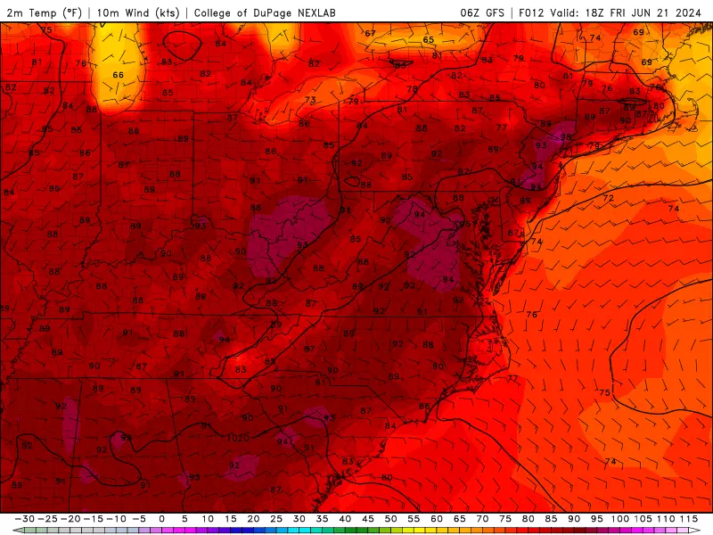
High temperatures on Friday are forecast to reach the lower to mid 90s across most of New Jersey. As hot air surges into the state, I could see a couple spots potentially reaching 100. The Jersey Shore will once again benefit from a nice sea breeze, keeping mainland beaches in the 80s and barrier islands in the 70s.
A Heat Advisory continues for almost all of inland New Jersey.
An Air Quality Alert Code Orange is in effect once again too. Concentrations of ground-level ozone are elevated in this kind of hot weather, creating breathing problems for the very young, the very old, and those with preexisting heart/lung issues. Just another reason air conditioning is your friend this week.
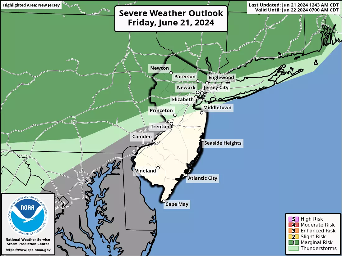
There is one important addition to Friday's hot and steamy forecast: A stray thunderstorm. The best chance for a popup shower or storm will be northern New Jersey, around the dinnertime (early evening) hours. Very isolated. But lacking any steering currents, a stagnant downpour could soak a small area for an extended period of time. Most of the state stays completely dry (and hot) — but it is worth keeping an eye on the sky, just in case.
Friday night low temperatures will only dip into the lower 70s across the state. Definitely warm and sticky.
Saturday
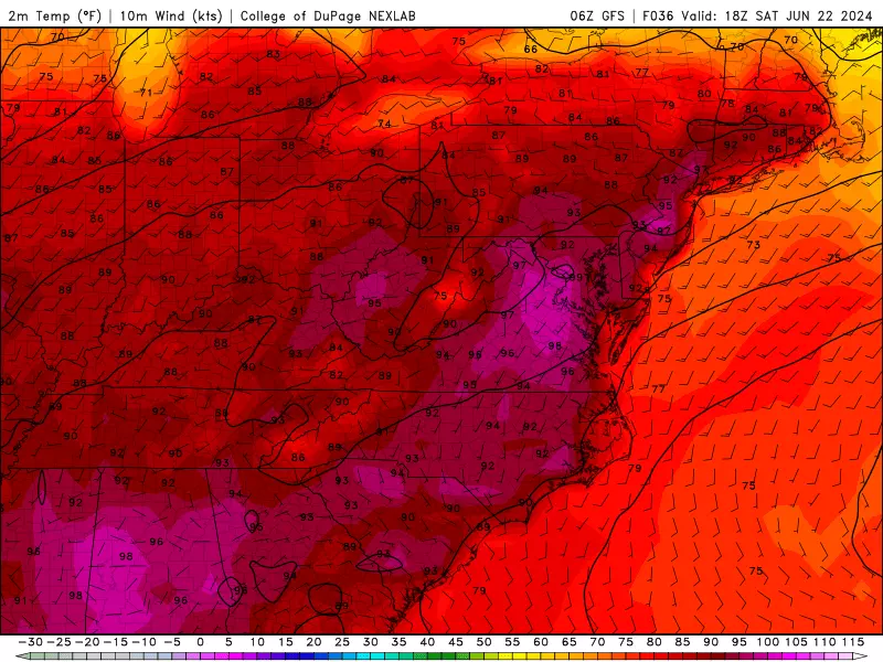
More 90s.
Cooler at the beaches.
Partial sunshine.
Chance of a late-day stray thunderstorm again.
And that's your Saturday.
Sunday
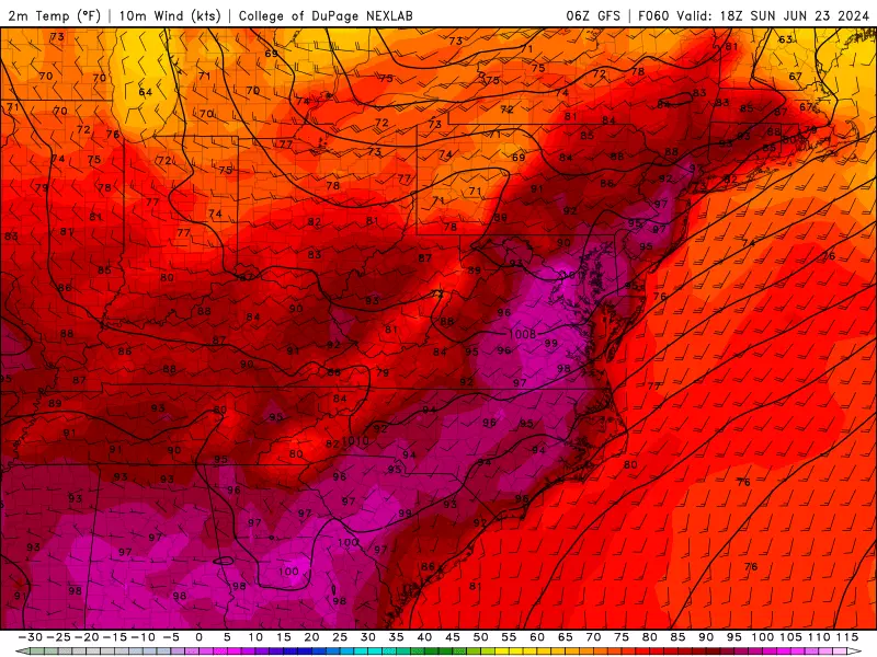
Sunday is not going to be a nice weather day. Two concerns here: Steamy and stormy weather.
First of all, Sunday could be the hottest day of the week. Highs will reach the mid 90s for most of the state, with triple digits potentially in play for some too.
With a stiff southwesterly breeze, and no sea breeze, even mainly beaches could be hot (and buggy) on Sunday.
Skies will progress from sun to clouds, with dry weather through at least mid-afternoon.
And then, as a cold front approaches from the west, a line of thunderstorms looks likely from Sunday late afternoon through evening.
This is one of those situations where everyone in New Jersey will probably see a thunderstorm. And given the intense heat and humidity in the atmosphere, those storms will probably be quite strong. Damaging winds and flooding rain top the list of concerns.
Monday
Behind that cold front, our air mass will dry out Monday. Lower humidity is always a good thing in the summer months.
But don't expect much of a cooldown. Highs on Monday will probably still close in on 90 degrees. Hopefully we will fall out of "Heat Advisory" criteria, but I do expect the Jersey heat wave to continue for one more day.
Monday will be sunny, breezy, and dry. (Aside from a possible lingering shower in the morning.)
The Extended Forecast
Tuesday will be our best shot at breaking this heat wave. My latest forecast puts highs in the upper 80s. Still very warm — but potentially not 90+.
Wednesday looks like another steamy and stormy day, back to the 90s with a batch of late-day thunderstorms.
That round of rain may last into Thursday too, keeping our weather wet, skies cloudy, and temperatures potentially cooler. We could see a solid inch of rain — which would be fantastic news, given our recent drought concerns.
It does not look like extreme heat will return late next week. In fact, the latest forecast through the last weekend of June looks good — dry, bright, and seasonable.
POP QUIZ: Can you guess these NJ theme parks from Google Earth images?
Gallery Credit: Dan Zarrow
Dan Zarrow is Chief Meteorologist for Townsquare Media New Jersey. Follow him on Facebook for the latest forecast and realtime weather updates.
More From New Jersey 101.5 FM