
NJ weather: Drying out Monday, but still unsettled this week
The Bottom Line
Total rainfall for Friday, Saturday, and Sunday ranged from 2 to 7+ inches across New Jersey. Incredible — more than a month's worth of rain in just a few days. We really needed it. And I am so happy to not have to talk about drought and/or wildfire danger for a few days.
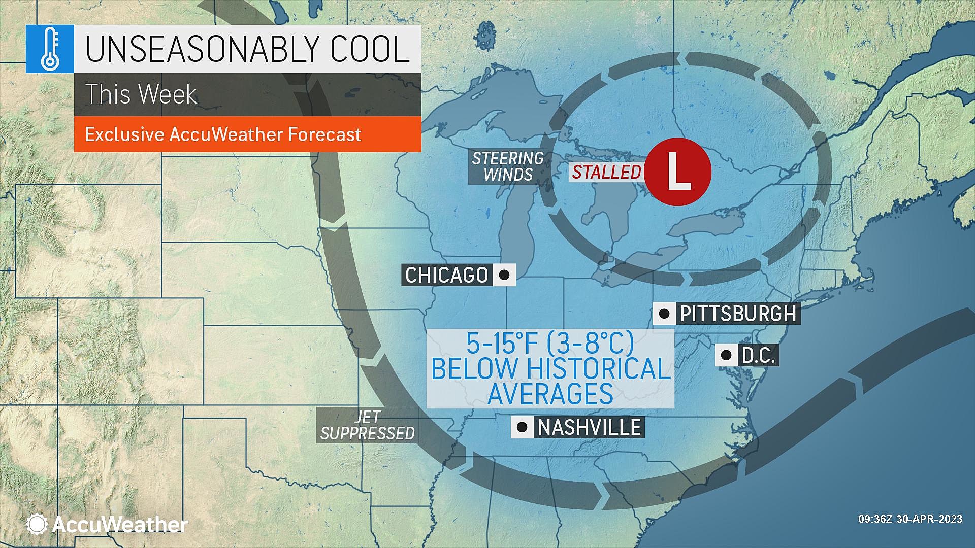
We do have some brighter, drier weather ahead. However, clouds stick around and temperatures are stuck below normal. And a few weak pieces of energy complicate the forecast too. Technically, I have a rain chance plugged in for every day this workweek. However, most of those showers will be sporadic and isolated.
If you're looking for bright sunshine, completely dry weather, and warmer temperatures, you will have to wait until the weekend. But oh, that weekend forecast is looking great!

Monday
The broad, deep area of low pressure responsible for Sunday's heavy, steady rain is exiting out to sea rapidly. As of this writing (6 a.m.), there are still some light showers yet to clear the coast. But radar is looking much cleaner now, and our threat for soaking rain is over.
You will still find some residual puddles and areas of flooding during Monday morning's commute. Never attempt to drive, walk, or swim through flooded areas.
A brighter day is ahead, as sunshine breaks out alongside fair-weather clouds Monday morning. Temperatures start the day near 50 degrees. And highs will come close to the 60-degree mark. Not bad, but definitely below normal for early May (upper 60s). It will be breezy too, with southwesterly gusts over 20 mph.
The day will not be totally dry. The backside of this weekend's storm system will swing in Monday afternoon and evening, providing the spark for some popcorn showers. Maybe even some little thunderstorms, capable of producing small hail or graupel. Certainly nothing as heavy nor as prolonged as this weekend's rain, but definitely worth mentioning.
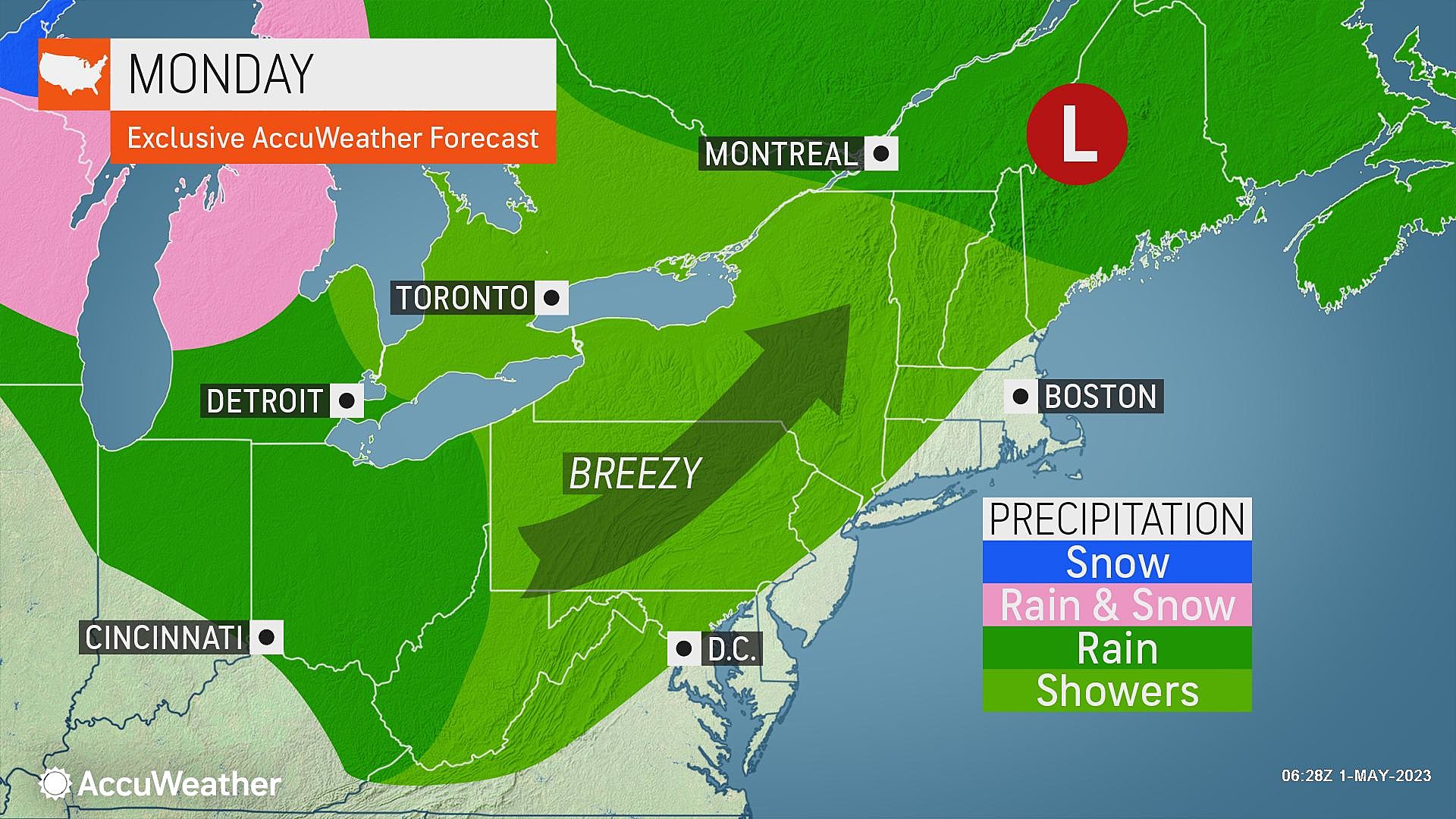
That shower chance should fade by Midnight Monday evening. The rest of the overnight will be mostly cloudy and cool, with lows around the upper 40s.
Tuesday
Tuesday's forecast reads as a rather "blah" day. Cloudy skies will join with spotty showers and drizzle. It's not a total washout — just dreary and damp at times.
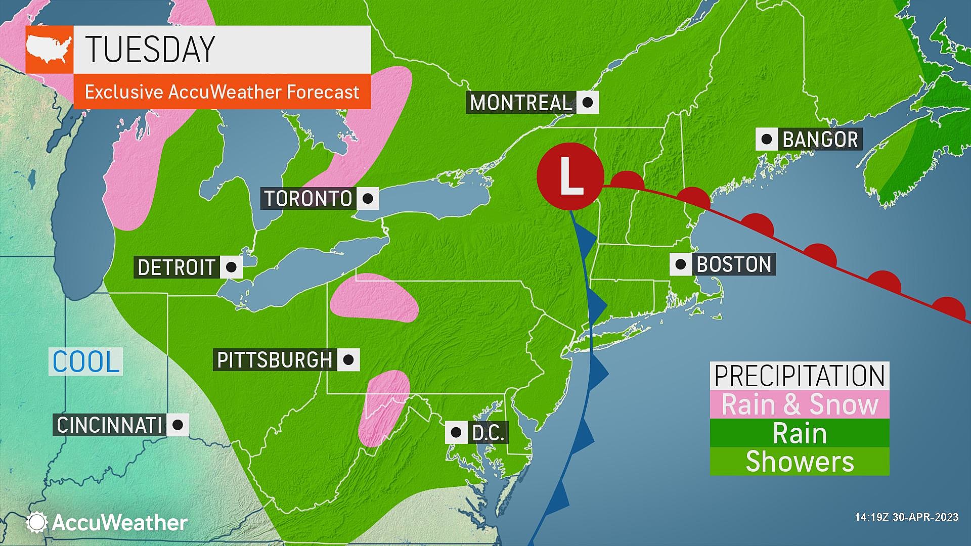
High temperatures on Tuesday will struggle to surpass the mid 50s.
Wednesday
Wednesday looks brighter, but even cooler. Skies will turn partly sunny. However, I can not rule out a few showers starting around midday.

Highs will only reach the lower to mid 50s — more typical of March than May.
Thursday & Friday
Still semi-unsettled and on the cool side. But I think we will find some glimmers of pleasant skies. Both days will be partly sunny, with an isolated shower chance. Highs will average mid 50s — still 10+ degrees below seasonal normals.
The Extended Forecast
After two weekends in a row of stormy, soggy weather, I think we deserve some nice Spring weather. And it looks like the first weekend of May will be a real winner.
At the moment, I'm seeing sunshine, light winds, and dry weather for both days next weekend. Upper 60s on Saturday. Lower 70s on Sunday. Beautiful weather all around.
Rain will return early next week. But hopefully temperatures will stay more seasonable and comfortable — closer to 70-plus than 60-minus.
Dan Zarrow is Chief Meteorologist for Townsquare Media New Jersey. Follow him on Facebook or Twitter for the latest forecast and realtime weather updates.
LOOK: The most expensive weather and climate disasters in recent decades
Gallery Credit: KATELYN LEBOFF
KEEP READING: Get answers to 51 of the most frequently asked weather questions...
More From New Jersey 101.5 FM


