

A steamy, stormy week: Remnants of Chantal may soak parts of NJ
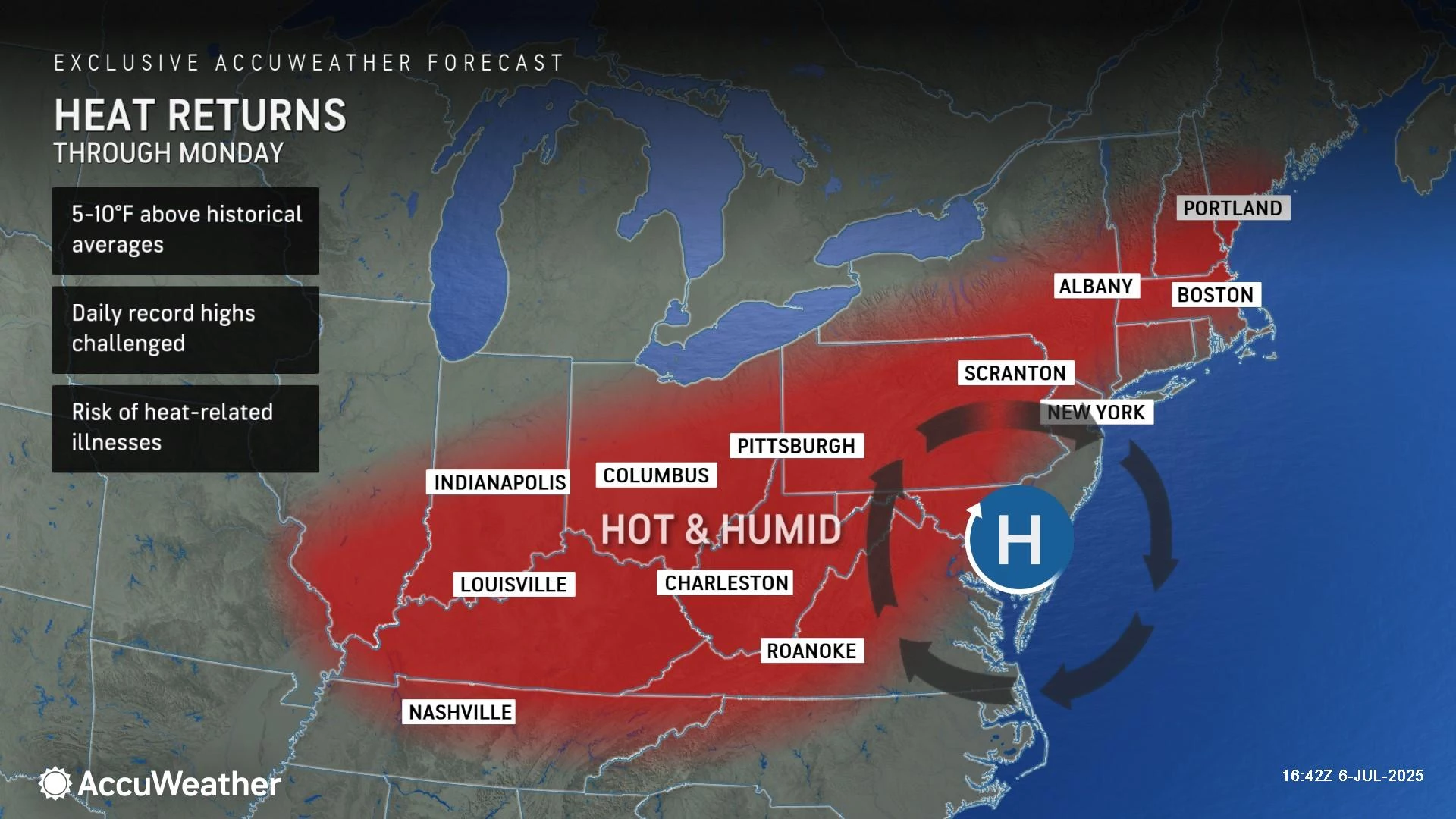
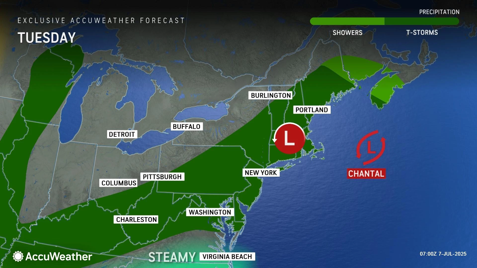
Coming off a simply spectacular 4th of July holiday weekend, changes are ahead in New Jersey's weather forecast. The remnants of Tropical Storm Chantal will drive moisture up the coast Monday. That will lead to a rise in humidity and increasing rain chances through the afternoon, notably including the threat for downpours and areas of flooding. A Flood Watch has been issued for part of the state. Otherwise, it will be warm and much more humid, reaching into the 80s. Tuesday will be hot and humid, back in the 90s. I'm actually more concerned about widespread thunderstorms late tomorrow, which could have some teeth — wind, heavy rain, lightning, etc. Steamy, stormy weather will stay in the forecast for Wednesday and probably Thursday too.
Monday NJ weather: Here comes Chantal
Tropical Storm Chantal made landfall along the South Carolina coast early Sunday morning, and has since soaked the Carolinas and Virginia. Now it is New Jersey's turn to taste that tropical moisture.

To be crystal clear, we are NOT (note the capital letters) expecting "tropical storm" conditions in New Jersey. However, I have learned time and time again to never underestimate the rainfall potential of storm systems of tropical origin.
We start Monday with a return to more typical summertime weather. That means the return of sticky, steamy humidity. Temperatures are in the 70s Monday morning. And will climb to the mid to upper 80s Monday afternoon. Technically a few degrees cooler than Sunday. But with high humidity back in play, you will sweat just as much.
For the most part, we will see times of sun and clouds throughout the day. There is a chance of an isolated shower on the northern edge of Chantal at any time, especially around the southern half of New Jersey.
Once the afternoon hours arrive, the chance for spotty rain will go up. Not everyone in New Jersey will get wet Monday. But if you do see a batch of hit-or-miss rain, the chance is there for some heavy stuff. And a torrential downpour based on tropical moisture could spit out over an inch of rain in a short period of time — enough to cause ponding or flooding of low-lying areas.
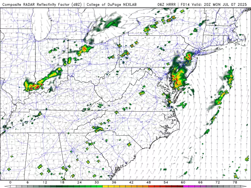
The National Weather Service has issued a Flood Watch for all or part of __ NJ counties from 10 a.m. to 10 p.m. Monday: NW Burlington, Camden, Cumberland, Gloucester, Hunterdon, MercerMiddlesex, inland Monmouth, Salem, and Somerset. (For the record, that "central and southwestern New Jersey" geography is a little too specific for my taste — anyone south of about I-78 should stay "weather aware" to potential heavy rain and "big puddles" Monday.)

Once rain wraps up Monday evening, the overnight will stay sticky with scattered lows. Low temperatures will only dip into the 70s overnight.
Tuesday NJ weather: Widespread heat, widespread storms
I am actually more concerned about Tuesday's storms than Mondays, because 1.) they will be most widespread, and 2.) they will be multi-impact (rain, wind, lightning).
First, Tuesday will be a hot and humid summer day. With inland high temperatures reaching the lower 90s, the heat index will flirt with 100 degrees. That is spicy enough to spark a Heat Advisory for most of the state, cautioning of potentially dangerous conditions for those spending extended time or doing strenuous activities outdoors. Please take care of yourselves out there.
Starting around mid-afternoon, we will have to watch the western sky for an approaching cold front. That is expected to be the catalyst for a round of scattered thunderstorms through the late afternoon and evening hours. Given the high heat and humidity, there will be plenty of ammunition for those storms to reach strong to severe limits.
My big concern here would be for gusty winds, enough to cause downed trees and power outages. Frequent lightning and heavy downpours are likely too. There could be some pretty nasty storms around — just like we have seen several times over the past few weeks.

Look, summertime is New Jersey's heat and thunderstorm season. This type of forecast should surprise no one. But do not be complacent here — this weather means business, and you should not be caught off-guard and unprepared for potentially hazardous conditions.
Wednesday NJ weather: Still steamy and stormy
Wednesday is a bit of a question mark, as it depends upon how far Tuesday's cold front progresses to the south. If it stalls over southern New Jersey, or meanders back over the Garden State at some point, we are in for another round of stormy weather. (In fact, the GFS model forecast favors a widespread round of pouring rain Wednesday night.) If not, we could see some spotty showers, and that is it.
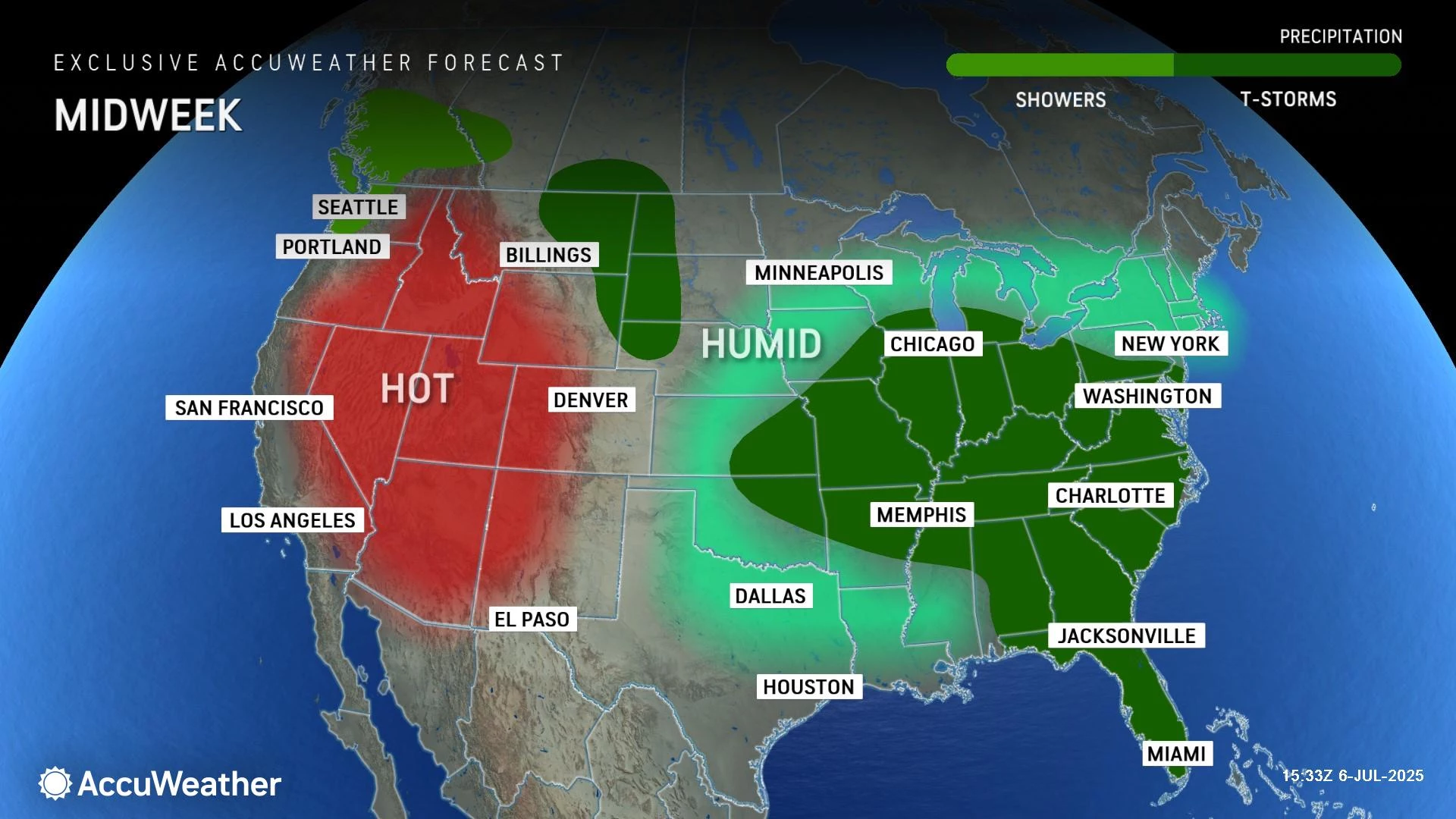
So I will keep a chance for showers and thunderstorms in the forecast for now, and will have to wait and see to update that precipitation outlook further. Temperatures will trend slightly cooler on Wednesday afternoon, settling in the 80s. Still quite warm and steamy though. Skies will be mostly cloudy.
Thursday NJ weather: One more unsettled day
I have to be honest — I am so focused on the short-term forecast that I do not have great resolution or insight on the second half of the week.
Thursday looks OK. Mostly cloudy, fairly warm and humid, with highs in the lower 80s. We will probably still see a few showers around, especially late. And that's about it.
Not the greatest beach day, given the clouds and an on-shore breeze. But nowhere near a washout either.
Friday NJ weather: Better weather by the weekend
If all goes well, Friday should be all about improving weather. A morning shower and early clouds should give way to emerging sunshine by the afternoon. High temperatures will end up somewhere around 80 degrees, although there is a lot of give and take to that number according to model guidance. (Literally from 75 to 85 degrees.)
That would set us up for a solid second weekend of July, filled with dry weather, partial sunshine, and comfortably warm temperatures.
Having said that, there is at least one model solution — the Euro — that keeps spotty rain over New Jersey through Friday, Saturday, and Sunday. I don't like such a soggy solution, mainly because there is no significant forcing in play to form such persistent, persnickety showers. But it is something we will have to watch closely — especially since those summer weekends are so precious here in the Garden State.
The complete list of names for the 2025 Atlantic Hurricane Season
Gallery Credit: Dan Zarrow
Dan Zarrow is Chief Meteorologist for Townsquare Media New Jersey. Follow him on Facebook for the latest forecast and realtime weather updates.
Here's why NJ heat waves can be incredibly dangerous
Gallery Credit: Dan Zarrow
More From New Jersey 101.5 FM


