

NJ weather: A few showers, a burst of wind, and a cooldown ahead
The Bottom Line
There's still a lot more springtime flip-flopping weather to come this week, as we go from mild to chilly to mild to downright warm.
There are two storm systems to watch here. First, a cold front will drive in a shower Wednesday evening, kick up a chilly breeze, and push temperatures downward on Thursday. A more potent system will drive in steadier, heavier rain — and maybe even some thunderstorms — late Friday into Saturday. Gusty winds and warm temperatures will start the weekend, while another cooldown arrives for Sunday.
So yes, there is a little bit of everything in the forecast here. But no significant travel impacts and no "shock to the system" kind of weather shifts. Just a typical transition from March to April.

Wednesday Daytime
On paper, Wednesday reads like a pleasant late March day. No wind or rain problems yet. And temperatures will be slightly warmer than Tuesday, right around the long-term average for this time of year.
As a storm system south of New Jersey clears the coast, we should enjoy several hours of sunshine Wednesday morning. Fair-weather clouds will return in the afternoon. High temperatures are forecast to reach the mid 50s.
Wednesday Night
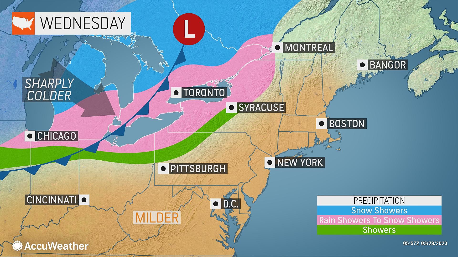
As a cold front slides into New Jersey late Wednesday evening, we will see a few weather impacts.
First, some showers. They could be raindrops, or even (more likely) snowflakes. But anything falling from the sky will be light and spotty — our air is pretty dry right now. Showers will probably fizzle out before the frontal boundary reaches the coast. The window for these showers is very narrow, between about 9 p.m. and 3 a.m.
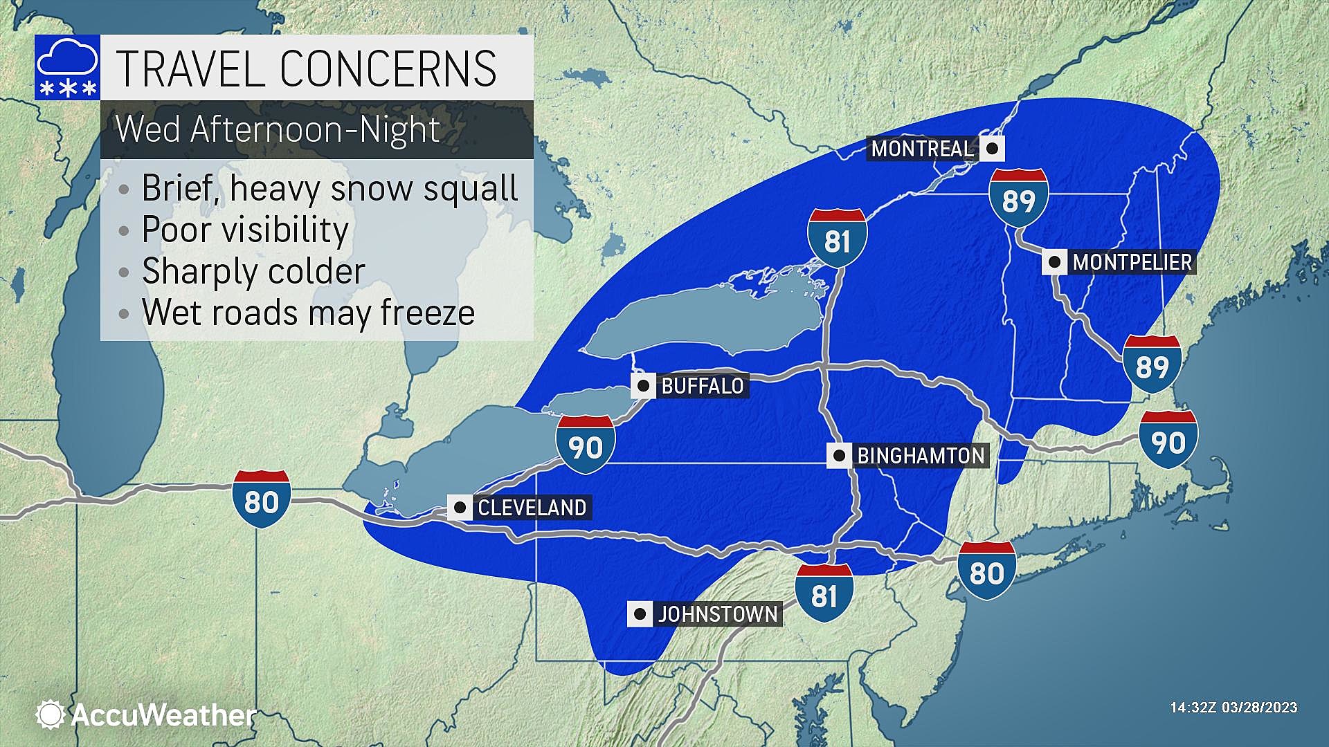
Second, it will turn breezy to windy. A few forecast models show wind gusts in the 30+ mph range, as a northwesterly flow causes colder air to "whoosh" in.
And third, it will get colder. Most of the state — away from cities and the immediate coast — will probably freeze Thursday morning. Low temperatures are expected to bottom out in the lower 30s or so.
Thursday
Thursday will be a bright, sunny day! But also breezy and chilly.
High temperatures will only reach the mid 40s — more typical of late February than late March. Regular wind gusts of 20+ mph are expected throughout the daytime hours, calming at night.
Friday
As the wind direction turns southerly, we will warm right back up again on Friday. Look for highs around 55 to 60 degrees. (A bit cooler, closer to 50, in North Jersey.)
Clouds will increase throughout Friday. And then I have to add a chance for some rain showers starting sometime in the afternoon. Not everyone in NJ will get wet late-day Friday, but there could be a few hours worth of wet, inclement weather for many.
Saturday
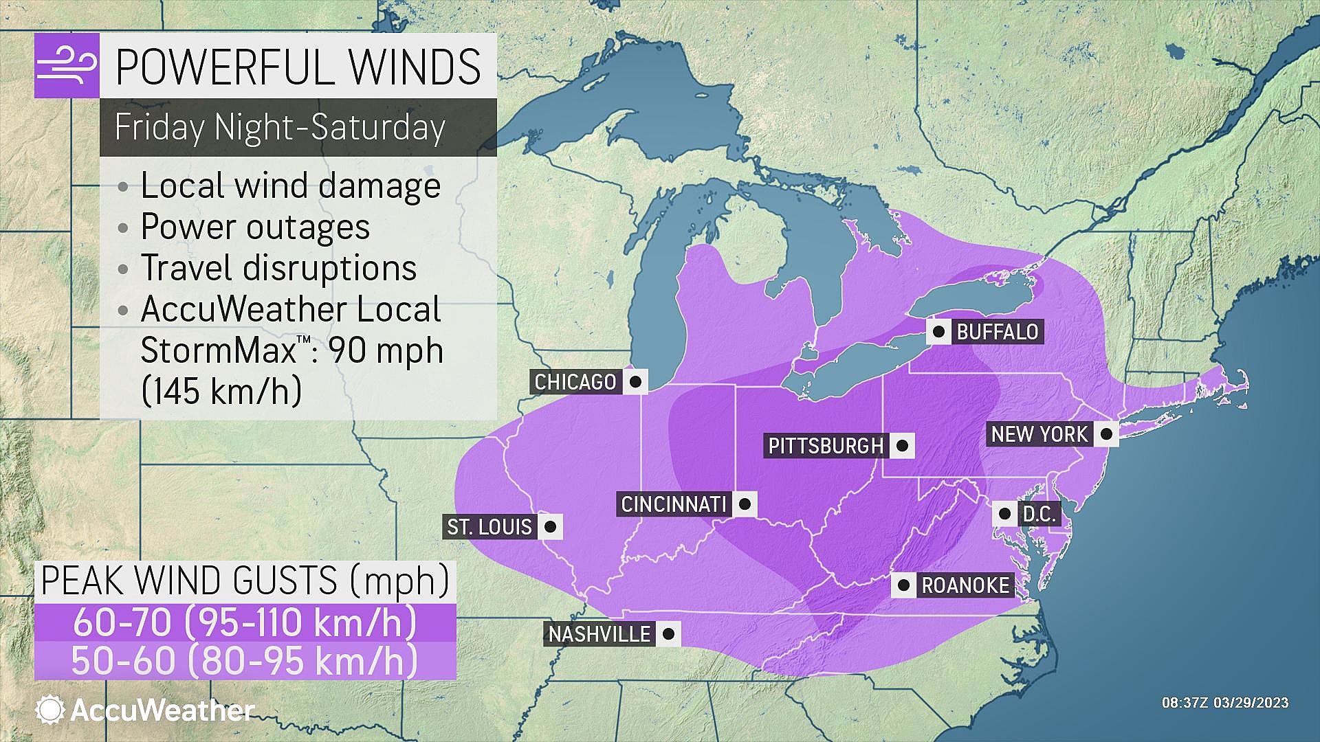
We welcome April on Saturday with a tumultuous weather day. And Saturday will be a very different weather day than Sunday.
The chance of rain will continue Saturday — scattered stuff in the morning, then a "grand finale" round of rain later on. Thunderstorms and pockets of heavy rain are possible, largely thanks to an influx of warmer, more humid air.
Oh yes, Saturday is looking warm. Despite the raindrops. Despite the clouds. Low temperatures in the lower 70s would be the warmest day of the season so far.
In addition, wind is a concern for Saturday. Pre-front southwesterly gusts to 30+ mph. Post-front northwesterly gusts to 40+ mph. Secure your garbage can and batten down the hatches, folks.
Sunday & Beyond
Again, conditions on Sunday will be very different.
Skies should go mostly sunny by Sunday morning. It will remain breezy, with top gusts in the 20+ mph range. And temperatures will end up about 20 degrees cooler than Saturday, with highs in the lower 50s or so.
I suspect 60s will return for Monday and Tuesday, with more April showers in the forecast by midweek.
Dan Zarrow is Chief Meteorologist for Townsquare Media New Jersey. Follow him on Facebook or Twitter for the latest forecast and realtime weather updates.
Weird things NJ taxes - and some they don't
Gallery Credit: Eric Scott
Spring is here: This NJ park is a great place to explore
Gallery Credit: Kyle Clark
More From New Jersey 101.5 FM


