

NJ says goodbye to storms and humidity, for a few days at least
In the first 20 days of July, New Jersey recorded 18 days of measurable rainfall. (The only exceptions were the 5th and 6th.) 10 of those days saw over an inch or more somewhere in the state. On the temperature side, 16 of those 20 days had at least one weather station in New Jersey hit 90+ degrees. July is supposed to be a hot, wet month ... but this has been a special kind of ridiculous lately.
I am so happy to pass along that the next few days will feature lower humidity, comfortable temperatures, and zero chance of thunderstorms. If you planned your summer vacation, summer camp, yardword, etc. for this week, you made a very good call. Humidity will fall away on Monday, with sunshine and a refreshing breeze. High temperatures will be in the seasonable 80s for Monday, Tuesday, and Wednesday. Overnights will be quite comfortable too. Mother Nature will crank up the heat again soon enough though — 90s and thunderstorms return at the end of the week.

Monday NJ weather: Bye-bye, humidity
A cold front slid through New Jersey Sunday night, along with some spotty thunderstorms. And now slightly cooler, much drier air is starting to leak into New Jersey. The end result of this dry air advection: Several days of much more comfortable air and very pleasant summer weather.
Monday morning is still a bit sticky, especially across the southern half of New Jersey where temperatures are still in the 70s. 60s to the north are par for the course for this time of year.
Highs will reach the mid 80s Monday afternoon. Definitely warm. Very close to normal for this time of year. But because dew points will likely drop into the 50s, the air will be less muggy and less thick, so you will not have to "chew through" it.
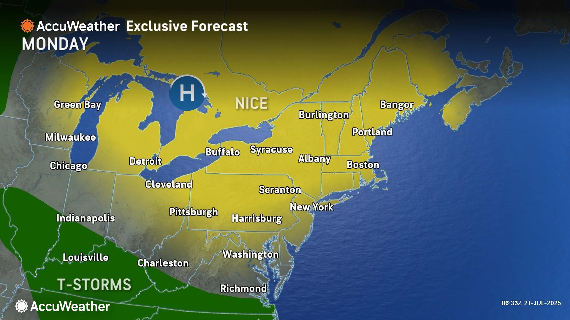
We should see mostly sunny skies. And you should feel a refreshing northwesterly breeze throughout the day. (That is a land breeze at the Jersey Shore: Watch out for flies at the beaches.)
The best part of this forecast: It is the first Monday in a month with zero chance of thunderstorms. Your outdoor activities are 100% good to go.
By Monday evening, we will be fully entrenched in dry air, leading to a spectacularly comfortable overnight. It will be clear and calm, with low temperatures around 60 degrees. (I hope it doesn't get too cool in the 50s for some?)
Tuesday NJ weather: Dry air, dry weather
As high pressure — the core of this dry air mass — builds overhead on Tuesday, we will continue to see pleasant, dry weather. And we will continue to benefit from the bargain-basement low humidity.

Again, expect plenty of sunshine. And high temperatures around 80 degrees. Tuesday will likely be the "coolest" day of the week. (I put that in quotes, because 80 degrees is still nice and warm.) I also expect it to be our coolest dry weather day in over a month.
Wednesday NJ weather: A bit stickier
Some subtle changes will take over Wednesday. Namely, a slight uptick in temperature and stickiness. But it still looks very good.
Look for sun with some clouds and highs in the lower to mid 80s on Wednesday.
Forecast models are putting some showers and sprinkles over the coast Wednesday morning, as a weak little meso-low spins up over the ocean. I am not buying into this scenario for now — it's just something to watch.

Thursday NJ weather: 90 returns
On Thursday, that protective area of high pressure shifts off-shore. And our wind becomes southwesterly. Translation: Here comes the heat.
Thursday won't be half-bad. Especially since it looks like we will once again remain storm-free, for the fourth day in a row.
Under mostly to partly sunny skies, high temperatures will shoot for about 90 degrees. Coastal areas should benefit from a generous sea breeze in the afternoon, keeping beaches cooler.
Typical summer weather, with moderate humidity.
Friday NJ weather: Ferociously hot, next storm chance
On Friday, we might need to start ringing alarm bells again for both heat and thunderstorms.
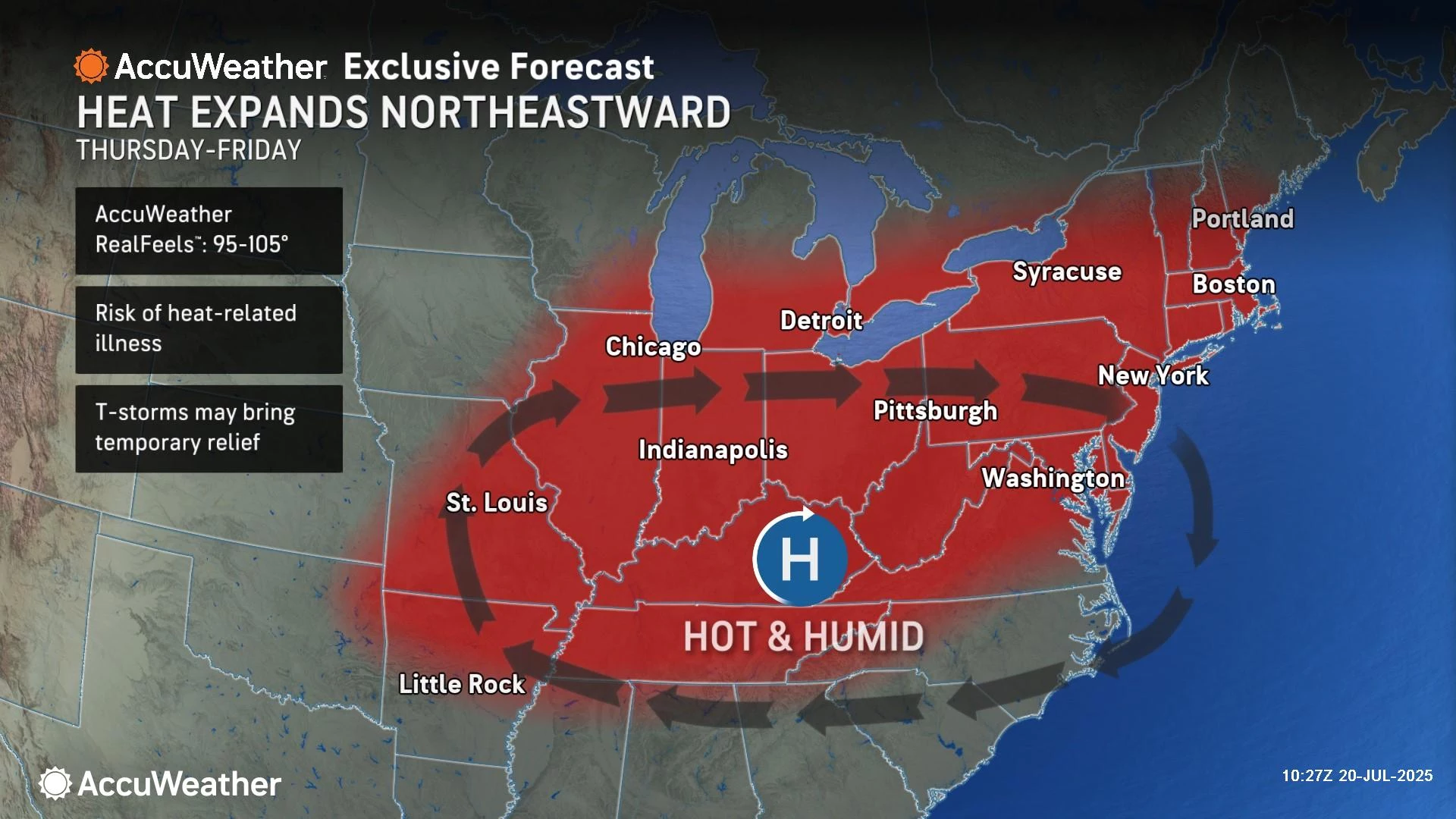
The latest forecast calls for inland highs in the mid 90s, at least. As humidity rises again, that would be the heat index in the danger zone, above 100 degrees.
Plus, the increased heat and humidity would be a focal point for strong to severe thunderstorms. At the moment, storm activity late Friday does not look widespread. But given the energy in the atmosphere, we will have to watch the threat for damaging winds and flooding rains very closely.
The early look at the last weekend of July keeps things hot and potentially stormy. But as usual, it is pointless to dive into details until we are much closer.
NJ DOT's Electronic Sign Safety Messages Summer 2025
Gallery Credit: Dan Alexander
Dan Zarrow is Chief Meteorologist for Townsquare Media New Jersey. Follow him on Facebook for the latest forecast and realtime weather updates.
2025 National Night Out events in New Jersey
Gallery Credit: Dan Alexander
More From New Jersey 101.5 FM


