NJ beach weather and waves: Jersey Shore Report for Mon 5/27
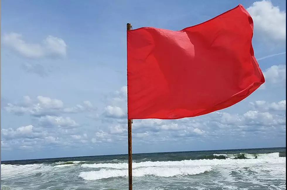
MODERATE RISK OF RIP CURRENTS. Life-threatening rip currents are possible in the surf zone.
SMALL CRAFT ADVISORY in effect between 3 p.m. and late Monday night
At the Shore
Current conditions and forecast as of Mon morning
| Rip Current Risk | Moderate |
|---|---|
| Waves | 1 - 3 feet |
| Winds | From the Southeast 11 - 17 mph (Gust 23 mph) 10 - 15 knots (Gust 20 knots) |
| Ocean Temperature | 58° - 70° (Normal 58° - 68°) |
| Air Temperature | 68° - 77° |
| Sunrise/Sunset | 5:30am - 8:17pm |
| UV Index | 7 (High) |
Tide Times
| SANDY HOOK Sandy Hook Bay | Low Mon 5:28a | High Mon 11:25a | Low Mon 5:19p | High Mon 11:36p | |
| LONG BRANCH Atlantic Ocean | High Mon 10:59a | Low Mon 4:43p | High Mon 11:10p | Low Tue 5:39a | |
| MANASQUAN INLET Atlantic Ocean | Low Mon 5:04a | High Mon 11:13a | Low Mon 4:55p | High Mon 11:24p | |
| SEASIDE HEIGHTS Atlantic Ocean | High Mon 10:55a | Low Mon 4:47p | High Mon 11:06p | Low Tue 5:43a | |
| SEASIDE PARK Barnegat Bay | Low Mon 9:33a | High Mon 3:05p | Low Mon 9:24p | High Tue 3:16a | |
| BARNEGAT INLET Barnegat Bay | Low Mon 5:32a | High Mon 11:16a | Low Mon 5:11p | High Mon 11:31p | |
| MANAHAWKIN BRIDGE Manahawkin Bay | Low Mon 9:07a | High Mon 2:12p | Low Mon 8:58p | High Tue 2:23a | |
| LITTLE EGG INLET Great Bay | Low Mon 6:16a | High Mon 12:19p | Low Mon 5:48p | High Tue 12:35a | |
| ATLANTIC CITY Atlantic Ocean | Low Mon 5:04a | High Mon 10:59a | Low Mon 4:43p | High Mon 11:15p | |
| OCEAN DRIVE BRIDGE Townsends Inlet | Low Mon 5:35a | High Mon 11:34a | Low Mon 5:11p | High Mon 11:58p | |
| WILDWOOD CREST Atlantic Ocean | Low Mon 5:09a | High Mon 11:03a | Low Mon 4:52p | High Mon 11:24p | |
| CAPE MAY Delaware Bay | Low Mon 6:02a | High Mon 12:10p | Low Mon 5:54p | High Tue 12:30a |
Marine Forecast
From the National Weather Service, Mt. Holly
SMALL CRAFT ADVISORY IN EFFECT FROM 3 PM EDT THIS AFTERNOON THROUGH LATE TONIGHT
TODAY: SE winds 10 to 15 kt with gusts up to 25 kt, becoming S 15 to 20 kt with gusts up to 25 kt late. Seas 2 to 4 ft. Wave Detail: SE 4 ft at 5 seconds and SE 2 ft at 9 seconds. Areas of dense fog this morning. Patchy fog this afternoon. A slight chance of showers and tstms this morning, then a chance of showers and tstms early this afternoon. Showers and tstms likely late. Vsby 1 NM or less, increasing to 1 to 3 NM this afternoon.
TONIGHT: S winds 15 to 20 kt, becoming SW 10 to 15 kt after midnight. Seas 3 to 5 ft. Wave Detail: S 5 ft at 5 seconds and SE 1 foot at 8 seconds. Showers and tstms in the evening, then showers likely with a chance of tstms after midnight. Patchy fog. Vsby 1 to 3 NM.
TUE: SW winds around 10 kt. Seas 2 to 4 ft. Wave Detail: S 4 ft at 6 seconds.
TUE NIGHT: W winds 10 to 15 kt. Seas 2 to 4 ft. Wave Detail: SE 3 ft at 7 seconds.
WED: W winds 5 to 10 kt, becoming SW in the afternoon. Seas 2 to 3 ft. Wave Detail: S 2 ft at 7 seconds and E 2 ft at 8 seconds. A chance of showers and tstms in the afternoon.
WED NIGHT: W winds around 10 kt, becoming NW after midnight. Seas 2 to 3 ft. Wave Detail: NW 2 ft at 3 seconds and S 2 ft at 7 seconds. A chance of showers and tstms in the evening.
THU: NW winds 10 to 15 kt, diminishing to 5 to 10 kt in the afternoon. Seas 2 to 3 ft.
THU NIGHT: SW winds 10 to 15 kt, becoming NW after midnight. Seas 2 to 3 ft.
FRI: NW winds 10 to 15 kt, becoming W 5 to 10 kt in the afternoon. Seas around 2 ft.
FRI NIGHT: W winds around 10 kt, becoming NW after midnight. Seas around 2 ft. Winds and seas higher in and near tstms.
Plan Your Trip
Data on this page amalgamated from several sources, including the National Weather Service (weather), National Ocean Service (tides), U.S. Naval Observatory (sun), and the U.S. Environmental Protection Agency (UV index).
Dan Zarrow is Chief Meteorologist for Townsquare Media New Jersey. The Shore Report is generated semi-automatically daily at 5 a.m. from mid-May to late September. Follow Dan's weather blog, Facebook page, and Twitter feed for your latest forecast and realtime weather updates.
33 Beach Umbrellas You've Seen At The Jersey Shore
Gallery Credit: Rich De Sisto
What Is This Foam I Spotted On A Jersey Shore Beach
Gallery Credit: Nicole Murray
5 Fantastic Dog-Friendly Beaches in New Jersey
More From New Jersey 101.5 FM