
Monday NJ weather: T.S. Fred spits humid air and waves of showers our way
UPDATE... This article is outdated...
For the latest storm forecast information, please refer to my newest weather blog post.
The Bottom Line
Hey, we didn't hit 90 degrees on Sunday! Although there's no more heat waves in the forecast, we do have to talk about the return of humidity.
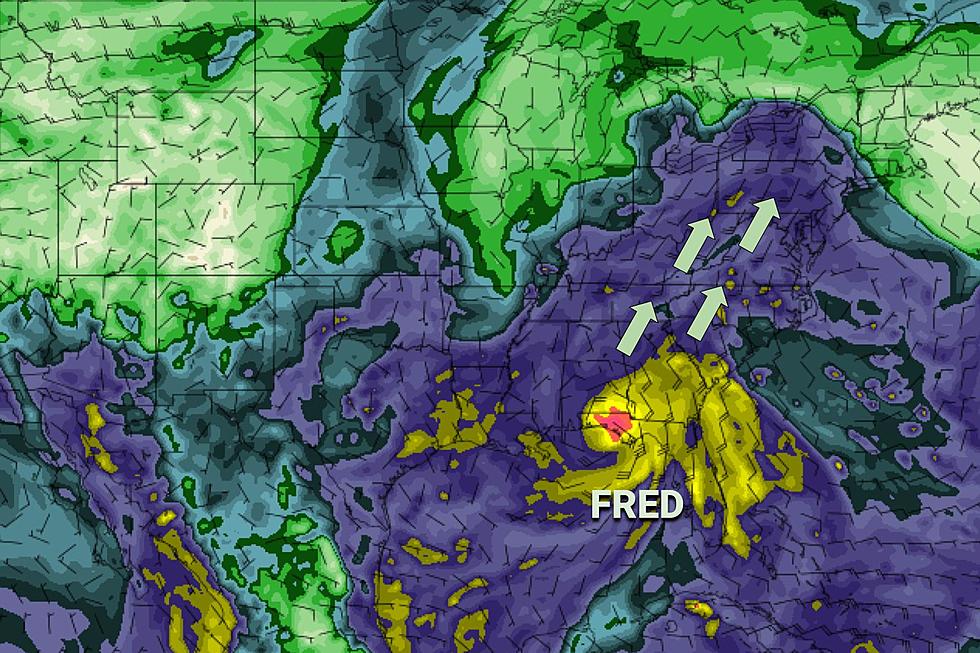
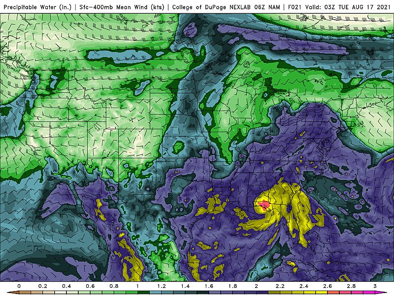
The big driver of our weather this week will be the storm system currently known as Tropical Storm Fred, spinning in the middle of the Gulf of Mexico, a thousand miles from New Jersey. Fred is going to spit bursts of energy our way, leading to an uptick in humidity and cloud cover. We'll also see several waves of showers over the next few days, leading to some unsettled and wet-at-times weather.
Monday
Our best shot at a "mainly dry" day this workweek will come Monday. And I think it's fair to call it a pleasant day, with a mix of clouds and sun and high temperatures in the lower 80s. Dew points are in the 60s - not quite steamy, but not dry and crisp either. Decent day for the beach, even with limited sunshine.
For the most part, the "river of rain" tapped into Fred's tropical moisture will stay west and north of New Jersey on Monday. However, I believe a shower or thunderstorm may creep into southwestern New Jersey after about 3 p.m. Monday afternoon.
Additional showers and sprinkles may scrape past the western and northern edge of the state Monday night. Otherwise, look for mostly cloudy skies and low temperatures around 70.
Tuesday
As our next shortwave arrives during the day Tuesday, we'll see even more widespread shower activity. While I don't see anything heavy - rainfall totals should only reach a tenth or two - it may even turn into a "mainly wet" day.
Tuesday will turn noticeably more humid too, with dew points pushing back to 70. That's pretty steamy. And that's about where our moisture levels will stay for the next week (at least).
Because of cloud cover and the persistent shower chance, high temperatures on Tuesday will only reach the upper 70s to around 80 degrees. That is 5+ degrees below normal for mid-August.
Wednesday
Wednesday looks very similar to Tuesday. Waves of showers. Lots of clouds. Highs in the lower 80s, a few degrees warmer only because of the wind direction (southerly rather than southeasterly).
Thursday
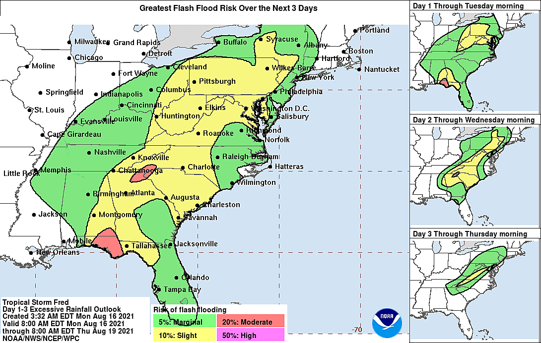
The chance for scattered rain continues. In fact, models paint a batch of heavy rain and possible thunderstorms over New Jersey Thursday morning, as the remnants of Fred make their closest pass.
We can keep fingers crossed for some breaks of sun late Thursday, pushing many high temps into the seasonable mid 80s. That will be the start of a slow drying-out trend.
The Extended Forecast
Friday will probably be the warmest day of the week, with inland highs potentially popping into the upper 80s. It will be humid too. I think we'll still have mostly cloudy skies, and maybe a shower. But in general, it looks much drier than Tuesday, Wednesday, and Thursday.
I like what I see for the upcoming weekend, but it's a little too early to offer a confident thumbs up. Partly sunny, 80s, and only stray shower chances would be about as good as it gets this time of year. I'm a little concerned about a dominant on-shore breeze, potentially keeping Shore temperatures cool and skies extra cloudy.
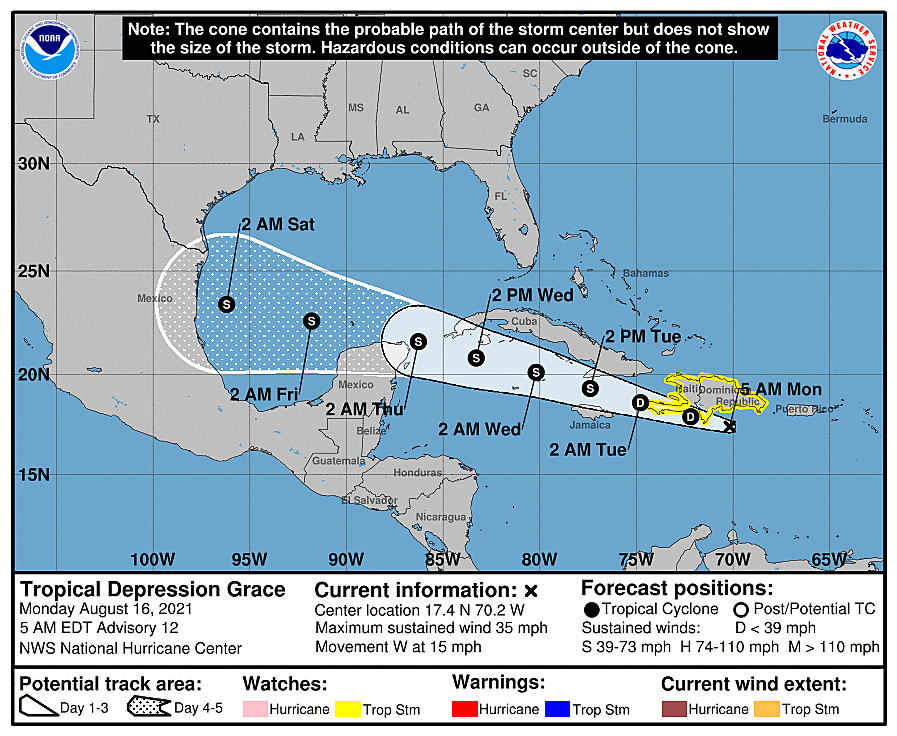
The tropics are definitely getting more active now. In addition to Fred, Tropical Depression Grace is passing by Hispanola. And Tropical Depression #8 is looping around to impact Bermuda. Neither of these pose an immediate threat for New Jersey's sky or surf. But we're less than a month away from the peak of the Atlantic hurricane season, so we'll be watching and updating regularly.
Dan Zarrow is Chief Meteorologist for Townsquare Media New Jersey. Follow him on Facebook or Twitter for the latest forecast and realtime weather updates.
13 things to love about Six Flags Great Adventure's new Jersey Devil roller coaster
Gallery Credit: Dan Zarrow
Point Pleasant Beach NJ: 11 most popular spots
Gallery Credit: Erin Vogt
More From New Jersey 101.5 FM


