Frigid February Friday with light snow, then welcome weekend warmup
Welcome to February! The final month of climatological winter, it is (on average) New Jersey's second coldest month of the year (behind only January). It is also our driest month of the year. We enter the month with unseasonable cold, but I'm happy to report those frigid temperatures will exit this weekend.
For the second morning in a row (and technically the third consecutive calendar day), we've got single digit temperatures on the board on this Friday morning. But not everywhere — it's not as bitter and painful as Thursday morning, because the wind is much calmer and thermometers are ever so slightly warmer.
I still can't believe Walpack, New Jersey dropped to -25 degrees on Wednesday morning — just 9 degrees away from the all-time New Jersey record low temperature! Walpackians are waking up to a temperature of -18 this morning — muuuuch better... #Ridiculous Cold
We'll avoid dangerous cold territory on Friday, but it's still going to be uncomfortably frigid. High temperatures will be limited to the lower 20s — still 15 to 20 degrees below seasonal normals.
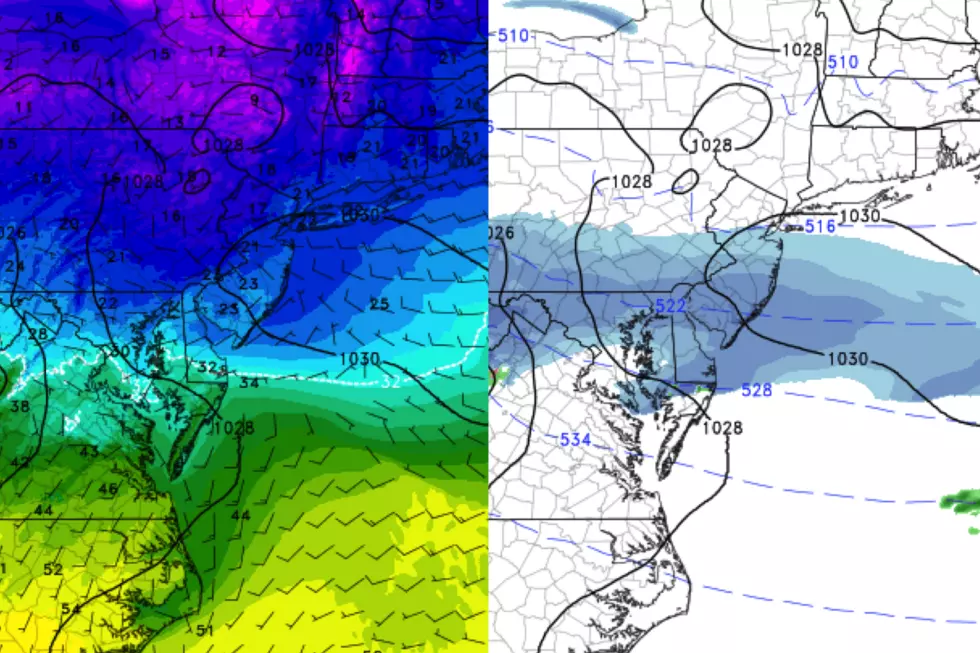
In addition, we're still watching a little storm system that is aiming for the southern half of New Jersey Friday afternoon. While our cold air mass is a very dry air mass, it won't take much to produce some light to moderate powdery snow. Here's the rundown:
--Timing: First flakes will enter SW NJ by about 10 a.m. Friday, spreading throughout the southern half of the state by early afternoon. Final flakes expected between around 5 p.m. and 7 p.m.
--Totals: Limited, but I am concerned about this little thing surprising us with high snow ratios. (Cold, dry air creates very fluffy snow that could accumulate quickly.) I'm thinking the area south of Interstate 195 will see a coating to an inch on the ground by the end of the day, with the potential for up to 2 inches south of the Atlantic City Expressway. North of 195, you may see some flakes flying around, with maybe a dusting on the ground. (Note: No snow map for this one — that's reserved for 2+ inch winter events.)
--Advisories: None at this time. (It wouldn't surprise me if the National Weather Service pops an advisory for far southern NJ at some point, especially if the snowfall arrives even heavier than expected.)
--Impacts: Meh, this one really looks like a minor snowmaker for New Jersey. (Otherwise I would have cancelled my day off today!) Visibility may be reduced during periods of snow, and untreated surfaces may get a little slippery. There could be some slowdowns during Friday evening's commute.
Looking ahead, Friday night won't be nearly as cold as the past two frigid overnights. Lows will dip into the mid to upper teens, with the wind chill just a few degrees below the actual air temperature.
The big thaw kicks in this weekend! High temperatures are expected to climb into the 30s on Saturday and potentially the 40s on Sunday. I am seeing mixed clouds throughout the weekend, and maybe a few sprinkles.
Our warming trend continues for early next week. Monday's high temps are forecast to push into the 50s in South Jersey — definitively above-normal for early February. Thermometers may flirt with 60 degrees on Tuesday, close to record highs. (I don't think we'll get there, but it will be close.)
A few rain showers are expected on Tuesday morning, but there are still no big storm systems on the horizon. We'll cool down through the middle and late parts of next week, but it looks like a slow chill and not another arctic blast.
Enjoy your weekend!
Dan Zarrow is Chief Meteorologist for Townsquare Media New Jersey. Follow him on Facebook or Twitter for the latest forecast and realtime weather updates.
More From New Jersey 101.5 FM


