

Friday NJ weather: Wraparound rain showers, then brighter skies this weekend
The Bottom Line
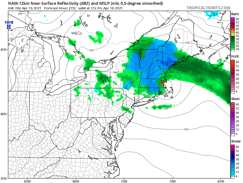
Thursday’s storm system isn’t quite done with us yet. As the center of that potent little area of low pressure hovers over Cape Cod, Massachusetts, we will see clouds and rain showers swing around the backside of the storm’s circulation. That will lead to one more round of unsettled, damp, gloomy weather Friday afternoon.
But then the weekend looks pretty good. Temperatures will end up slightly cooler than we might like. And the chance for rain is not zero - but it’s close.
Friday
Rainfall totals on Thursday ended up right on target, with a quarter-inch to a half-inch across most of the state. The Shore got soaked, while the Delaware River got spit on.
As of Friday morning, we’d found a pocket of clear sky and dry air. That’s led to temperatures dipping into the “cool zone”, with many thermometers in the 40s to start the day. Grab the jacket, and enjoy the early sunshine.
It will be a breezy and cool day overall. Westerly wind gusts will touch 20 mph. And high temperatures will only reach the lower 50s, at best. That is on the order of 10 degrees below normal for mid-April.
By Friday midday, we’ll be watching the western sky for the return of clouds. In addition, a batch of widespread rain showers will impact the Garden State between about 10 a.m. and 7 p.m. It’ll be a few hours of rain, at most. The wettest part of the state will be North Jersey, with up to a tenth of an inch of rainfall. Damp, but not heavy.
We’ll dry out and (partially) clear out again Friday night. That will lead to another chilly night, with lows around 40 degrees. A frost (37 degrees) is possible in the coldest spots. I think we’ll miss a widespread freeze.
Saturday
Not bad. Skies will range between mostly and partly cloudy, keeping temperatures a bit below seasonal normals. We’ll see highs in the mid 50s.
In addition, a few models - namely, the NAM - show some light rain showers (sprinkles) clipping the state Saturday evening. I’ve included this limited chance of raindrops in the forecast, just in case.
Sunday
Even better. Partly sunny and upper 50s.
Monday & Beyond
The warmup will continue for early next week. Monday looks like a splendid spring day, with lots of sunshine and highs in the lower 60s. (Although the sea breeze machine may fire up, keeping Shore points in the 50s.)
Thermometers should creep even closer to 70 on Tuesday. Skies will progress from sun to clouds, and we’ll keep a dry forecast for now.
Our next storm system will be a cold front on Wednesday. That will drive in a round of rain and potential thunderstorms. And then cooler air will knock back temperatures significantly for the second half of next week. Depending on exact timing and temperatures, there could be some snowflakes in NW NJ at the tail-end of the storm system. And gardeners should monitor the chance of a frost or freeze for Thursday morning.
Looking long-range, the second half of April generally looks seasonable. There will be some cooler days and some warmer days. Some unsettled days, and some breaks of sun. I’m still thinking our next chance of a sustained warmup will come in the closing days of the month.
Have a great weekend!
Dan Zarrow is Chief Meteorologist for Townsquare Media New Jersey. Follow him on Facebook or Twitter for the latest forecast and realtime weather updates.
How to start your first garden
NJ towns that actually cut property taxes in 2020
More From New Jersey 101.5 FM


