

Bertha’s remnants to drive clouds, humidity, and a few showers into NJ Thursday
Let's talk about big Bertha. First of all, what a name! Second (and more seriously), I'm skeptical about whether this storm system even deserved a name. While it does have a clear link to rich tropical moisture, it was never well-organized, nor showed sustained winds of 39+ mph. It was a tropical storm for all of 9 hours on Wednesday, then a tropical depression for 6. It did drop upwards of a half-foot of rain over the Carolinas.
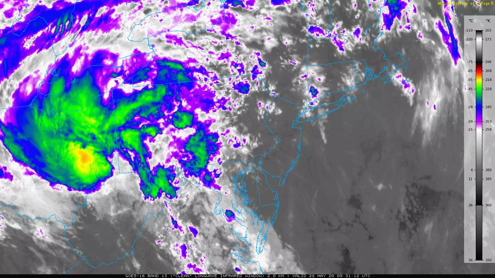
As of this writing Thursday morning, the remnants of Bertha are centered over West Virginia and Ohio, passing well west of New Jersey. That's pretty much a best-case scenario for us, as we avoid the worst of the rain and wind with zero surf concerns. Having said that, the-storm-formerly-known-as Bertha will drive four minor effects toward New Jersey Thursday:
1.) Enhanced cloud cover. Skies becoming mostly cloudy to overcast.
2.) Rising humidity. Dew points coming close to 70 degrees.
3.) A few rain showers. Mainly (although not exclusively) along the western edge of the state.
4.) The ocean is still a bit churned up, raising a moderate risk of rip currents and rough surf. Wave heights up to 4 feet.
High temperatures Thursday afternoon will be generally cooler than Wednesday, in the lower to mid 70s. As we've seen every day so far this week, the Jersey Shore will be the cool spot, stuck in the 60s all day.
Thursday night will be cloudy, with some fog. Feeling rather muggy and summerlike, low temperatures will only dip into the mid 60s at the coolest.
That will set up a steamy Friday, with high temps in the upper 70s to lower 80s. As a cold front slowly approaches from the west, a few thunderstorms will probably fire off during the day Friday too. Given the juicy atmosphere, any storms that form may be on the strong side, with localized downpours, wicked lightning, and possibly some wind and hail.
We move into the weekend with one more round of rain and potential thunderstorms early Saturday morning. Again, given the mugginess, we'll have to be on the lookout for any strong to severe storm cells.
Behind that scattered rain, skies will clear to partial sunshine through Saturday afternoon. And, more importantly, the high humidity will start to fall away too. Dew points will eventually fall from about 70 to the 30s through early next week — a very noticeable change!
Therefore, as long as the rain clears out early enough, Saturday will turn into a nice day. Increasing sunshine, decreasing humidity, and continuing warmth. I think highs will still come close to 80 degrees.
Sunday will be the cooler day of the weekend, with morning 50s and afternoon lower 70s. It will be mostly sunny, with a refreshing northerly breeze. Not a bad way to close out the month of May!
The pleasant, although slightly below-normal, weather will continue into early next week. High temperatures will generally reach about 70 to 75 degrees, with predominant sunshine and only minimal rain chances.
Dan Zarrow is Chief Meteorologist for Townsquare Media New Jersey. Follow him on Facebook or Twitter for the latest forecast and realtime weather updates.
More From New Jersey 101.5 FM


