

Winter Weather Advisory: Snowy scene for southern NJ by Sunday
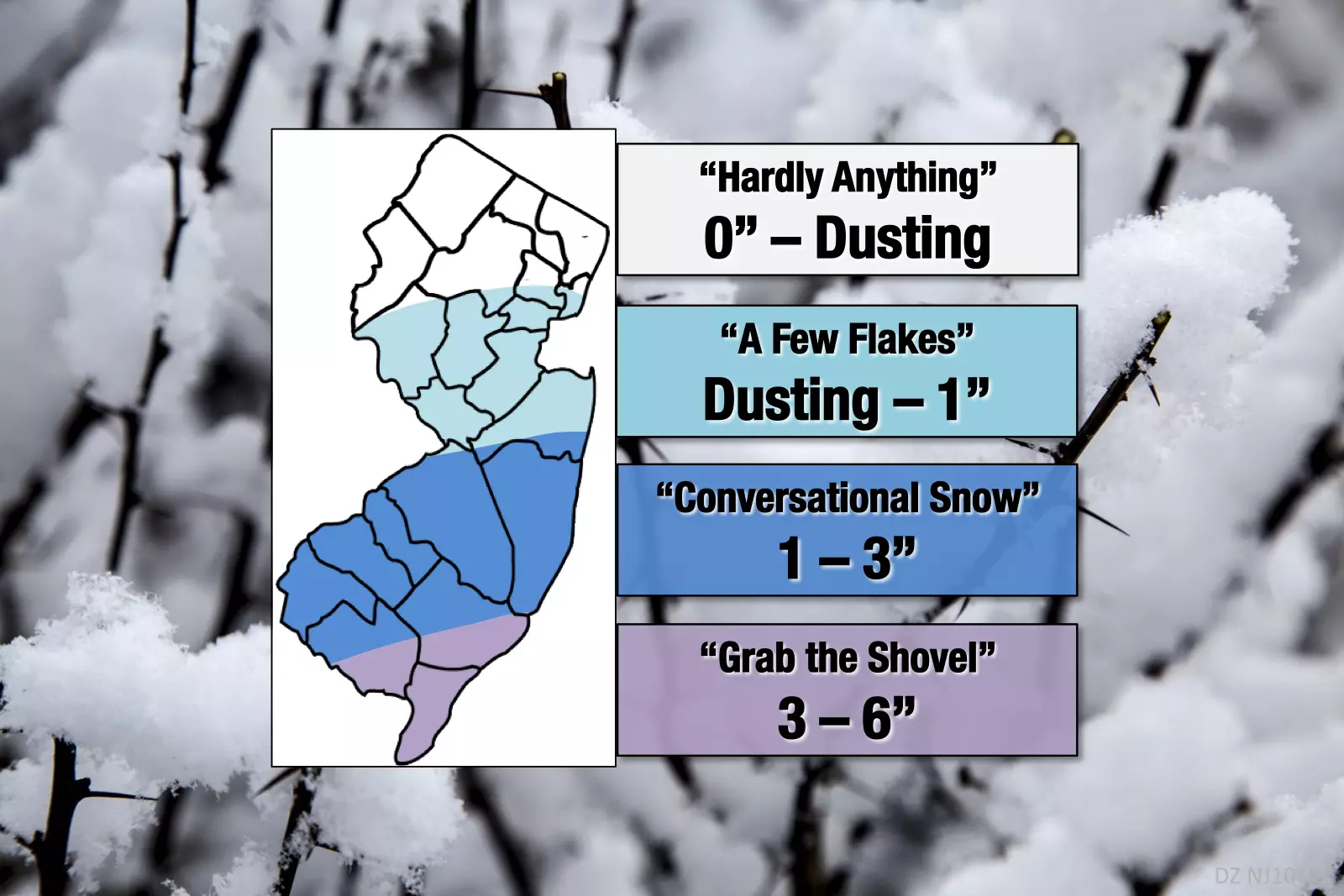
After taking a last close look at model guidance before our weekend snow event is set to begin, I've decided to upgrade my snow total forecast. For much of the state, the forecast remains largely unchanged from my Saturday morning forecast. (Slight tweaks to contours and ranges, in an effort to better communicate the forecast, rather than to drastically change the snow outlook.) However, for the southern half of the state, there's pretty good evidence pointing toward deeper snow by the end of the weekend.
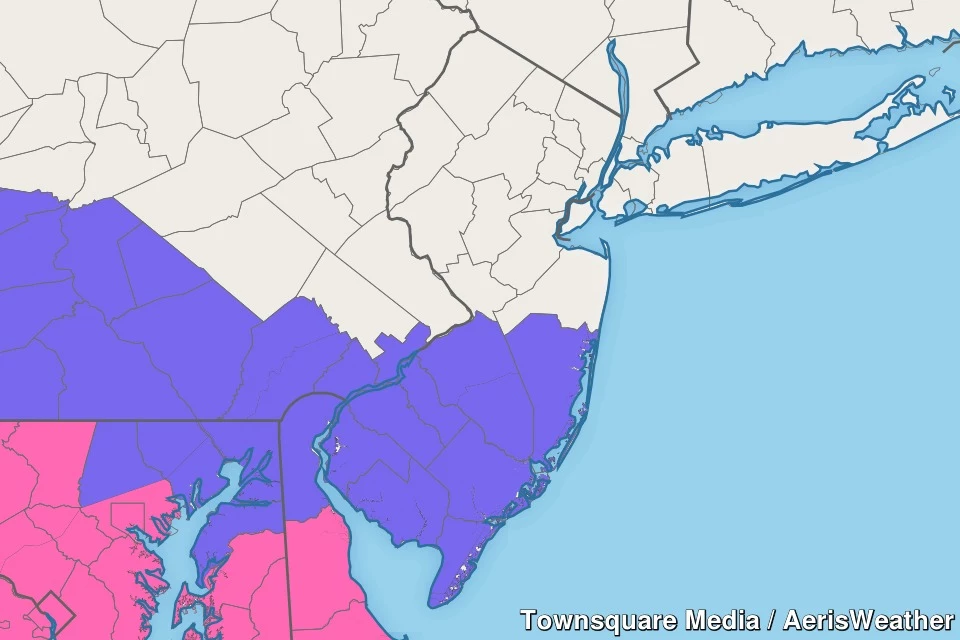
In addition, the Winter Weather Advisory has been expanded in both time and geography. It is now effective from 7 p.m. Saturday through 1 a.m. Monday, and includes Atlantic, Burlington, Camden, Cape May, Cumberland, Gloucester, Ocean, and Salem counties. (Everything south of Interstate 195.) An advisory means snow may reduce visibility and traction, creating hazardous travel conditions.
Why the last-minute adjustment? It really comes down to the fact that I have become much more concerned about overperformance than the storm being a total dud. I have two concerns in particular:
1.) Cape May is going to end up awfully close to some heavy snow. (Warnings are posted just across the bay in Delaware.) Heavier snowfall would lead to higher totals.
2.) A few model solutions are now suggesting that snow will linger along the southern coast past the previously-advertised end time of Sunday afternoon. Possibly even lasting into early Monday morning. (It's a scenario I floated earlier in the week, but prematurely ruled it out.) A longer period of snow would lead to higher totals.
Up to 6 inches of snow is now expected in far southern New Jersey. And yes, even higher amounts still can't be ruled out.
The rest of the storm timeline remains the same — first flakes Saturday evening, snowfall ramps up Sunday morning, and for most will taper off Sunday afternoon.
For more info on this winter storm, including a more detailed timeline, description of travel impacts, and discussion on wind/coast/temperature concerns, please check out the Saturday morning edition of my weather blog:
Next weather blog update is scheduled for Sunday morning, just as the snow starts to really ramp up.
Dan Zarrow is Chief Meteorologist for Townsquare Media New Jersey. Follow him on Facebook or Twitter for the latest forecast and realtime weather updates.
More From New Jersey 101.5 FM


