

Winter Weather Advisory: Monday-Tuesday snow-rain-ice timeline for NJ
Winter Weather Advisory
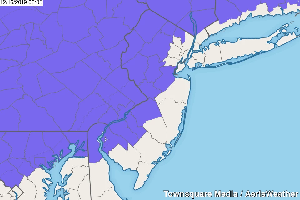
Our Winter Weather Advisory has been expanded, to cover the potential for Monday morning snow in SW NJ. Advisory timing has been tweaked too. Here's the breakdown:
—7 a.m. Monday to 1 a.m. Tuesday... NW Burlington, Camden, Gloucester, and Salem counties.
—1 p.m. Monday to 10 a.m. Tuesday... Hunterdon, Mercer, Middlesex, and Somerset counties.
—1 p.m. Monday to 1 p.m. Tuesday... Morris and Warren counties.
—1 p.m. Monday to 6 p.m. Tuesday... Sussex County.
—6 p.m. Monday to 6 p.m. Tuesday... western Bergen and western Passaic counties.
It's not an advisory, not a warning. And our National Weather Service forecast offices generally issue winter weather advisories on a dime when there's even a hint of ice in the forecast. While there could be slick spots and reduced visibility anywhere in the state, just keep in mind that the threat for significant icing Monday night will be geographically limited. (Keep reading for more details.)

Monday Morning
As of this writing, radar shows some light precipitation already intruding southern New Jersey. It's mainly snow along the Interstate 295 corridor (Burlington, Camden, Gloucester, and Salem counties). And mainly mix/rain closer to the coast. Our air is still very dry though, so I'm not sure how many of those snowflakes and raindrops are reaching the ground.
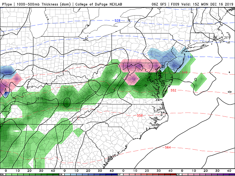
In southern and central NJ, light snow may cause low visibility and slippery spots at times through the morning commute. A coating to an inch of snow accumulation is possible on grassy surfaces. However, this piece of this storm system should not be a major impediment to your routine.
Monday Afternoon
As thermometers rise into the mid to upper 30s for most Monday afternoon, straight snow will transition to scattered wintry mix — and even that looks to be mostly a cold, uncomfortable rain. (Note: Far North Jersey will remain cold enough for all snow, but it doesn't look like precipitation will reach that far north during the afternoon hours.)

While I had previously raised alarm bells for Monday afternoon's rush hour, it's actually looking better. Mainly rain and a lull in our storm system in the late afternoon hours will hopefully allow you get home safely and efficiently.
Monday Night
Things are still expected to get dicey and icy starting around 10 p.m. Monday evening. We're still eyeballing the area northwest of the Route 1 corridor for the best chance of wintry weather overnight. To the south and east, from the cities to the coast, we're leaning toward just plain rain as temperatures slowly rise overnight. The heaviest precipitation of this storm system is expected to fall Monday night through early Tuesday morning.
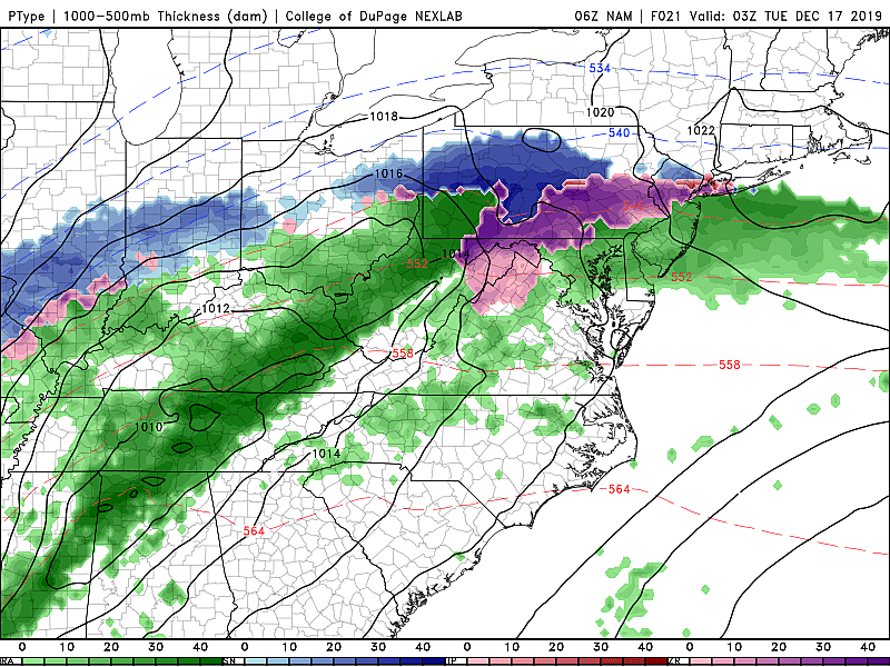
For the "ice zone" of NW NJ, models are still pumping out a quarter-inch to a half-inch of ice accumulation. That doesn't sound like much, but that is some serious icing. Enough to make travel on untreated roads practically impossible. And enough to cause widespread power outages due to downed trees, branches, and power lines.
However, as we've discussed, the temperature profile of the entire atmosphere has to be just right to see such an extended period of sleet and/or freezing rain (rather than rain and/or snow). A few degrees will make all the difference between exactly what falls from the sky.
So the numbers above represent our worst-case scenario for Monday night. However, keep in mind that even a light glaze of ice would be more than enough to make roads treacherous.
Tuesday Morning
For the area of NW NJ that skews toward skating rink rather than <puddles, there may be school delays and travel issues for Tuesday morning's commute.

And even as the precipitation intensity lets up during the daytime hours Tuesday, the icing concern will continue for far northwestern New Jersey. Most of the state is looking just wet. (South Jersey may hit 50+ degrees on Tuesday — definitely too warm for anything wintry.)
Tuesday Afternoon
As this storm system finally exits the coast, rain (icy mix northwest) will finally taper off from west to east between about 1 p.m. and 5 p.m. Tuesday. I'm optimistic the evening rush hour will be problem-free. But there could be residual icy spots in colder North Jersey.
Beyond the Storm
Skies will clear quickly as Tuesday evening descends. A brisk northwesterly wind will kick up, eventually ushering in cooler air.
You'll really feel the big pattern change on Wednesday, a cold and windy day. Gusts of 30+ mph (inland) and 40 mph (coast) are expected. High temperatures will only reach about 30 degrees (north) to 40 degrees (south). Sunshine will meet a few snow showers through Wednesday afternoon.
Thursday gets even colder. This would be a frigid day in the middle of winter! (Keep in mind we're still about 45 days away from the coldest period of the year.)
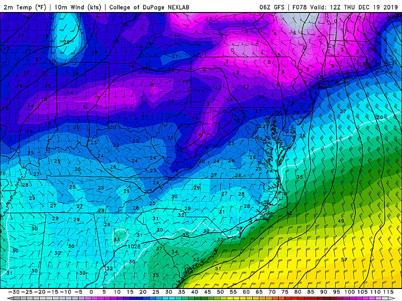
Temperatures on Thursday morning will bottom out in the teens. With a continuing biting breeze, the wind chill ("feels like" temperature) may dip as low as 0 degrees. Thursday afternoon will only top out between 25 and 30 degrees. At least the wind will die down and plentiful sunshine will continue.
A gradual warmup will take us into the last shopping weekend before Christmas. Other than a few rain and snow showers on Saturday, our weather looks clear and dry.
We had been watching a potential coastal storm for early next week, but it has since disappeared from all our weather models. The current long-range outlook keeps New Jersey storm-free through Christmas Day.
Dan Zarrow is Chief Meteorologist for Townsquare Media New Jersey. Follow him on Facebook or Twitter for the latest forecast and realtime weather updates.
More From New Jersey 101.5 FM


