

Why NJ’s weather forecast is trending even hotter this week
The Bottom Line
It has been a hot July so far. And really a hot summer — the final numbers are still being tabulated, but it looks like New Jersey just registered a top three hottest June on record.
The Newark Airport weather station, traditionally one of the hottest in the state, has hit 90+ degrees a total of 16 days so far in 2024. That ties for the 6th highest year-to-date tally since 1931. Over the course of the next week, we will probably add about six more. The record for 90-degree days at Newark in a single calendar year is 54 in 2010.
More heat and more humidity in the forecast, with very little opportunity for relief. Tuesday will be the 6th day of this 8-day heat wave.
We continue a daily chance for a popup shower or thunderstorm. And there are two chances for most organized rain coming up — late Wednesday and throughout the day Friday.
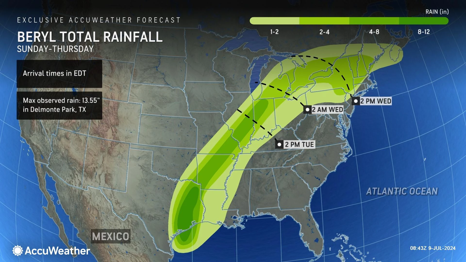
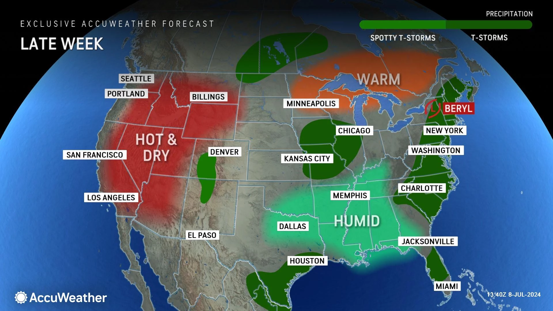
Once a powerful category five hurricane over the Caribbean Sea, Beryl will continue to fall apart over inland Texas and Arkansas Tuesday. It will pass over the Great Lakes Wednesday into Thursday.
The forecast storm track has pushed farther west — unfortunately that means New Jersey's forecast is trending drier and hotter for later this week. We will clearly fall out of the rainfall sweet spot. But parts of New Jersey could still see over an inch of rain, especially on Friday — fingers crossed!
[brandedappproo]
Tuesday
It's hot. It's humid. It's summer.
A Heat Advisory continues for both Tuesday and Wednesday, as the heat index could soar above 100 degrees once again. Stay cool, stay hydrated.
We are starting in the 70s. High temperatures will reach the lower to mid 90s for most of the state. 80s along the coast.
One other issue affecting the Jersey Shore this week has been fog. Weird fog that just lingers over the beach. Fog is an odd weather phenomenon, and honestly one of the hardest things to forecast. Fog generally forms due to heating differences between air masses, or among the land, air, and sea. So that's where the fogginess is coming from. It may slow you down a bit Tuesday morning, but visibility should improve into the afternoon.
One subtle change Tuesday will be increasing cloud cover — let's call it mostly cloudy by the afternoon. So at least you will not have the sun beating down on your back, on top of the ferocious heat and humidity.
In this hot, wet sponge of an atmosphere, a popup shower or thunderstorm is literally possible at any time. But those storm chances look very limited for Tuesday.
Tuesday night stays muggy, as clouds thin. Low temperatures will only dip into the mid 70s. Not cool, nor refreshing.
Wednesday
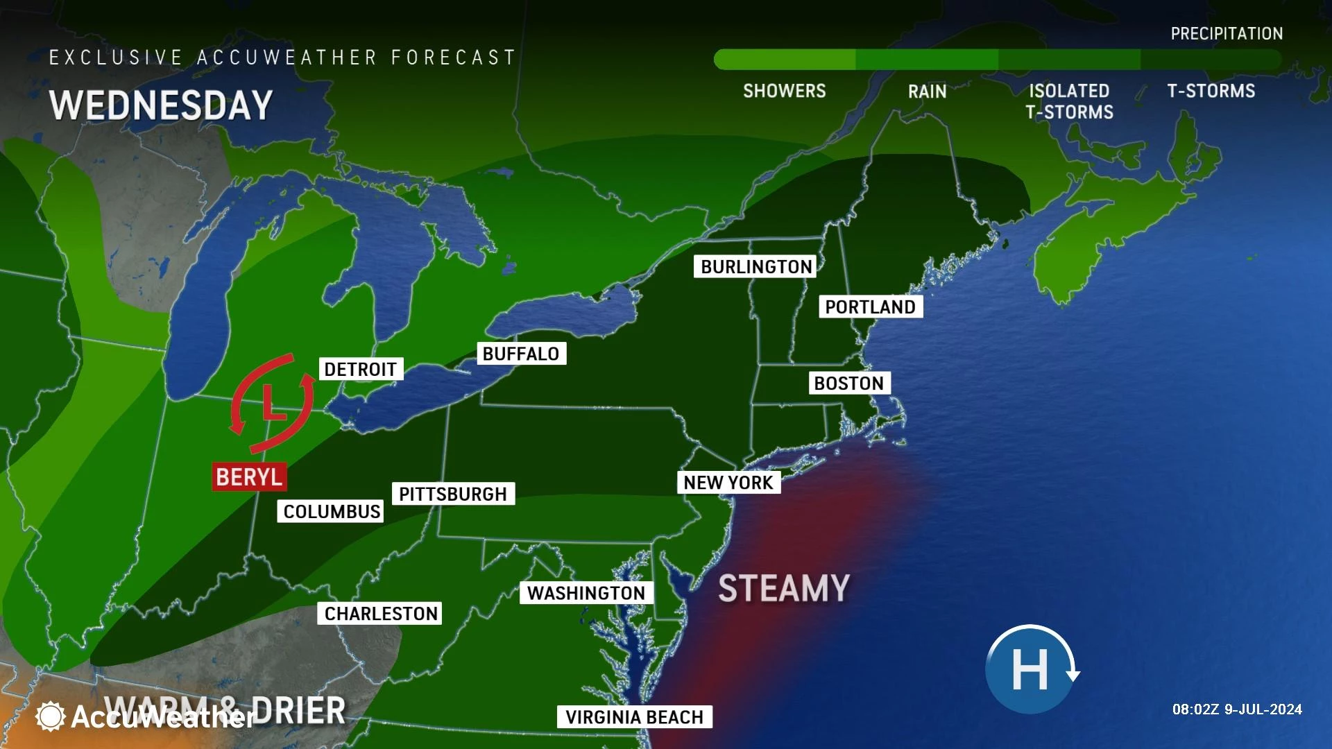
Two new additions to Wednesday's forecast: A stronger breeze, and a higher rain chance.
It will be partly sunny, hot and humid. Wednesday afternoon high temperatures will once again soar into the lower 90s. Technically a couple degrees cooler than Tuesday, but really not noticeable.
A stiff southerly breeze will kick in Wednesday afternoon, as Beryl's remnant low passes to our west.
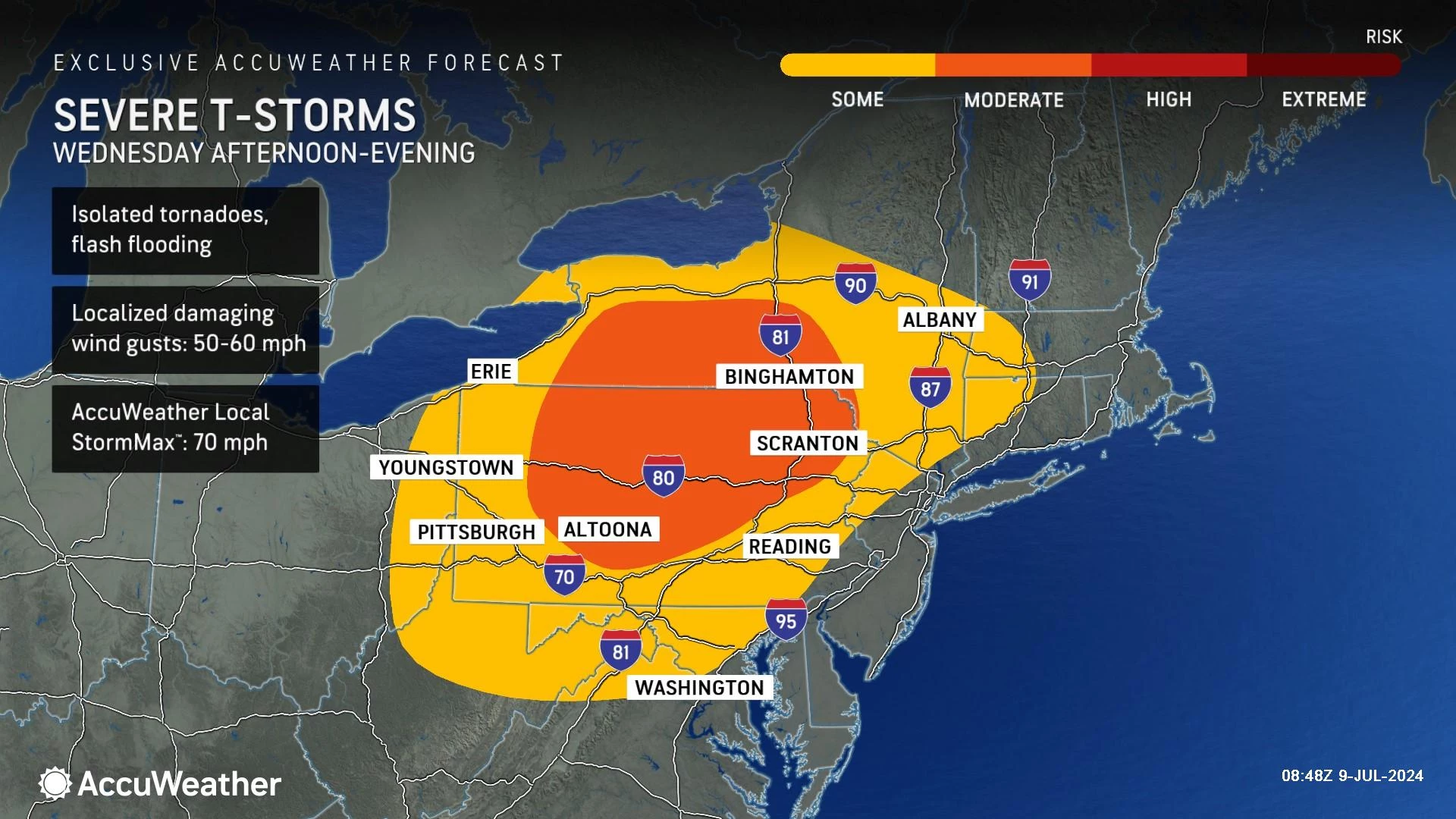
And we will probably see a few showers and thunderstorms around on Wednesday. Isolated to spotty stuff — most of NJ will stay dry. The best chance for a storm would be in the evening to overnight hours. A quick downpour is possible. Maybe a gusty of wind. Any area of rain that does form over New Jersey would be moving quickly, so I doubt it would last long.
Thursday
OK, I can give you one piece of very good news on Thursday. Humidity will dial back ever so slightly. Dew points are forecast to scale back from the steamy 70s to the sticky 60s. Hooray!
Therefore, if you like it hot, Thursday should be a nice summer day. Expect partly sunny skies, and minimal rain chances. High temperaturess will still reach about 90 degrees, fueled by a continuing southwesterly breeze. Heat wave day 8 of 8.
Friday
If you don't like it hot, you may like Friday's forecast a lot. It is the only day in the next week where my forecast does not call for 90+ degrees in New Jersey. And hopefully, we will get some much needed rain.
Friday will not be a washout. Any pockets of rain that visit will be spotty to scattered. But also locally heavy. I think we could see over an inch of rain in spots, especially to the north and west. (Closer to Beryl's tropical moisture plume.)
Technically, heavy rain poses a flash flooding threat. But our ground is pretty dry and thirsty at the moment — as long as the deluge is not too intense, it should be able to soak up all that rain without much trouble.
There's not much of a rain timeline to lay out here, as both the GFS and Euro model show potentially wet weather at any point Friday and Friday night. Carry the umbrella.
With raindrops and lots of clouds in play, high temperatures will come down to the seasonable 80s on Friday. Still very warm. And humidity comes roaring back too.
Saturday & Beyond
With no new air masses and no big storm systems in sight, we fall right back into steamy weather for the weekend. Highs should reach 90-ish on Saturday, and then into the 90s again on Sunday. There is a chance of a popup thunderstorm, especially on Saturday. But primarily, it'll just be hot.
Next week could turn a bit more active again, as a more substantial storm system and batch of rain could really knock back temperatures and humidity levels. That is still pretty far in the distance though. And, of course, there is still plenty more sultry summer weather yet to come.
The best supermarkets in New Jersey
Dan Zarrow is Chief Meteorologist for Townsquare Media New Jersey. Follow him on Facebook for the latest forecast and realtime weather updates.
Best SAT scores in every NJ county
Gallery Credit: Dino Flammia/Sergio Bichao
More From New Jersey 101.5 FM


