Two words to describe NJ’s weather Thursday: Steamy and stormy
The Bottom Line
You know, we do need rain every once in a while. We have enjoyed so many beautiful, dry weather days lately. And overnight, we got soaked. Some spots recorded over an inch of rain. That batch of wet weather is now exiting, so most of New Jersey will only have to deal with wet roads and puddles Thursday morning.
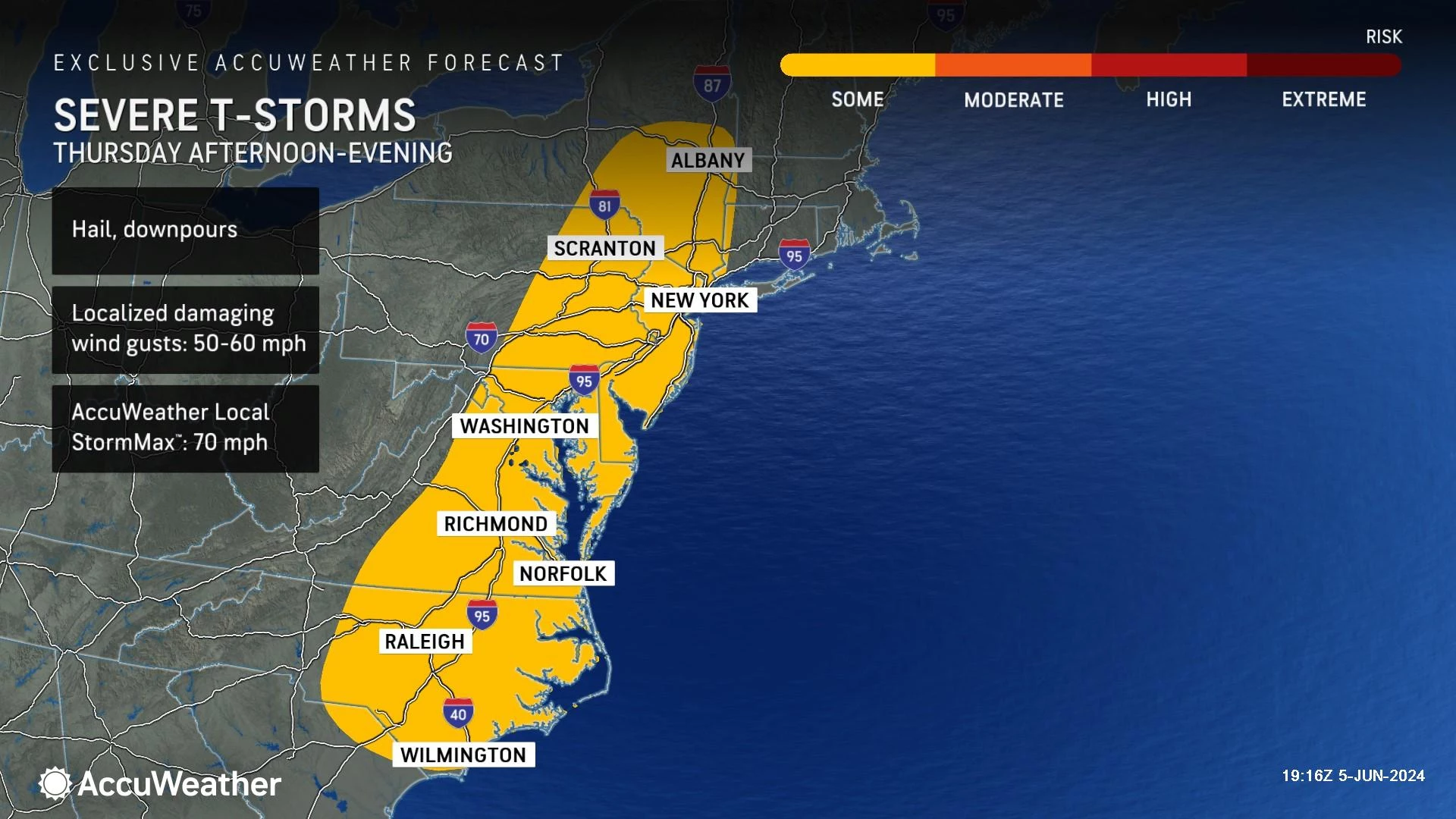
But we are not done with stormy weather for the day. Another round of spotty thunderstorms is expected to develop from midday through the afternoon hours. Spotty = not as widespread and steady as the overnight rain. But strong to severe storm cells may produce localized downpours and gusty winds. So it is an "eyes on the sky" kind of day.
Drier, more comfortable air settles in by Friday morning, setting us up for weather success over the weekend. There are just one or two stray shower chances coming up — but no more widespread soakings for the next week at least.

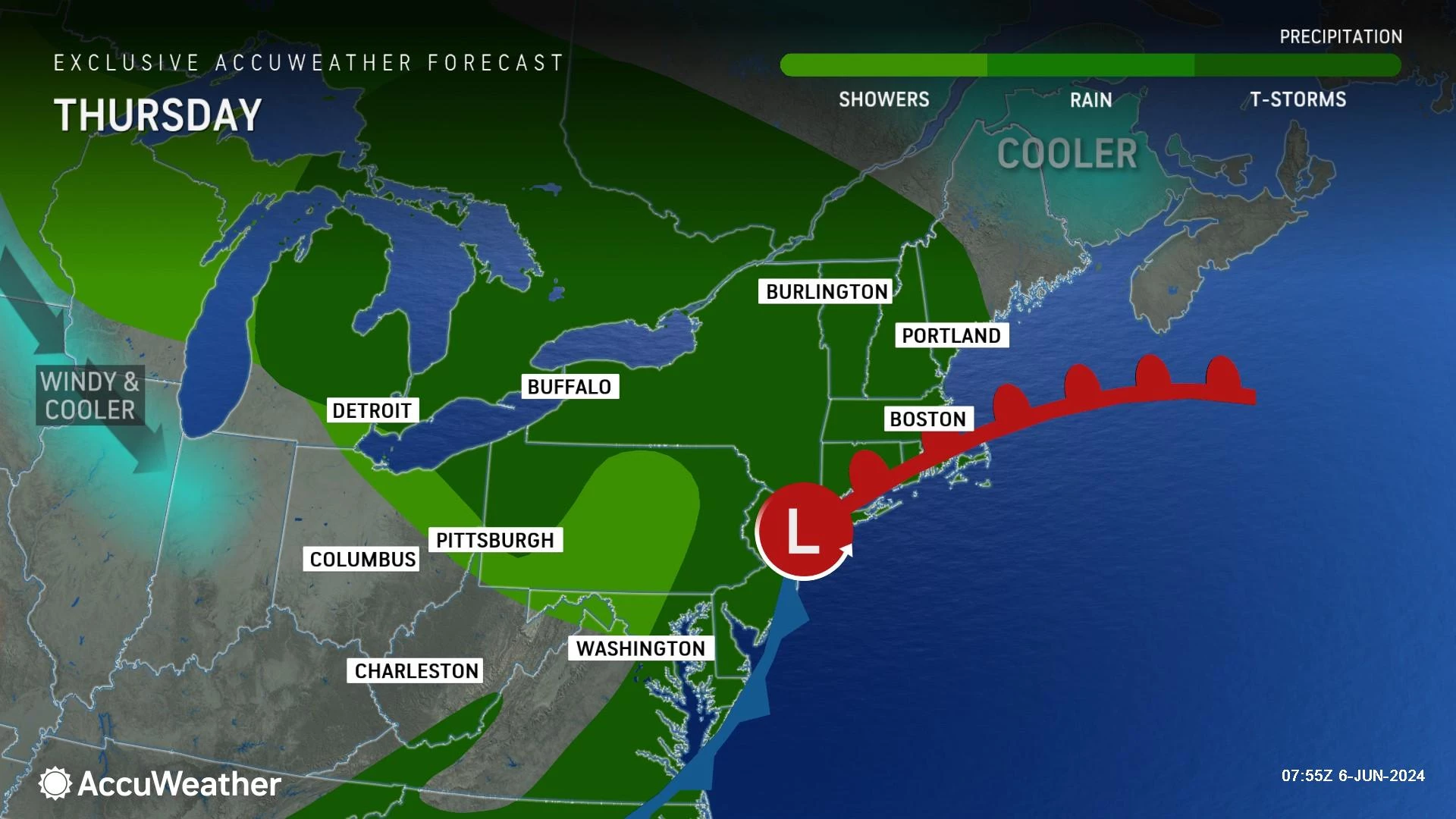
Thursday
Steamy and stormy. We really haven't seen many days this season with this flavor of weather, typical of summertime in New Jersey. But here we go, another 12 hours of unsettled weather.
We have entered a lull Thursday morning, with only a couple isolated pockets of rain around. And wet roads and puddles from the overnight soaking, of course.
Starting around 11 a.m. give or take — the midday hours — we will have to watch for spotty showers and thunderstorms to develop. Given this humid, warm air mass, any storms that form could reach strong to severe limits. Localized downpours, gusty winds, and lightning would be the biggest concerns. A tornado is not impossible given how the ingredients are coming together, but it is at the bottom of the threat list this time around.
In between thunderstorm cells this afternoon, it will be a mostly cloudy, warm, and very humid day. Dew points are around 70. High temperatures should reach the lower to mid 80s. Even the coast will be toasty, thanks to a steady westerly land breeze.
By around 6 or 7 p.m., rain chances will end and skies will start to clear. Thursday night will feature a slow drop in humidity — by Friday morning the air should be much more breathable and comfortable. Low temperatures will end up somewhere in the 60s. (Depending on just how fast the humidity drops.)
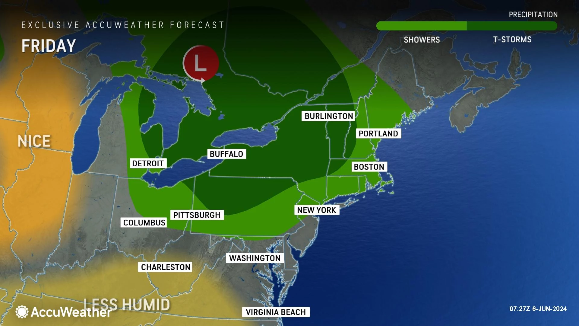
Friday
Overall, we flip back to pleasant weather. Especially with a return of low humidity.
Skies will become partly sunny, at least. Dew points relax to the 50s, making for a nice, comfortable, refreshing feel to the air. It will be breezy and warm, with highs reaching the lower 80s. (Again, a land breeze, so the beaches will also be warm. And potentially buggy.)
While a few showers are not impossible late-day Friday, I am leaning toward a dry forecast.
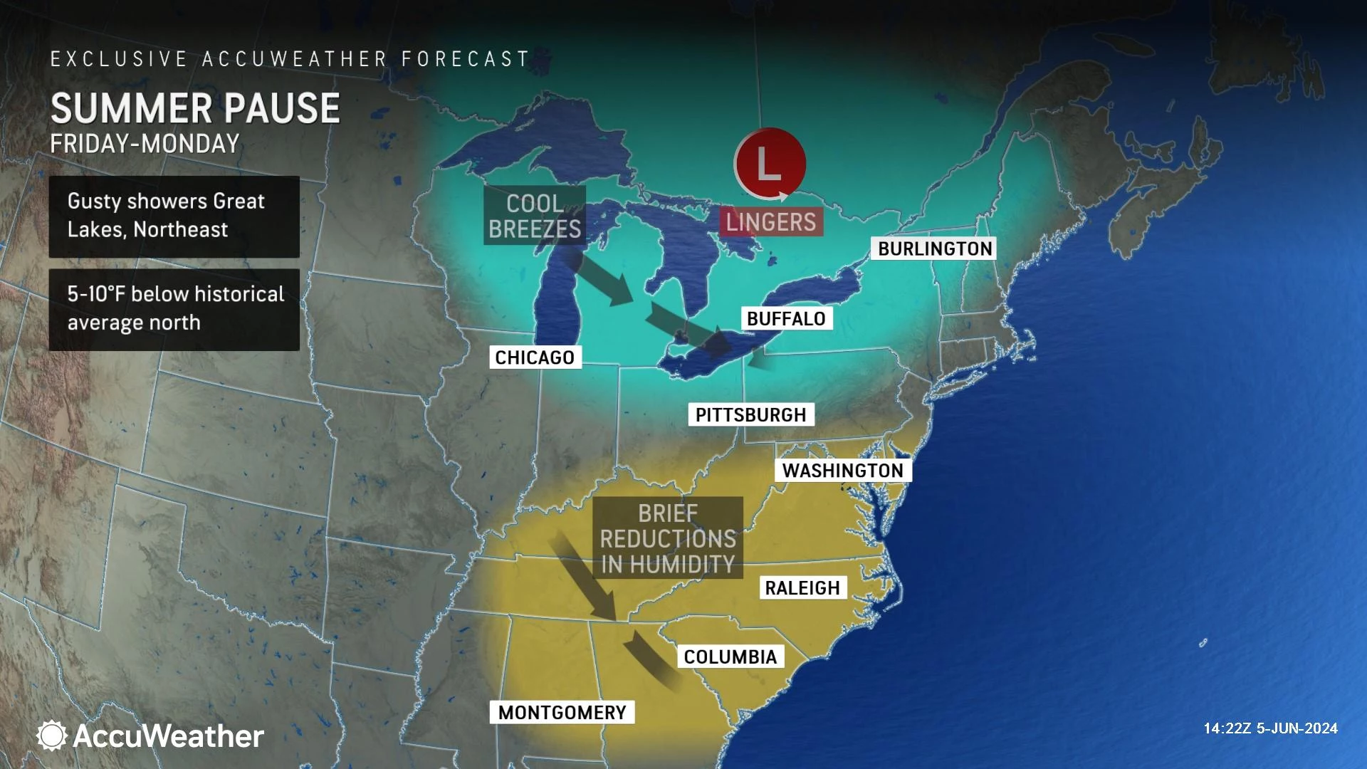
Saturday
Summery? No. But I am calling Saturday a nice late spring day.
It will be seasonable — that means morning lows in the upper 50s and afternoon highs in the upper 70s. Yes, more 70s than 80s on Saturday. But with plentiful sunshine, it should be nice and warm. And with low humidity, that warmth will be comfy.
Clouds will probably increase by late Saturday afternoon. But the entire day looks dry.
Sunday
The one snag of the upcoming weekend is a piece of wet weather Sunday morning. Spotty showers will likely clip through the northern half of the state. It will be light and brief, but damp for a few hours.
For the rest of Sunday, sunshine will mix with clouds. And high temperatures shoot right back into the upper 70s to around 80 degrees.
The Extended Forecast
Cooler air settles in for early next week, which may keep high temps closer to the below-normal lower 70s than anything else. Rain chances will be minimal, with just some midweek showers. There are no "big" storm systems on the horizon to cause soaking rain or major temperature swings. Just more delightful June weather on the way.
New additions to NJ DOT's 2024 collection of humorous safety messages
Gallery Credit: Dan Alexander
Dan Zarrow is Chief Meteorologist for Townsquare Media New Jersey. Follow him on Facebook for the latest forecast and realtime weather updates.
The complete list of names for the 2024 Atlantic Hurricane Season
Gallery Credit: Dan Zarrow
More From New Jersey 101.5 FM