

Third and final round of strong t-storms and heavy rain Thursday
Another night of ominous storms. Ping pong ball sized hail in Hunterdon County. Over 3 inches of rain in Burlington County. Trees and branches down all over. And flooding causing significant issues during the evening commute.
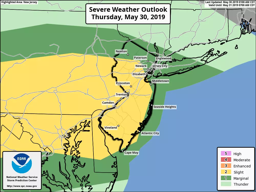
We have one more round of thunderstorms and heavy rain on the way Thursday. The severe weather risk dials back slightly, thanks to cooler temperatures and a less violent atmospheric setup. But we all still need to be "weather aware," as damaging winds, flooding rain, hail, and an isolated tornado are still on the table.
Temperatures on this Thursday morning are actually cooler than expected for the northern half of the state (above Interstate 195). As thermometers drop to meet the dew point, we get fog. And especially in places where it poured rain on Wednesday (Mercer/Burlington Co), that fog is pretty thick. Some visibilities are at or below a quarter-mile, so be careful out there.
As fog burns off, we'll be left with mostly cloudy skies Thursday. High temperatures will range from the mid 70s to lower 80s — that will be a bit warmer than Wednesday for northern and coastal NJ, and a bit cooler for South Jersey.
The timing and geography of Thursday's thunderstorms look similar to Wednesday's, with first storm cells arriving around 3 p.m.Thursday afternoon.
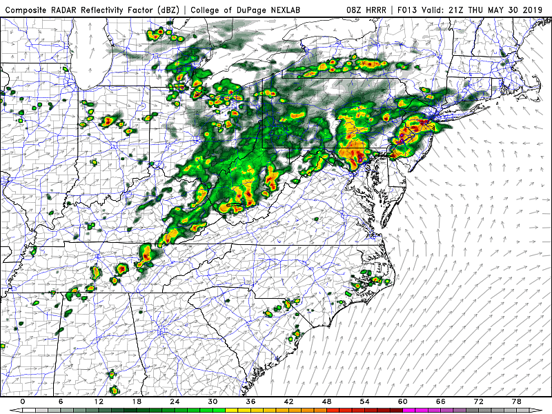
Our biggest concern will be torrential rain leading to flooding issues during the Thursday evening commute. There will be a brief window for significant severe weather once again — if I had to pick a "bullseye" for severe storms, it would be in western New Jersey from about Hunterdon to Camden counties.
Heavy rain is likely. Gusty winds are possible. Isolated instances of hail and a tornado can't be ruled out.
Thunderstorms should exit the Garden State by around 10 p.m. Thursday night, with lingering showers possible until about 4 a.m. Friday morning. Skies will begin to clear shortly thereafter.
We finally get to enjoy a dry, pleasant weather day on Friday, as Mother Nature pushes the 'reset' button on this persistently stormy weather pattern. Skies will be mostly sunny, with a fresh breeze up to 20 mph. High temperatures will remain on the warm side of normal, close to 80 degrees.
The weekend doesn't look half-bad, but things could get a bit unsettled once again. I'm going with partly sunny skies and lower 80s (away from the coast) for both Saturday and Sunday. But a few showers and thunderstorms may creep in late-day Saturday, especially for northern and central NJ. A few more showers and storms are possible on Sunday, again especially later on.
The big pattern change is scheduled for next week, as a big dome of high pressure — dry, sinking air — arrives on Monday. We'll see several days in a row of rain-free, mostly sunny weather. Temperatures may actually dip below normal briefly around Tuesday of next week.
Once again, I urge you to be smart and stay safe during Thursday's storms. If things get dangerous, you'll be among the first to know!
Dan Zarrow is Chief Meteorologist for Townsquare Media New Jersey. Follow him on Facebook or Twitter for the latest forecast and realtime weather updates.
More From New Jersey 101.5 FM


