

Sweet relief for NJ: Not as hot, not as humid, watching for storms
For the most part, New Jersey's horrendous heat wave breaks Thursday — I have to say that because someone could still hit 90+ degrees in southwestern New Jersey. At least we don't have to talk about "extreme" or "dangerous" heat anymore, as temperatures end up 15+ degrees cooler than earlier this week. Humidity will dial back too. We'll just have to watch for some spotty thunderstorms starting late afternoon. Friday gets even cooler, barely in the 70s, with clouds and occasional drizzle. And then 80s return for the weekend, with one or two batch of stormy weather.
Thursday NJ weather: Not as hot, humidity dropping
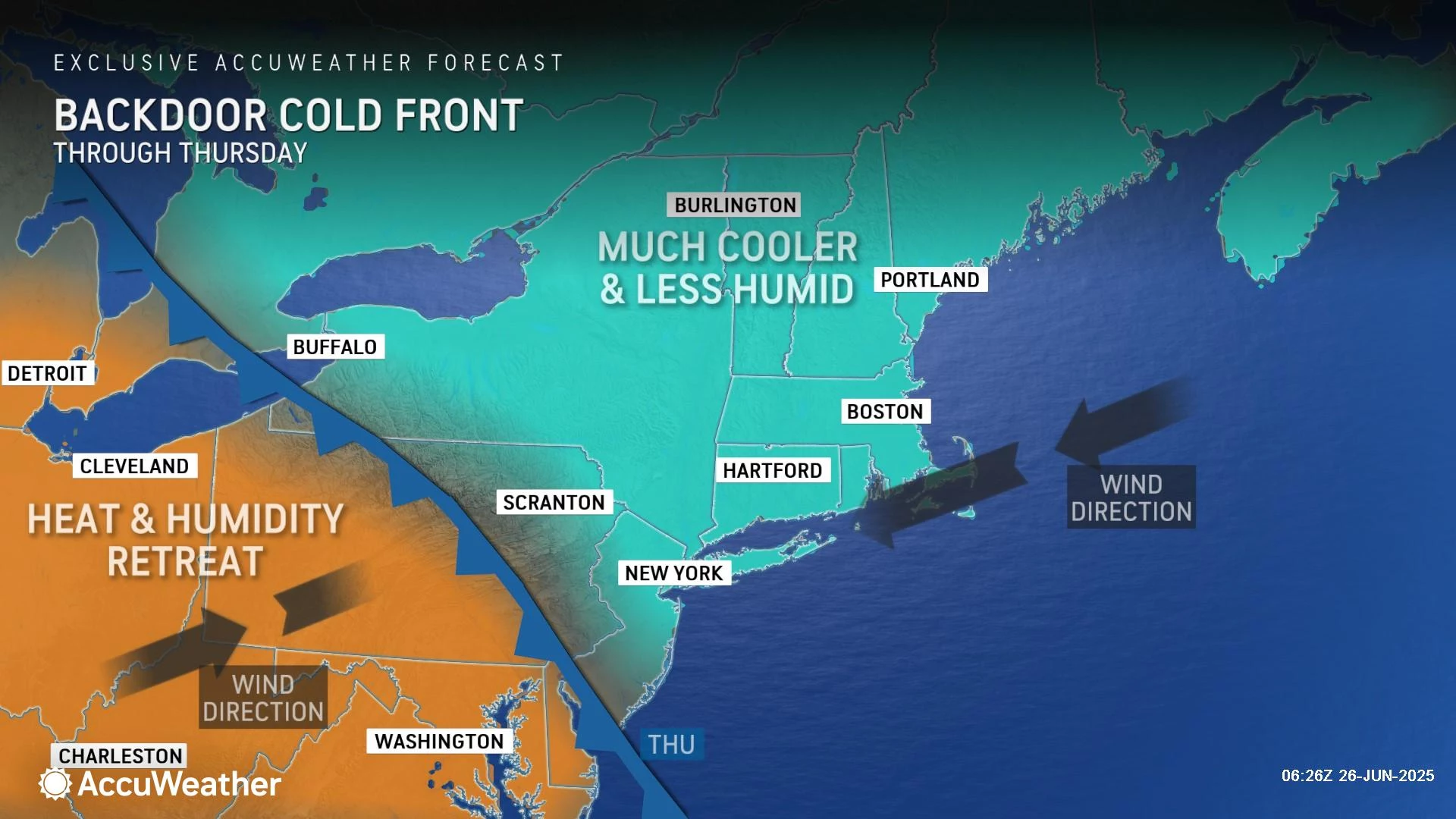
Much friendlier weather settles into New Jersey on Thursday, thanks to a backdoor cold front. So named because it is coming from the "wrong" direction. Most weather systems here in the mid-latitudes move from west to east. But today's influx of cooler, drier air is coming from the northeast. That direction is important, because it will delineate who will see the coolest temperatures Thursday.
Even though we are talking about a cooldown, Thursday morning is still really muggy. Temperatures are mainly in the 70s, with a few 80s in urban areas. Another sticky, steamy start — because the cooler air is not here yet.
Everybody in New Jersey will end up cooler than Monday, Tuesday, and Wednesday. But there will be a wide range of temperatures around the state Thursday afternoon, because of that slow-moving front.
I believe most of us will end up in the lower 80s — not too shabby. To the north and east, thermometers will probably get stuck in the 70s. To the southwest, along the I-295 corridor — call it "inland South Jersey" — 90+ degrees is a realistic possibility, for the sixth day in a row.
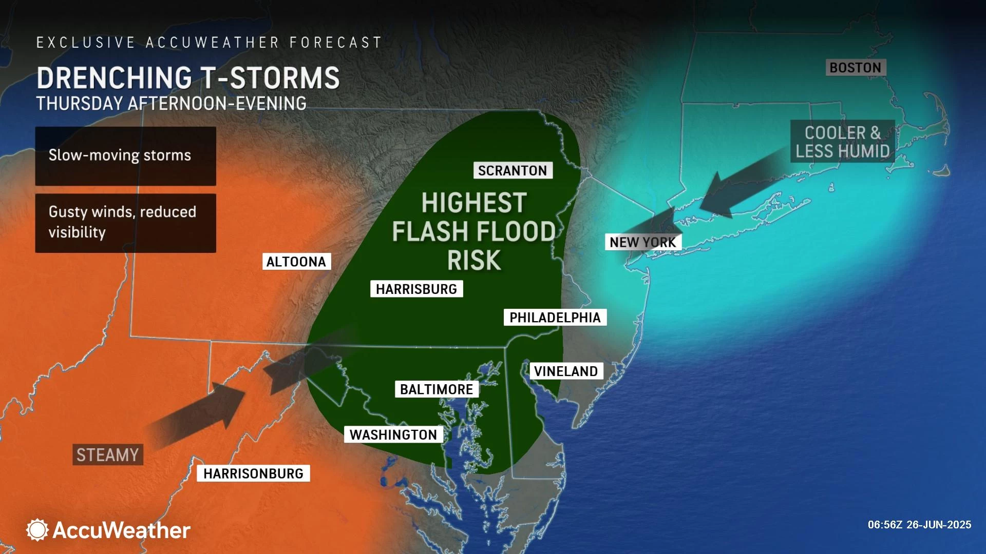
Skies will be partly sunny. We will have to watch for spotty showers and thunderstorms to develop in the late afternoon and evening hours, starting around 2 p.m. Not everyone will necessarily get wet, but localized downpours and rumbles of thunder could have you running for cover.
We will finally get a taste of comfortable air Thursday night, as dew points finally drop from the "high" to "moderate" range. Look for low temps around the mid 60s.
Friday NJ weather: Blah weather, cool temperatures
What a difference! It is surprising how cool Friday's forecast is trending, especially given how hot it was just two days prior.
With lots of clouds, occasional drizzle, and an on-shore breeze, high temperatures will only reach the lower 70s on Friday.
It is a one-day return to "blah" weather. But you know what — I'm not complaining!
Saturday NJ weather: Warming up, watching for storms
As winds turn southerly again this weekend, temperatures will soar back into the 80s. We like to see 80s this time of year — that is where NJ's normal highs land from now through September.
Saturday looks mostly cloudy, with highs in the upper 80s. Humidity will ramp up too, making for a sweaty summer day. But again, so far so good.
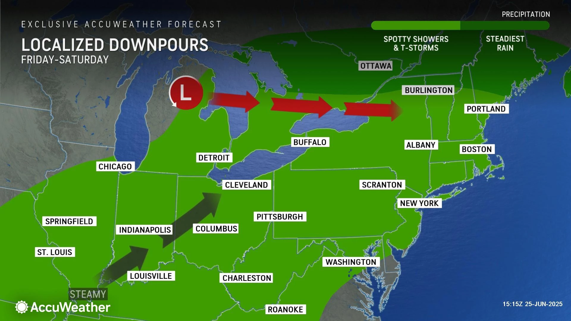
The problem is that everyone will probably get wet this weekend, although only for a brief time. I am thinking the best chance for thunderstorms on Saturday will be in that typical "late-day" time frame, after about 3 p.m. Yes, that means you will have some time to get in your outdoor activities and get some beach time before storms arrive.
Sunday NJ weather: Probably pleasant
There's still some flip-flopping among forecast models for Sunday's weather. But I am still favoring a mainly dry day, aside from a morning show.
Again, clouds will win the sky. And temperatures will cool slightly, to the lower 80s. Again, you can't complain about 80s in summertime.
Monday NJ weather: No big heat or big storms in sight
Monday looks good, with partly sunny skies, dry weather, and highs in the 80s. Humidity may dial back a bit, making the air more breathable and more comfortable throughout the day.
And then July begins on Tuesday. Obviously, we are keeping a close eye on the 4th of July Weekend in the long-range forecast. And I still like what I see: No signals suggesting bigtime heat or bigtime storms. It may rain at some point over the holiday weekend. But as long as it is brief and as long as temperatures are seasonable, that will be a big win.
(We will start dialing in details for the holiday weekend early next week.)
NJ DOT's Electronic Sign Safety Messages Summer 2025
Gallery Credit: Dan Alexander
Dan Zarrow is Chief Meteorologist for Townsquare Media New Jersey. Follow him on Facebook for the latest forecast and realtime weather updates.
It's here! The complete 2025 NJ county fair summer schedule
Gallery Credit: Mike Brant
More From New Jersey 101.5 FM


