
Occasionally wet, cloudy, and cool weather continues for NJ
Scattered showers and thick clouds will keep temperatures way below normal for a few more days.
Good Tuesday morning, New Jersey! You won't hear my voice on the radio Tuesday and Wednesday, as I have to take care of a personal matter. However, given the potential for somewhat active (i.e. wet) weather, I found a few minutes to share my latest meteorological ponderings here!
Part of New Jersey — mainly the southern half — saw yet another good drenching of rain on Monday, with a few rainfall totals topping a half-inch. There's some more unsettled weather on the way, including a little bit more rain. But there's also a light at the end of the tunnel in the form of warmer, sunnier weather by the weekend.
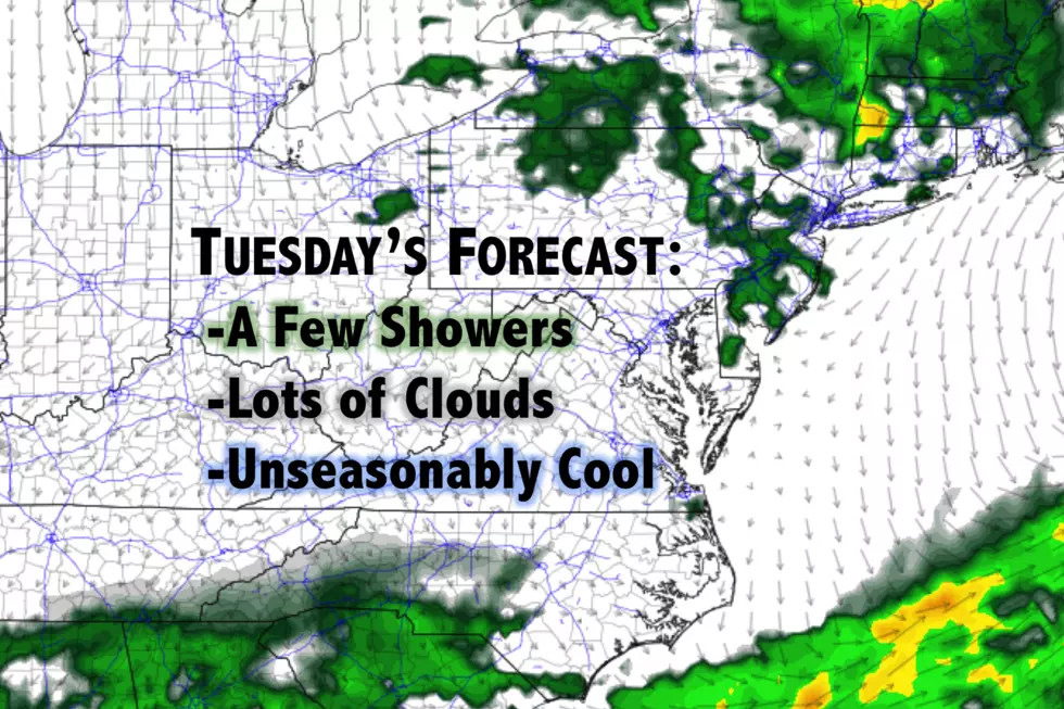
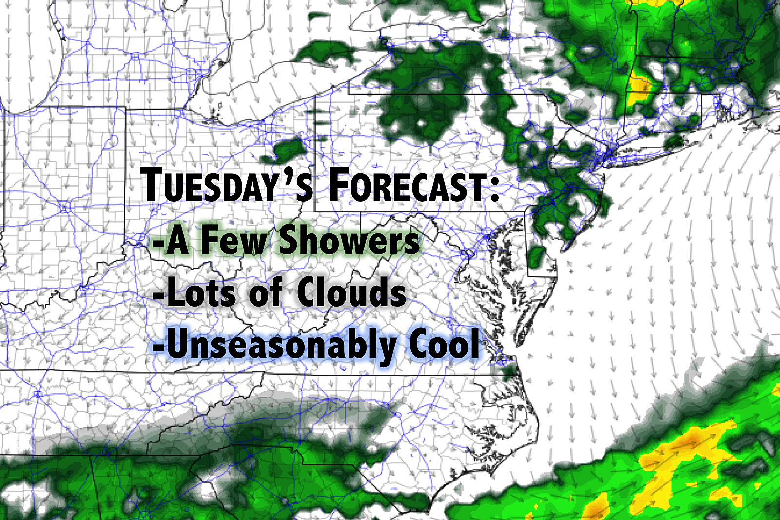
Thick clouds, occasional showers, and a northeast (on-shore) breeze will prevent temperatures from going far at all on Tuesday. Thermometers will hover in the upper 50s to lower 60s all day.
Meanwhile, a weak atmospheric disturbance will slowly traverse the area, adding the threat for pesky scattered showers. I'll hesitantly say the best chance for rain will be early Tuesday and mainly in North Jersey — but I'm not ruling out showers or even a thunderstorm in other places at other times. Overall rainfall totals should be light.
We'll dial back the rain chances on Wednesday quite a bit, as our atmosphere dries out. That doesn't mean we'll return to pleasant weather immediately, however. As the other puzzle pieces (clouds and on-shore flow) remain, high temperatures will again get stuck in the upper 50s to lower 60s. That's 15 to 20 degrees below normal for early June.
Models have cooled off Thursday a bit, and my previously mentioned 70 degrees might now be a stretch. I'm thinking Thursday afternoon's temperatures will be entirely sky-dependent — the brighter the sunshine, the warmer the temps. Not a terrible day, but certainly still below seasonal norms.
Another item to watch late week is a coastal storm system that should pass well off the Jersey coast from late Thursday to early Friday. No weather impacts (i.e. rain and wind) are anticipated for now, but there could be some rough surf and an elevated rip current risk heading into the weekend. Maybe some coastal flooding too. Worth watching — we'll let you know if it becomes problematic.
Temperatures will bounce upward before, during, and after the weekend. Highs will probably recover to around 75 on Friday, then warm to near 80 on Saturday, 85 on Sunday, and 90 on Monday. (Woo, nice warmup!) While there could be an isolated shower or pop-up thunderstorm on any of those days, and while I do have to temper excitement a bit for now, the weekend forecast does look mostly dry!
Dan Zarrow is Chief Meteorologist for Townsquare Media New Jersey. Follow him on Facebook or Twitter for the latest forecast and realtime weather updates.
More From New Jersey 101.5 FM


