

NJ weather: Storms and humidity go away, until the weekend
The Bottom Line
Thursday did not fail to deliver on the "steamy then stormy" promises I made in the forecast. Temperatures as hot as 98 degrees. Heat index up to 104. Thunderstorms dumped over an inch of rain in spots. And storm-related wind gusts blew as strong as 60 mph, bringing down trees and causing thousands of power outages. (Note: It was all straight-line winds, there were no confirmed tornadoes in New Jersey.)
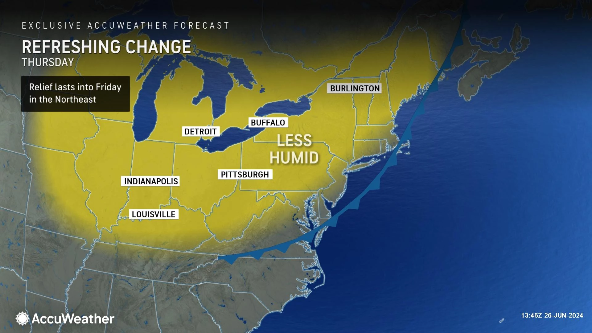
As final showers exit the coast and skies start to clear, we look forward to big weather improvements on Thursday. Humidity goes down, temperatures stay warm, as we enjoy a pleasant late June day.
Friday looks fantastic too, as you can potentially give the air conditioner a break. "Refreshing" is the operative word.
Then the weekend gets warmer and way more humid. Even tropical. Our weather is also set to turn unsettled this weekend too. For the most part, showers and thunderstorms will be hit-or-miss — there will be more dry hours than wet ones over the course of the last weekend of June.

Thursday
As of this writing (6 a.m.), there are still a few showers along the southern coast. They will exit shortly, and the rest of the day will be completely dry.
It is still rather humid to start, with temperatures mainly hovering around 70 degrees to start. Humidity levels will progressively drop as the day goes on, making the air more comfortable and more breathable. Dew points start around 70, but should be in the 50s by sunset.
High temperatures will still be on the warm side, reaching the mid 80s this afternoon. It is possible that some weather station in NJ hits 90 degrees for the third day in a row, technically marking another heat wave. At the same time, a sea breeze should cool down the Jersey Shore through the afternoon.
Expect clearing skies, probably becoming mostly sunny by the afternoon. It will be breezy, with top gusts around 20 mph out of the northwest.
Thursday night will be clear, calm, and comfortably cool. With low temperatures dipping to around 60 degrees, it is set to be New Jersey's coolest night in about a week and a half.
Friday
All around a beautiful day, although feeling more typical of springtime early June than summery late June.
High temperatures will reach the upper 70s to around 80 degrees. That is about 5 degrees below normal for this time of year. Lots of sunshine, low humidity, and dry weather will add to the day's lovely weather.
Saturday
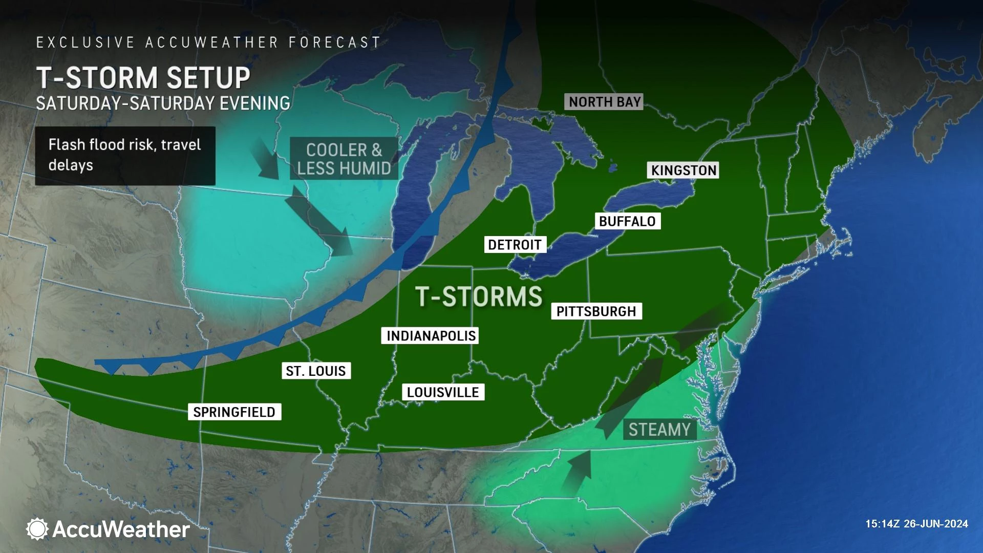
The theme for the weekend is building humidity and the return of rain chances. Saturday will be the more pleasant, more comfortable day of the weekend.
Most of Saturday's daytime hours look dry. There could be an isolated shower or thunderstorm at some point, but the best chance will hold off until late-day.
Expect mostly cloudy skies and a southeasterly breeze on Saturday. As dew points rise into the 60s, it will get pretty sticky. High temperatures will end up around 80 to 85 degrees for most. Probably a few degrees cooler at the Shore. (Although keep in mind, those golden rays of sunshine will be limited.)
Starting Saturday late afternoon, the chance for scattered showers and thunderstorms will go up. A widespread area of area is possible through the overnight hours. There will be a threat of downpours and gusty storm cells, especially for the western half of the state.
Sunday
Sunday's humidity will be suffocating. Dew points potentially hit 75, which is downright tropical air. It is going to be very warm too, as high temperatures make a charge for 90.
Given the soupy air, it should come as no surprise that the threat for thunderstorms will continue throughout Sunday. Primarily hit-or-miss stuff. But again, severe weather is a possibility. So you should keep your plans as flexible as possible.
The Extended Forecast
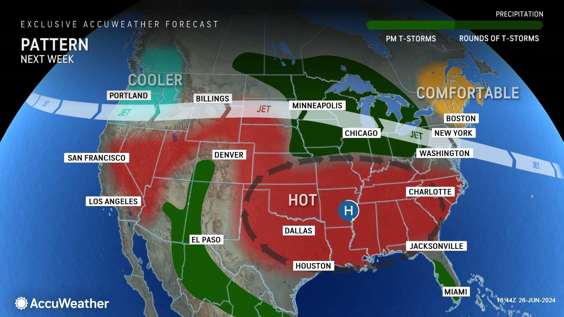
Following a cold front, temperatures and humidity will plummet again early next week. Monday and Tuesday look like very nice weather days, with partly sunny skies and high temperatures at 80 degrees or better.
Heat and humidity will ramp up again starting midweek. That is important because the 4th of July is exactly a week away, next Thursday. I think we could face a few isolated popup showers or thunderstorms around Wednesday the 3rd and Thursday the 4th. I am a little concerned about Friday the 5th, which looks a little bit stormier. But that is still way off on the horizon — we have plenty of time to figure out the full fireworks forecast for next week.
Look for these NJ athletes at the Paris Olympics
Gallery Credit: Erin Vogt
Dan Zarrow is Chief Meteorologist for Townsquare Media New Jersey. Follow him on Facebook for the latest forecast and realtime weather updates.
POP QUIZ: Can you guess these NJ landmarks from Google Earth images?
Gallery Credit: Dan Zarrow
More From New Jersey 101.5 FM


