

NJ weather: One more rainy day, then turning cold and windy
The Bottom Line
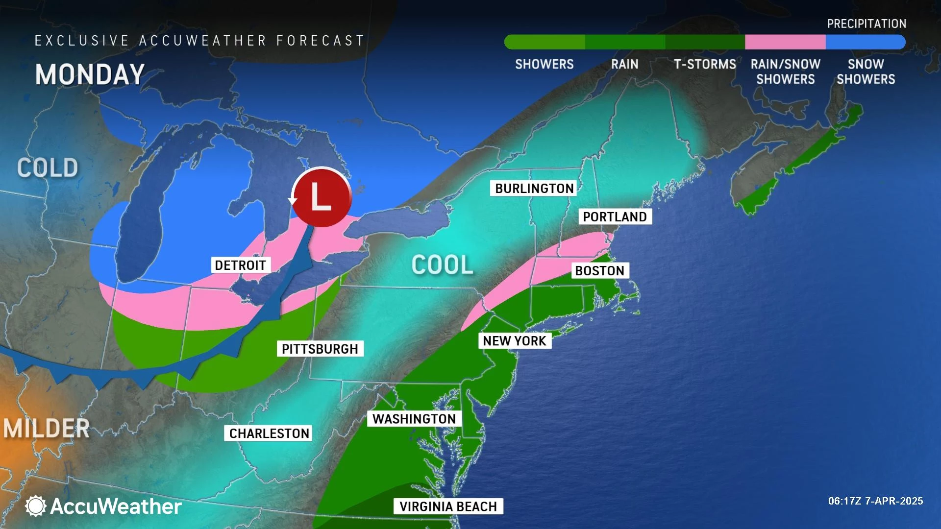
Monday will be the fifth day in a row of unsettled weather. Damp, dreary, cloudy, blah.
But Monday will also be the final day of this unsettled stretch. Another ¼" (north) to ¾" (south) of rain is expected, making for a soggy, gloomy day. (Although not necessarily a total washout.)
Oh, but don't celebrate just yet. As rain exits, cold air returns. It is going to feel February-ish around here, with our coldest temperatures in about six weeks in the forecast. Do not expect a return to anything resembling springtime warmth and/or seasonable temperatures this week.
More rain is coming up at the end of the workweek. That could be a real soaker, with an inch or two of total rainfall possible.

Monday
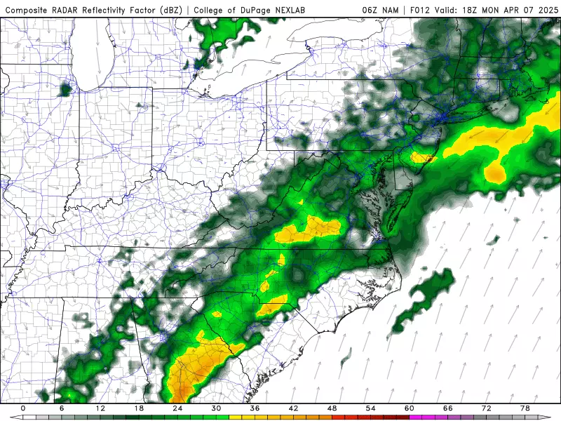
Hey, what do you know — another drizzly start to another unsettled weather day.
With a slow-moving front in the neighborhood, expect periods of rain throughout the day Monday. I do not think we can call it a total washout — meaning rain all day — but it will be a "carry the umbrella" situation.
To the north, in and around Sussex County, it may just get cold enough for some snowflakes to mix in with raindrops. No accumulation or travel issues are expected though.
All areas to the north and west will likely trend drier through Monday afternoon. Do not expect skies to clear much, if at all.
Meanwhile, in South Jersey and along the Jersey Shore, rainfall could turn steady or even heavy for a time Monday. And then rain will linger through the afternoon and early evening hours.
Final raindrops should exit the state Monday evening.
The other big story for Monday is the arrival of cooler air. Temperatures have dropped into the lower-mid 40s to start the day. And that is about where we will end up Monday afternoon.
After we dry out and start to clear out Monday night, temperatures will definitely be on the chilly side. Most of the state will end up near the freezing mark, in the lower 30s, by Tuesday morning. While a freeze is possible, I doubt it will be cold enough long enough for puddles to ice over.
Tuesday
Tuesday will be bright and sunny. But also cold and windy — an unpleasant combination I like to call blustery.
Gusts may climb above 30 mph, blowing out of the northwest. That is going to be a cold wind too. Especially since high temperatures will only reach the lower to mid 40s. That is rather February-ish, a full 15 degrees below normal for this time of year.
At least skies will be mostly sunny, with nary a raindrop nor snowflakes to be found over New Jersey.
Tuesday night will get even colder, with clear skies, lighter winds, and a cold/dry air mass. I think we could see widespread lows in the upper 20s by Wednesday morning. A freeze for all but urban centers and the immediate coast.
Wednesday
A cold start, a cool finish, a bright sky, and a lighter wind.
The calmer weather will probably make a difference on Wednesday, even as temperatures stay well below normal for early April. Look for highs improving to the upper 40s to around 50.
Again, it will be a sunny, dry day.
Thursday
Thursday daytime will be fine, although our next storm system could creep in late-night.
Skies will turn mostly cloudy by mid-morning Thursday, with an increasingly stiff southeasterly breeze. (That kind of ocean wind often enhances moisture in our atmosphere, which will play into our next rain chance.)
Highs on Thursday should push into the lower 50s.
Rain may arrive as early as Thursday evening, likely as just scattered showers to start.
Friday & Beyond
A broad and powerful storm system will come into view at the end of the week, producing New Jersey's next chance of rain.
At the moment, I would call Friday a washout. Latest model guidance shows rain from morning to night, heavy at times, totalling an inch or two. Heaviest stuff would be midday Friday.
There are some questions though:
1.) Will rain nudge earlier, potentially making for some wet weather Thursday evening?
2.) Will there be some breaks in the rainfall action on Friday, potentially allowing for some outdoor activities and/or better driving conditions?
3.) Will this storm system develop into a coastal low — a nor'easter?! — after exiting New Jersey, potentially producing rain chances on Saturday and/or Sunday too?
The weekend forecast is very much up in the air. At this point, expect wet weather Friday. And then we will fill in the rest in due time.
Our next shot at springtime warmth and above-normal temperatures is likely early next week.
The 10 commandments of surviving pothole season in NJ
Gallery Credit: Judi Franco
Dan Zarrow is Chief Meteorologist for Townsquare Media New Jersey. Follow him on Facebook for the latest forecast and realtime weather updates.
When will NJ theme parks open for the 2025 season?
Gallery Credit: Dan Zarrow
More From New Jersey 101.5 FM


