

NJ weather: A very different forecast for Christmas Eve vs. Christmas Day
The Bottom Line
All eyes remain on the Christmas holiday forecast, and it looks stormy. Between Christmas Eve and Christmas Day, we'll progress from warm to wet to windy to cold to potentially snowy. I hope Santa Claus is gearing up Rudolph the Red-Nosed Reindeer for his journey across the northeastern United States this year.
Tuesday
We're starting off this Christmas Eve Eve Eve damp and blah. New Jersey is barely getting "clipped" by a clipper system passing through new England. We've seen some showers and sprinkles and fog in the neighborhood. And with surface temperatures in the mid 30s, I'm not surprised radar is showing hints of wintry mix less than a half-mile over our heads. You may encounter some slippery spots during the Tuesday morning commute, but only because roads are wet — not really icy.
Raindrops should exit by mid-morning (10 a.m. at the latest), and then skies will break into sunshine through Tuesday afternoon. It will stay breezy, blowing out of the west at around 20 mph. High temperatures will reach the lower 40s — close to normal for late December.
Our weather will stay quiet for Tuesday night. And seasonably cold, with lows in the upper 20s. Skies will be mainly clear.
Wednesday
Not bad. In fact, it will probably be our nicest day of the week. (Not that there's much competition there!)
We'll eventually progress from sun to clouds Wednesday. High temperatures should bump into the mid 40s.
Thursday (Christmas Eve)
The only change in our potentially stormy Christmas forecast is a later arrival of the worst rain and wind. So the daytime hours on Christmas Eve will be mostly cloudy and warm, with highs popping to about 55 to 60 degrees. It will be our warmest day in about a week and a half.
Scattered rain showers will be possible at any point during the day Thursday. But things will really ramp up Thursday evening, as a strong cold front approaches from the west. A period of heavy rain is likely, totaling 1 to 2 inches. A period of gusty winds is expected too, peaking at 50+ mph along the coast and 40+ mph inland. Overall, a pretty nasty and noisy night.
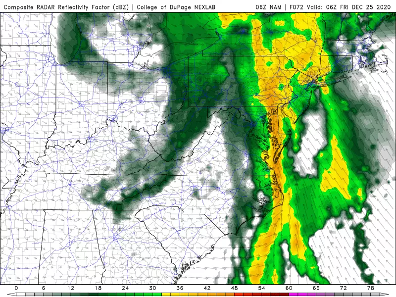
Friday (Christmas Day)
Rain will wrap-up early Friday morning, and then the door to really cold air opens wide. Friday afternoon could end up 25 degrees colder than Thursday afternoon, as thermometers drop into the lower-mid 30s. It will remain breezy too, so that wind chill will bite.
There will be two opportunities for snowflakes on Christmas. The first would be around 4 a.m. — as rain ends and cold air "whooshes" in, a brief transition to wintry mix or snow is possible at the very tail-end of the overnight storm system. The second would be a few stray snow showers or flurries Friday afternoon. In either case, no accumulation nor travel headaches are expected — just some nice, conversational flakes.
Of course, if you're looking for significant snow on Christmas, just drive ~300 miles west into western Pennsylvania, where 6+ inches of accumulation is expected from that same front.
Saturday & Beyond
The cold weather will continue through what could be called the Christmas weekend. On Saturday, sunshine won't do much, with highs only hovering near the freezing mark. Sunday will be a bit more comfortable, closer to 40 degrees.
Models are picking up on another storm system around Monday of next week. For now, it looks like another rain-maker.
Dan Zarrow is Chief Meteorologist for Townsquare Media New Jersey. Follow him on Facebook or Twitter for the latest forecast and realtime weather updates.
More From New Jersey 101.5 FM


