Heat Advisory continues for New Jersey, great relief at the Shore
The Bottom Line
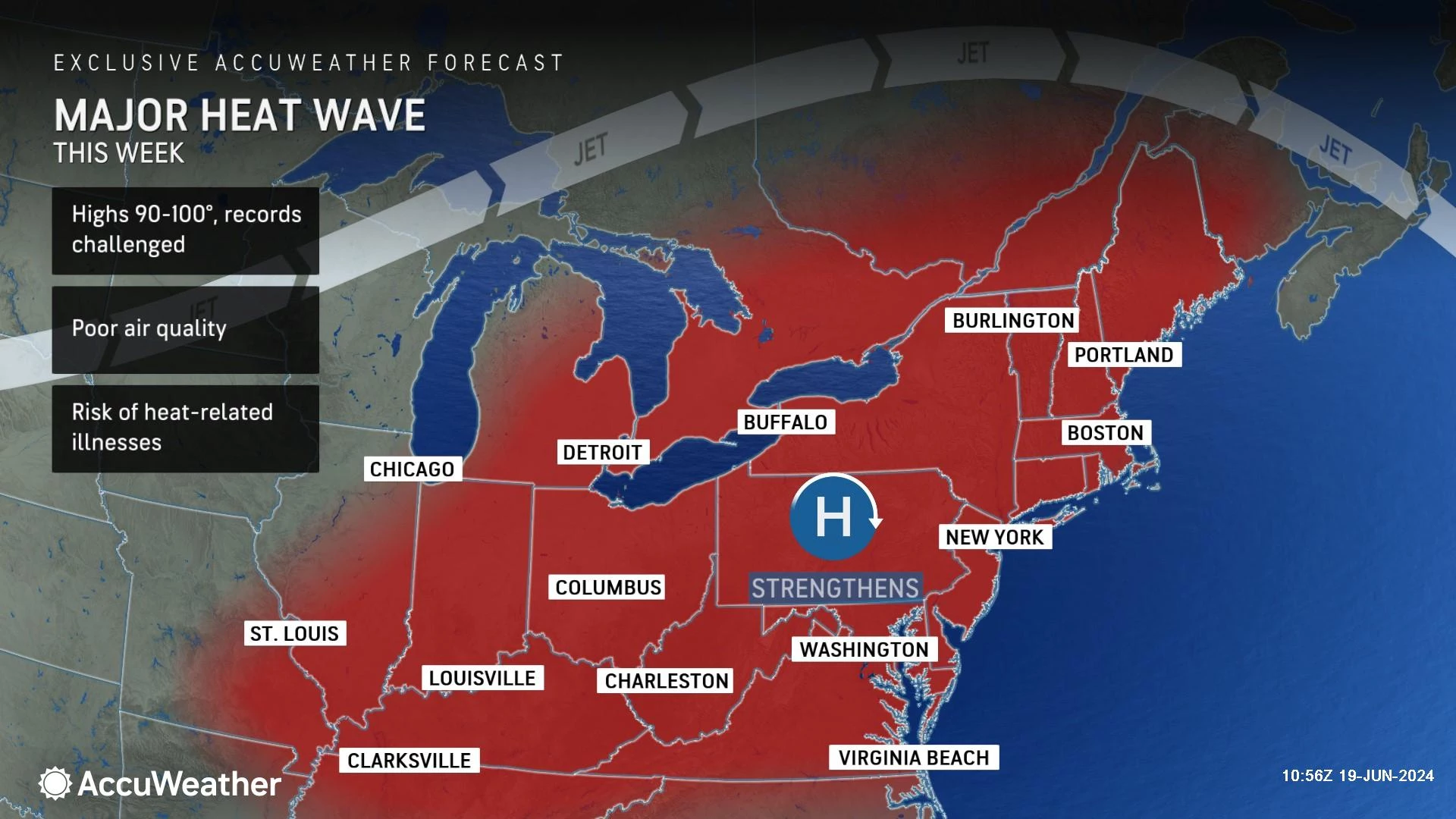
The unseasonable heat, moderate humidity, and air quality concerns continue today. It's our third 90-degree day in a row, making it an "official" heat wave. (Although there is no official definition or sanctioning body.)
On Tuesday, high temperatures across New Jersey ranged from 74 degrees along the coast (Harvey Cedars, Long Beach Island) to 95 degrees inland (Hillsborough). What a range! The Jersey Shore will continue to take advantage of "nature's air conditioning" — a sea breeze — keeping temperatures considerably cooler than the interior of the state.
I am still not buying into the idea that this is "extreme heat" or a "major heat wave" for New Jersey. Yes, you have to take care of yourself — stay hydrated, take frequent breaks in air conditioning, etc. But the comfortable mornings, much cooler coast, and non-tropical humidity levels make this bearable.
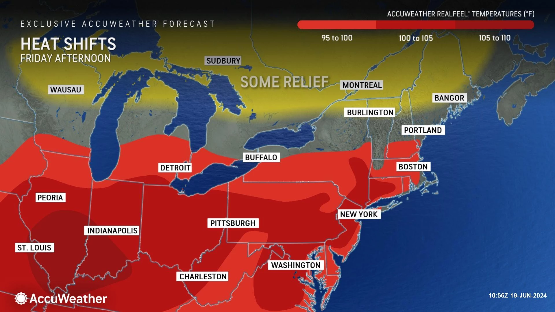
Forecast models have backed off on the idea of widespread 100s coming up. However, the heat and humidity are still set to kick up a notch starting on Friday. That will make for a steamy first weekend of summer. And potentially stormy at times too.
A Heat Advisory continues for Wednesday and Thursday. That steps up to an Excessive Heat Watch (which may be upgraded to a warning) for Friday, Saturday, and Sunday. No drop in temps until early next week.

Wednesday
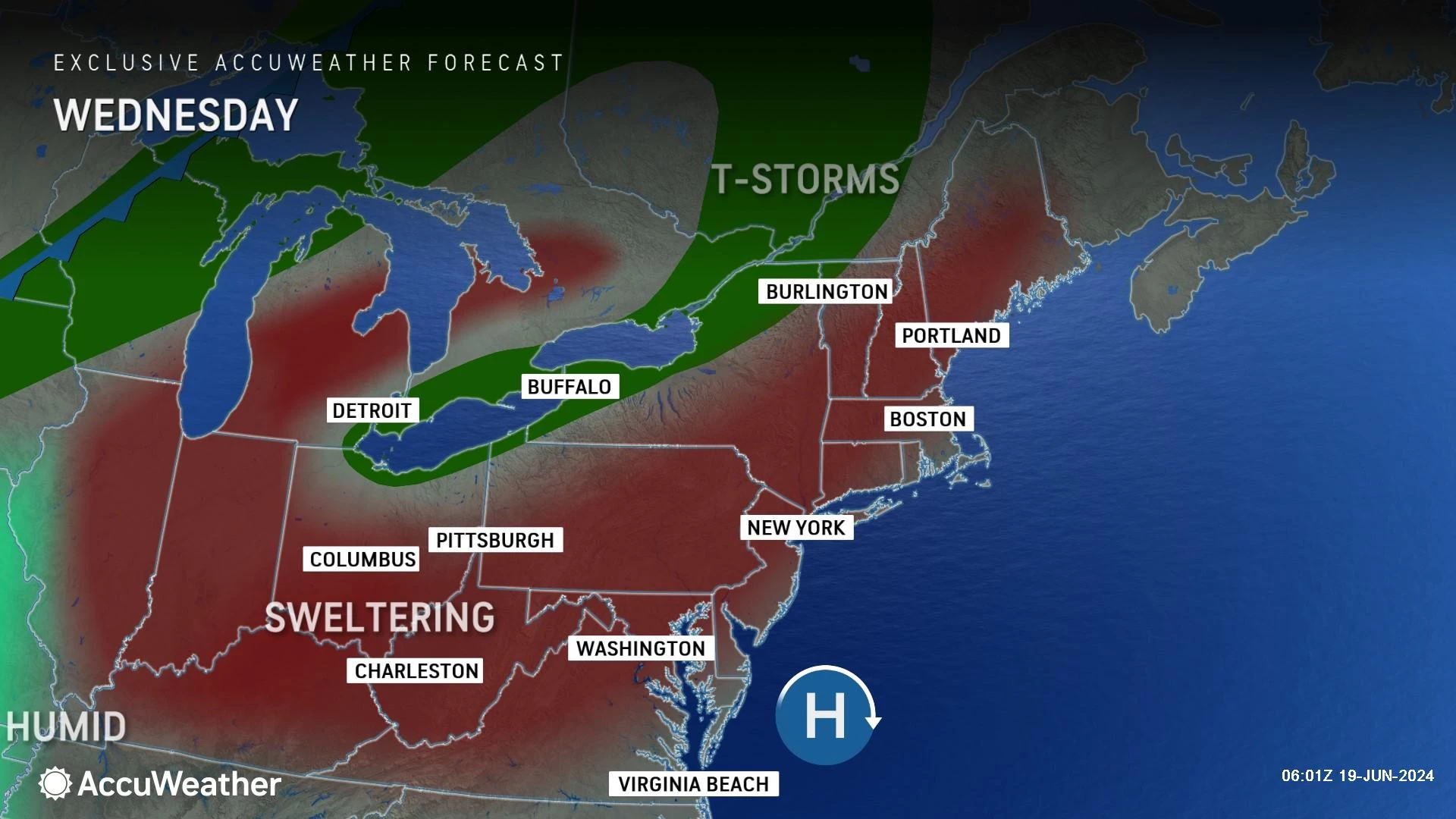
This is a copy-paste forecast. Tuesday's hot weather was so much fun, let's do it again Wednesday.
One of the biggest reasons this does not qualify as "extreme" heat in my book is that late nights and early mornings are fairly comfortable. Wednesday morning is starting off mainly in the 60s across the state. There are some pockets of stickier 70s in coastal and urban areas.
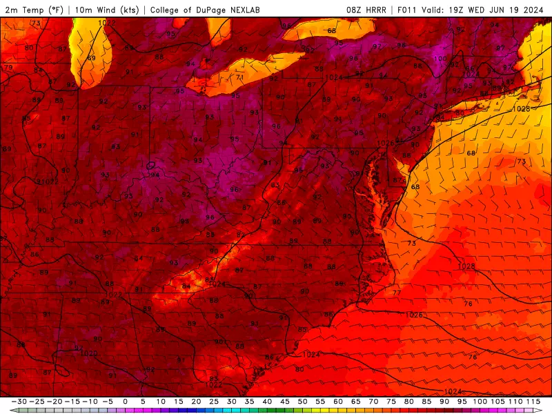
High temperatures on Wednesday will average lower 90s across inland New Jersey. Meanwhile, beaches at the Jersey Shore will end up closer to 80 degrees. It will be another partly sunny, dry day all around.
Once again, temperatures will turn comfortable Wednesday night, dipping into the upper 60s for most. The overnight will be mainly clear and uneventful.
Thursday
The Summer Solstice officially arrives Thursday at 4:50 p.m. And summer is going to start hot, of course.
Highs on Thursday will reach about 90 to 95 degrees. Again, the Jersey Shore will be the cool spot, closer to 80. The heat index ("feels like" or "apparent" temperature) will probably end up in the upper 90s — very close to the danger zone.
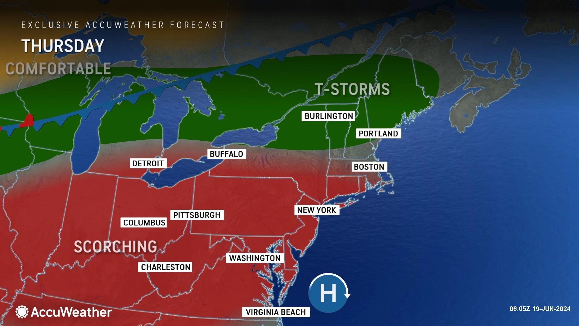
Friday
The heat and humidity are set to kick up another notch on Friday, as more and more places surge into the 90s and dew points surge into the mid-upper 60s.
Highs on Friday will reach the lower to mid 90s across most of the state. The coast will still end up cooler with a sea breeze. But mainland beaches will be a few degrees warmer too, pushing into the 80s.
Expect a mix of sun and clouds across the day Friday.
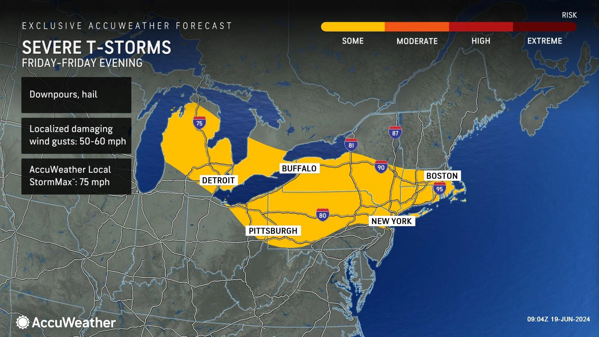
One more addition to Friday's forecast is the chance of an isolated thunderstorm. Best opportunity would be after 5 p.m. in the northern third to half of the state. This will be very hit-or-miss — most New Jerseyans will stay completely dry Friday. And the rain unfortunately looks to miss the parched southwestern corner of the state.
Saturday & Sunday
No big changes for the first weekend of summer.
Saturday will be partly sunny, with the chance of a late-day popup shower or thunderstorm. Again, especially to the north. High temperatures will reach the lower 90s away from the coast.
Sunday will be heat wave day #7. And it could be the steamiest of the bunch, with highs in the lower to mid 90s and a higher dew point. I believe Sunday is the best shot at seeing heat index values (or even a few temperatures) at or above 100 degrees.
A batch of spotty to scattered thunderstorms may temporarily cool you down Sunday afternoon and evening too.
The Extended Forecast
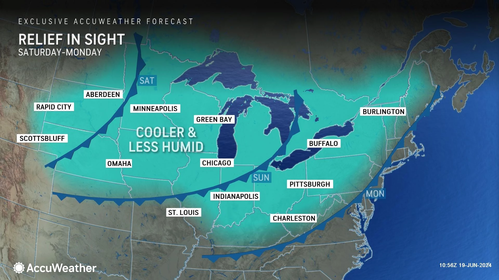
Eventually, a cold front will work through New Jersey, introducing ever-so-slightly cooler and much drier air to the state.
One more round of scattered thunderstorms is possible as that frontal boundary arrives on Monday. I think we're still looking at 90+ degrees for most to kickoff the new workweek.
Tuesday should be a more comfortable day, as humidity gets knocked back. It will be bright and sunny. And completely dry. But high temperatures will remain seasonably warm, in the upper 80s or so.
And then? Widespread 90s are forecast to return for the second half of next week too.
LOOK: The most extreme temperatures in the history of every state
Gallery Credit: Anuradha Varanasi
Dan Zarrow is Chief Meteorologist for Townsquare Media New Jersey. Follow him on Facebook for the latest forecast and realtime weather updates.
Heat Disorders to Watch for in New Jersey
More From New Jersey 101.5 FM