
From drought to flooding: NJ ends Labor Day Weekend with ‘too much’ rain
What's Up?
After a hot, dry summer and a mainly gorgeous Labor Day Weekend so far, a pattern shift is going to lead to New Jersey's biggest rain chance in months. Multiple inches of rain is just what "the drought doctor" ordered. However, this deluge could bring too much rain too quickly, raising flash flooding concerns on Tuesday.
A slow-moving cold front will inch toward New Jersey on this Labor Day Monday. That frontal boundary will serve as a highway for a couple pieces of energy, which will eventually drive rain through the entire state. Given the slow forward speed, our moisture-rich air mass, and the likelihood of training (backbuilding) thunderstorms, we have to ring alarm bells for flooding potential.

When?
—Monday daytime... Most of New Jersey stays dry, with mostly cloudy skies and highs in the 80s. The exception will be northern NJ — approximately north of Interstate 78 — where showers will become more and more prominent through the afternoon and evening hours.
—Monday evening... Starting around sunset (7 p.m.), rain will become steadier and more widespread. The southern coast of New Jersey will be the last to get wet, as raindrops may hold off until early Tuesday morning.
—Tuesday morning... The post-holiday-weekend back-to-work commute looks very wet, with ponding (big puddles) possible. (Especially to the north, where it will have been raining for on-and-off for over 12 hours at this point.) Parts of NJ may catch a lull in rainfall through the late morning hours, as we end up "in between" storm systems.
—Tuesday midday through early evening... Rain round two. This one looks less steady (i.e. not raining everywhere at any given time). But rainfall is expected to become quite heavy in pockets, as "juicy" air contributes to downpours. The axis of heaviest rain will likely shift toward central and southern New Jersey at this time.
—Tuesday night... Rain dials back. The flooding threat will subside, although scattered showers and thunderstorms may still contribute to wet roads and low visibility.
—Wednesday... Showers will linger through at least the morning hours along the coast. Some models keep conditions damp and dreary right through Wednesday late afternoon.
How Much?
All of New Jersey is expected to pick up a half-inch to an inch of rainfall. That is not enough to cause problems.
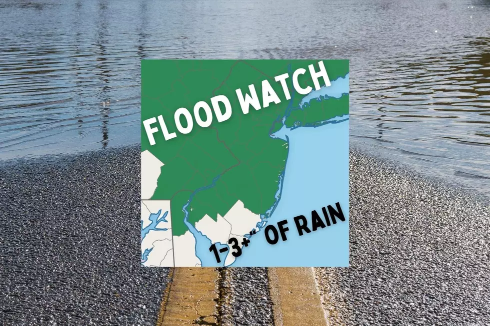
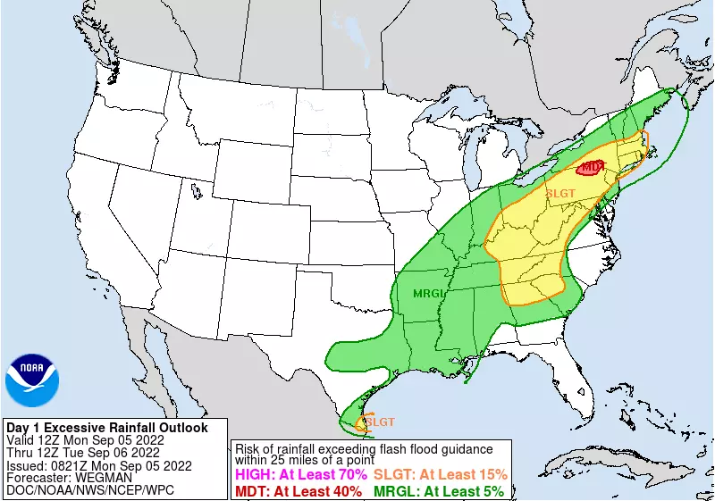
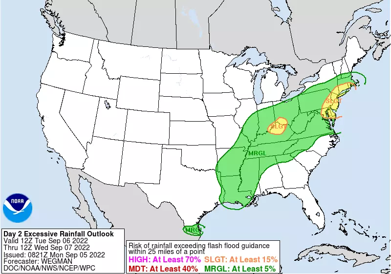
However, it looks like a wide area of the Garden State will see 1 to 3 inches of total rainfall by Wednesday. For some, that's more rain than we've seen in over two months. Plus, much of that storm total will come from 1-2" per hour downpours, contributing to the flash flooding concerns.
The worst-case scenario is even more concerning. Over the last several runs, several forecast models have pumped out a narrow swath of 3 to 6 inch rainfall over New Jersey. That is very concerning. (Again, especially considering the downpour potential.) Clearly enough to inundate storm drains and streets. Possibly enough to swamp cars and basements.
So What?
One saving grace here is our recent drought. Rivers, streams, and creeks are all running low, which means they will take longer to reach flood stage and overflow. Plus, the ground will take a while to become fully saturated. (Although I have heard that dry ground can repel heavy rain and cause ponding and flooding just as easily.)
All things considered, it is likely that someone in New Jersey sees serious flooding over the next 36 to 48 hours. Will it be Ida/Floyd level flooding? No way. But for the reasons I have laid out, this batch of very wet weather will likely go beyond "typical summertime thunderstorm" expectations.
The National Weather Service has issued a Flood Watch for 18 of New Jersey's 21 counties:
—5 p.m. Monday to Noon Tuesday... Northwestern New Jersey... Hunterdon, Morris, Somerset, Sussex, and Warren counties.
—5 p.m. Monday to 5 p.m. Tuesday... Northeastern New Jersey... Bergen, Essex, Hudson, Passaic, and Union counties.
—6 a.m. to 8 p.m. Tuesday... Central and Southwestern New Jersey... Burlington, Camden, Gloucester, Mercer, Midlesex, Monmouth, Ocean, and Salem counties.
—No Flood Watch at this time... Southeastern New Jersey... Atlantic, Cape May, and Cumberland counties.
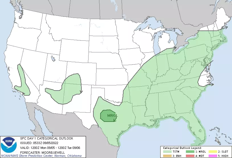
Note: These thunderstorms present only a flooding threat. Severe weather (wind, hail, tornadoes) is unlikely.
Questions?
You may notice I have given very little geographical detail about where in the Garden State the heaviest totals are likely to fall. That is deliberate — it is unclear whether northern New Jersey (round one) or central New Jersey (round two) or even eastern Pennsylvania has the greatest potential to pick up 3+ inch rainfall. It has to do with the timing and orientation of the juicest air, leading to the strongest thunderstorm cells.
That's why we have such a widespread flood watch by NWS. Although it is not a slam dunk forecast, everyone in New Jersey needs to stay vigilant as the soaking begins.
In addition, I am curious to see how the super-dry antecedent ground condition will play with heavy rain and contribute to flooding. Such a hydrologic concern is a bit beyond the scope of my meteorological expertise and training — I am not a soil scientist.
Finally, it is unclear how long rain will linger into Wednesday. It is clear the flooding threat will be over. But will we see damp and dreary conditions all day? Or clearing skies by lunchtime?
What's Next?
A strong cold front on Wednesday will sweep "the junk" out to sea. And we'll be left with delightful, seasonable September weather for Thursday, Friday, and Saturday. Our next chance of rain comes into view in the Sunday-Monday time frame.
Be smart and stay safe out there. We'll be with you on-air and online all day Tuesday with your latest news, traffic, and weather updates.
Dan Zarrow is Chief Meteorologist for Townsquare Media New Jersey. Follow him on Facebook or Twitter for the latest forecast and realtime weather updates.
BEEP BEEP BEEP: These are the 13 types of Wireless Emergency Alerts auto-pushed to your phone
Gallery Credit: Dan Zarrow
Flooding in Middlesex County, NJ on Aug. 23, 2021
Gallery Credit: Edwin J. Torres, Office of the Governor
More From New Jersey 101.5 FM


