

Extreme Heat Warning continues for NJ: More triple-digit temps
It is ferociously hot. It is disgustingly humid. And New Jersey faces another day of record-breaking heat. In fact, Tuesday will probably be a degree or two hotter than Monday, with high temperatures very close to 100 degrees (away from the coast). The heat index will once again soar to about 110. This is clearly dangerous heat, with heat warnings and advisories posted statewide. Wednesday will be steamy too, although temperatures will scale back slightly to the mid 90s. The heat wave is now set to break on Thursday, thanks to a backdoor cold front. That will drive in some showers and thunderstorms and cool us down through Friday — sweet relief!
Tuesday NJ weather: Dangerous, record heat
If you liked Monday's brutal heat and humidity, you are just going to love Tuesday too. (If not, get ready to sweat and swelter some more.)
It is already very warm Tuesday morning. Due to the humidity in the air, temperatures could not drop below the upper 70s across most of the state overnight. Even some 80s — that is not refreshing at all.
High temperatures Tuesday are forecast to reach the upper 90s to around 100 degrees across New Jersey. Probably a degree or two hotter than Monday. The Jersey Shore will be the cool spot eventually, once the sea breeze kicks in — but that probably will not be the case until the afternoon. (All NJ coastal weather stations hit at least 89 degrees before the sea breeze on Monday.)
Humidity remains high, which will push the dreaded heat index (the "feels like" or "apparent" temperature) toward 110 degrees once again. Remember, that is our key indicator of how heat and humidity will impact human health. In this case, we are back in the danger zone.
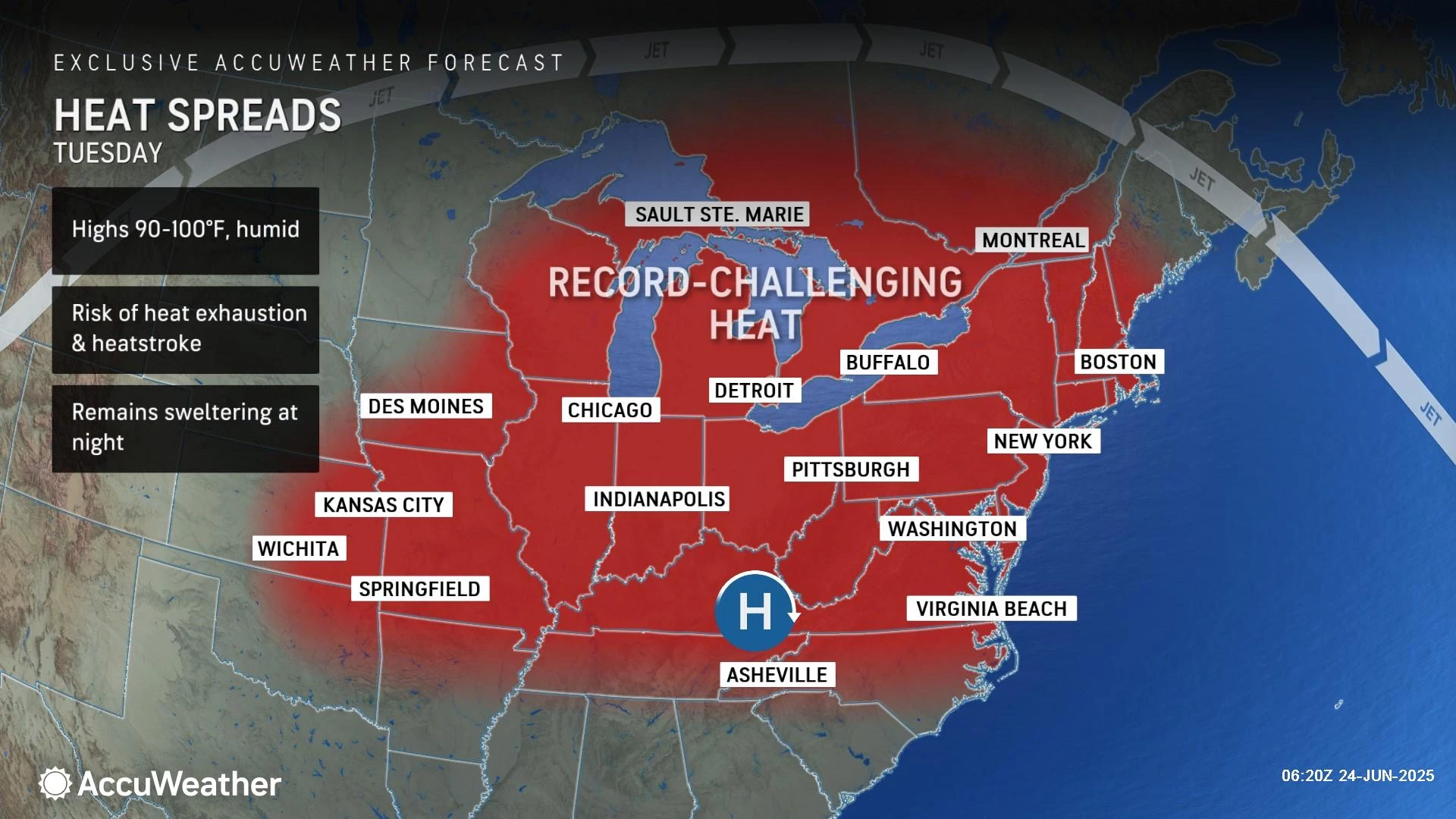
An Extreme Heat Warning continues for all of inland New Jersey Tuesday. (And in most places, that will extend throughout Wednesday too.) A less-severe Heat Advisory is in effect along the immediate coast. Limit strenuous activity during the hottest part of the day and dress for the weather. Be sure to stay super hydrated before, during, and after any exposure to the outside elements.
Expect sunshine and dry, storm-free weather Tuesday. It's just hot.
Tuesday night will be stifling and sweltering again too, with low temperatures averaging upper 70s overnight. Once again, urban and coastal areas may struggle to drop below 80.
Wednesday NJ weather: Slightly better
Wednesday is going to be another steamy day. But by the numbers, temperatures will end up ever-so-slightly lower.
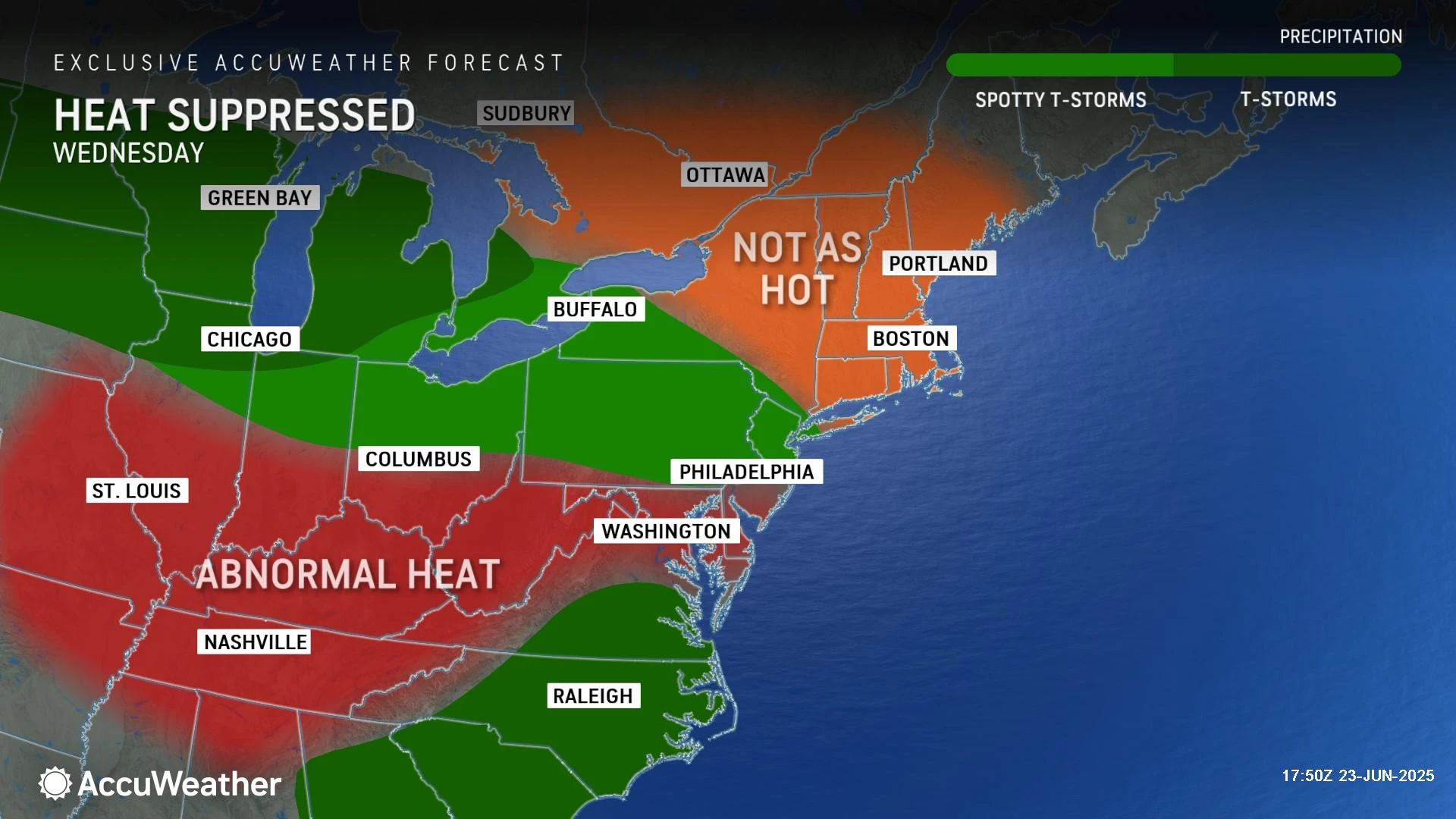
As skies become partly sunny, high temperatures will reach the mid 90s. Humidity scales back a little bit too. That gives a max heat index around 103 degrees. Still uncomfortable and potentially dangerous. But better than Monday and Tuesday.
Another new development on Wednesday is a possible isolated shower or thunderstorm. This would be a late-day thing, in the late afternoon or early evening hours. I will say the best chance for a spot of rain would be to the north, but that is not a guarantee.
Thursday NJ weather: The heat wave breaks
Relief from the horrendous heat and humidity is in sight. And our latest forecast shows cooler air arriving even earlier than previously advertised.
As a backdoor cold front slides in from the northeast on Thursday, we will see a marked increase in cloud cover. You will feel a slight decrease in humidity levels. And temperatures will end up quite a bit cooler.
Although forecast model guidance is all over the place for Thursday's high temperatures, I have settled on lower 80s. That will feel very nice after three days near the century mark.
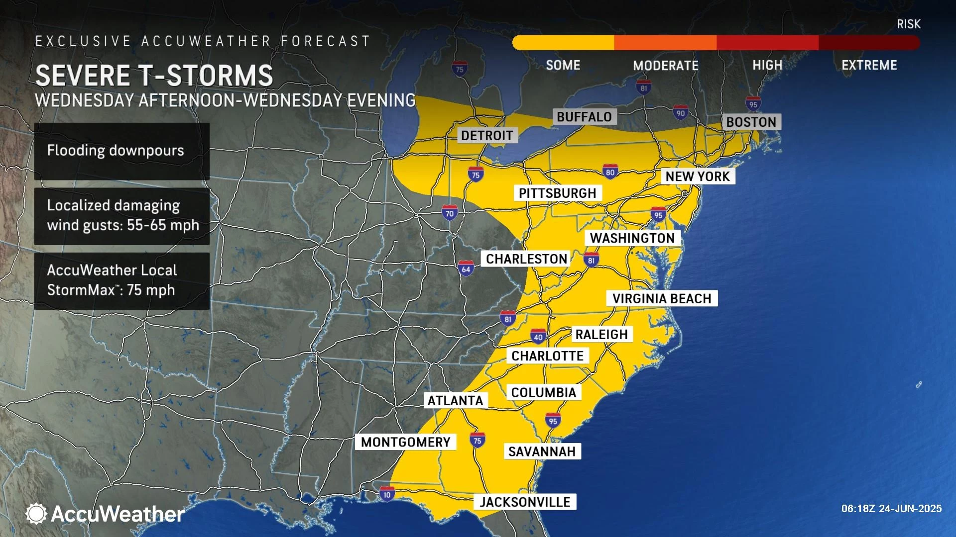
The other issue Thursday will be a round of scattered showers and thunderstorms in the afternoon and evening. I would not call the rain widespread but there will be some storms to dodge. Given how humid the atmosphere is, my primary concern would be for localized heavy downpours. Strong to severe wind gusts are possible too.
Thursday night will be a nice taste of relief too, as low temperatures dip into the 60s for the first time since last week.
Friday NJ weather: Sweet relief
Friday will be the coolest day of the week, although still a touch unsettled.
A shower may linger into Friday morning, but the rest of the day trends quiet and dry. High temperatures will only reach the springlike 70s. (Although I would not rule out a couple of 80-degree numbers in inland South Jersey.)
Expect mostly cloudy skies and a light on-shore breeze Friday, reinforcing the cooler air.
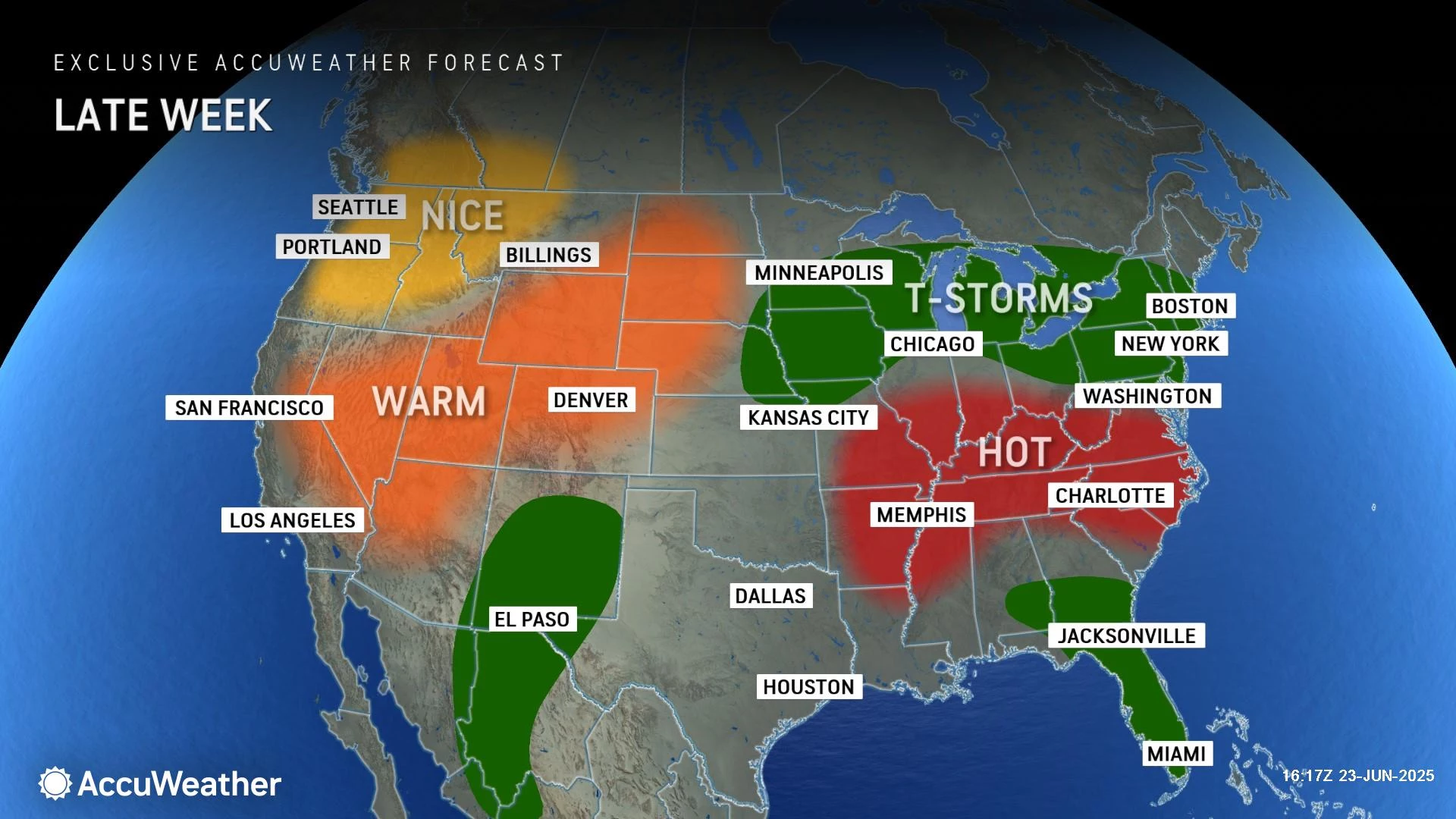
Saturday NJ weather: Warming up again
Moving into the final weekend of June, temperatures will be on the rise again. A warmup is inevitable — it's just a matter of how high temperatures go and how quickly they will climb.
I really did not have much time to pay attention to the weekend forecast, but I think mid 80s Saturday and near 90 Sunday are reasonable high temperature expectations. Each day will carry the chance for spotty showers and thunderstorms around, totally typical of warm and humid summer days.
If the forecast holds, we will pinpoint those weekend numbers and the intensity/timing of any storms soon, in a day or two.
The complete list of names for the 2025 Atlantic Hurricane Season
Gallery Credit: Dan Zarrow
Dan Zarrow is Chief Meteorologist for Townsquare Media New Jersey. Follow him on Facebook for the latest forecast and realtime weather updates.
NJ DOT's Electronic Sign Safety Messages Summer 2025
Gallery Credit: Dan Alexander
More From New Jersey 101.5 FM


