

Another day, another Wind Advisory: NJ cooling down Thursday
The Bottom Line
Talk about a best case scenario! New Jersey got absolutely soaked on Wednesday, with widespread 1 to 2 inches of rain around the state. It did get windy, but there were no severe weather reports. Just healthy, much-needed rain. That will definitely help tamp down the fire danger for a few days — especially good news since there is a lot of wind in the forecast.
Thursday is a weather transition day, as a cold front drives temperatures down and wind speeds up again.
But this is not an "arctic blast". Yes, it will be windy and colder — which I call "blustery" — but not dramatically so.
There is a minimal shower chance coming up this weekend. Otherwise, our weather looks dry for the next week at least. And although below-normal temperatures will take hold for a few days, a big warmup is on the horizon for next week.

Thursday
Thursday morning is starting off damp and fairly warm, with mainly 50s on thermometers across New Jersey.
But a cold front is racing through New Jersey, causing temperatures to go down as the day goes on. While you might not need a jacket early on, you will want it later.
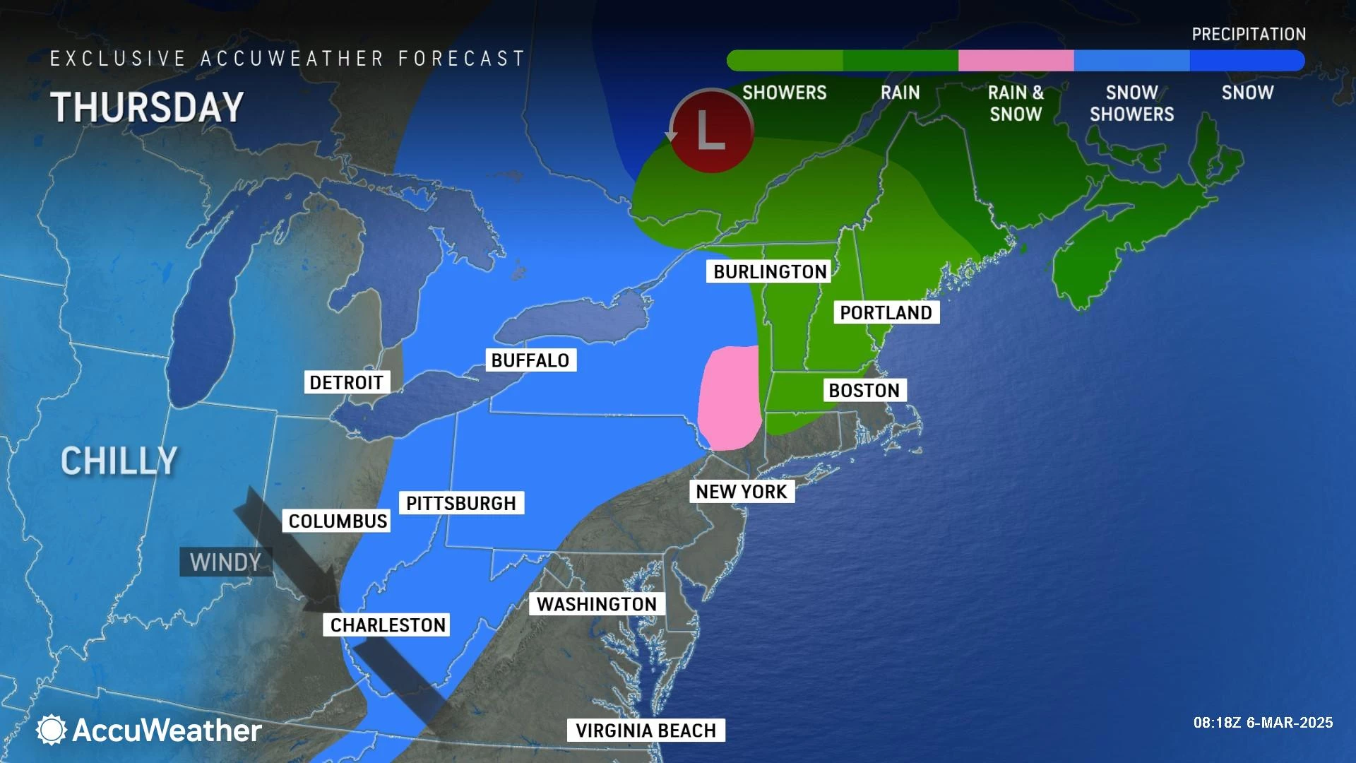
There are still some spotty rain showers around too, which should depart by about mid-morning. Then we will see a mix of clouds and sun.
Temperatures are forecast to settle in the mid 40s by this afternoon. Again, cooler than the early morning 50s. But not terrible.
The big weather nuisance of the day once again will be wind, potentially gusting to 40 or even 50 mph this afternoon and evening. A Wind Advisory has been issued for the entire state of New Jersey, for the second day in a row.
Do not expect the wind to calm down Thursday night. Under clearing skies, temperatures will be on the chilly side. Probably a freeze for most of New Jersey, with lows around 30. (I promised myself I would not write about the wind chill in this article — but yeah, that cold air will have a little bite to it overnight.)
Friday
Friday is going to look like a nice day. But that blasted wind will continue to blow.
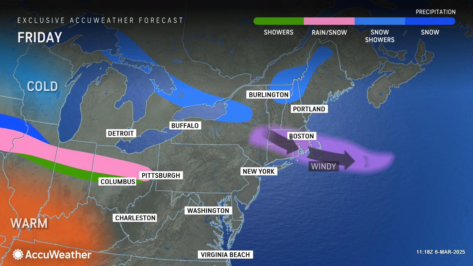
Top gusts on Friday will probably be around 20 to 30 mph. At least skies will be sunny. And temperatures will be seasonably cool, topping out in the upper 40s.
Saturday
A weak impulse could spark some light showers over New Jersey early Saturday morning. Model guidance has shown some snowflakes and raindrops for several runs in a row, so it is worth mentioning. But it will not amount to much — maybe a damp ground in spots. Any precipitation will probably wrap up by daybreak.

Early clouds will quickly give way to sun by Saturday late morning. It will be breezy still. And temperatures will come up just shy of seasonal normals, in the mid 40s.
Sunday
We had been watching a potential storm system for Sunday, but it will dive far south of New Jersey. Expect partly sunny skies, light winds, and highs holding steady in the mid 40s.
The Extended Forecast
Ready for a big warmup?
50s Monday.
60s Tuesday.
Potentially jumping into the 70s on Wednesday — the first of the year.
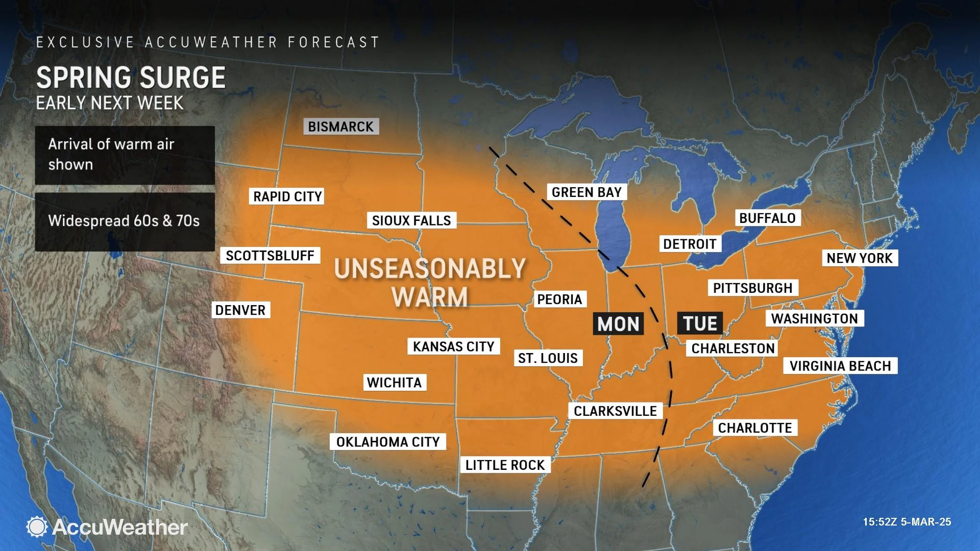
The warmth won't last, as we cool down with another solid batch of rain next weekend. But if you are looking for a real taste of spring ... and even a reason to take a day or two off of work ... the mid to late week forecast is for you.
TSA's top 10 things airline passengers forget but need to remember
Gallery Credit: Jen Ursillo
Dan Zarrow is Chief Meteorologist for Townsquare Media New Jersey. Follow him on Facebook for the latest forecast and realtime weather updates.
2025 NJ St. Patrick's Day Parades (by date)
Gallery Credit: Dan Alexander
More From New Jersey 101.5 FM


