

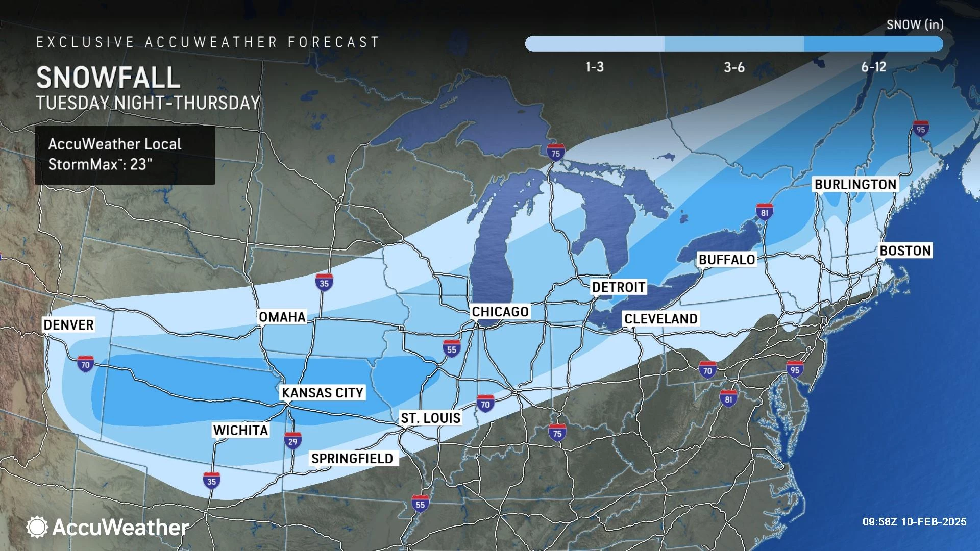
Triple threat: 3 winter storms taking aim at New Jersey
UPDATE... This article is outdated...
For the latest storm forecast information, please refer to my newest weather blog post.
The Bottom Line
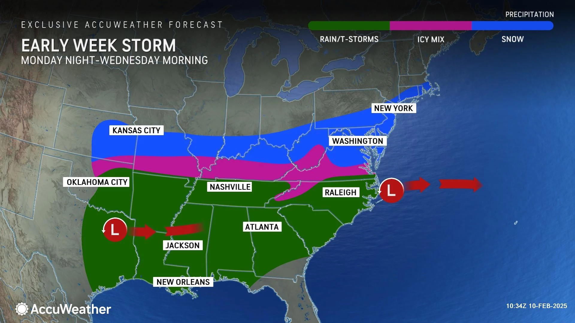
New Jersey's parade of storms continues. We have not one, not two, but three chances of wintry weather coming up over the course of the next week. And each of those storm systems will have a very different character and personality. The first one is all snow. The second will be another messy mix of snow and ice and rain. The third looks like mainly rain at the moment, although that is a low confidence call.
Obviously, we are mostly focused on the first storm in the sequence, with snow set to arrive on Tuesday. It is going to be a "South Jersey Special," with the highest snowfall totals expected over Cumberland and Cape May counties.
Here in the weather center, we are preparing for a busy week of active weather. Are you ready?

Monday: Quiet
Monday will be the calm between the storms. The only headline here is chilly temperatures, holding about 5 degrees below normal for mid-February.
Thermometers are in the 20s and 30s Monday morning — the more snow cover you have on the ground, the colder the air is.
Highs will only reach the mid 30s. At least winds will stay light. And the sky will be bright with sunshine and passing clouds.
A batch of showers is passing south of New Jersey on Monday. Other than a few flurries (maybe), I do not see any other impacts here.
Monday night will feature increasing clouds and cold low temperatures in the 20s.
Tuesday-Wednesday: Storm #1
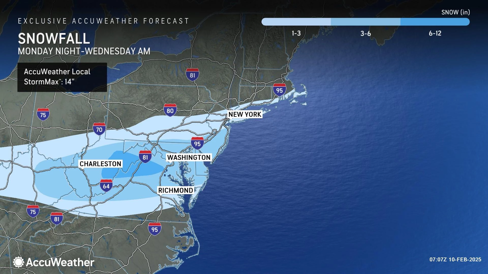
Since my initial forecast call on Sunday, not much has changed. I opted not to change my top 4-8" snowfall contour at all, while compressing (lowering) my 0-1", 1-2", and 2-4" areas through northern and central New Jersey. Since I am looking at the same basic story as yesterday, forecast confidence has increased.
Tuesday morning will be fine. Snow arrives in South Jersey Tuesday afternoon. The brunt of the storm, with the heaviest and more widespread snow will be Tuesday evening. And the storm will wrap up early Wednesday morning.
This is expected to be an all snow event — no nasty icing or even any rain this time around. And it is a "South Jersey Special".
Let me break it down by region, according to my latest forecast map above.
The Snow Zone (Orange)... Initial snow will arrive around 1 p.m. Tuesday. Snowfall will become steadier and heavier after 5 p.m. Things will start to calm after Midnight, wrapping up completely by about 9 a.m. Wednesday at the latest. Total snow accumulation of 4 to 8 inches is likely for this area approximately south of Garden State Parkway exit 63 and NJ Turnpike exit 3. That is plowable, shovelable snow and will have significant impacts on travel.
On the Edge (Dark Blue)... This area of south-central is expected to fall out of the heaviest and most-prolonged snow bands. Initial snow bands should arrive by 5 p.m. Tuesday — perfect timing for the evening commute. Steady snow is possible through the evening, tapering after Midnight. Final flakes may linger through about 9 a.m. Wednesday at the latest. Expect total accumulation of 2 to 4 inches here. That is enough to cause travel disruptions, although treated major roadways should fare well. (Especially since it is all snow and not ice this time around.)
Conversational Snow (Light Blue)... North of New Brunswick, this is not your storm. Snow will not arrive until the tail-end of the evening commute, around 7 or 8 p.m. Tuesday. The window for steady snow will close around Midnight. Snow showers may linger through about 9 a.m. Wednesday at the latest. I think you will see some wintry weather and light accumulations, on the order of an inch or two. Barely enough to shovel, but there could be slippery spots.
Hardly Anything (White)... North Jersey gets a break from snow and ice from this particular storm, as most precipitation stays south. Some snowflakes are possible eventually (although not guaranteed) along and north of the I-80 corridor. But it probably will not start until after 9 or 10 p.m. Tuesday. And then wrapping up early Wednesday morning, with final snowflakes by 9 a.m. at the latest. I will put a precautionary "up to an inch" forecast here, but do not expect much.
A Winter Storm Watch has been issued for the eight southernmost counties in New Jersey, effective from Tuesday afternoon through Wednesday afternoon. That watch will likely convert to warnings and/or advisories soon — that is when it is time to complete storm preparations (if any) and consider your travel plans carefully.
My biggest concern continues to be Tuesday evening's commute. Conditions will only get messier and messier, especially the farther south in New Jersey you are traveling.
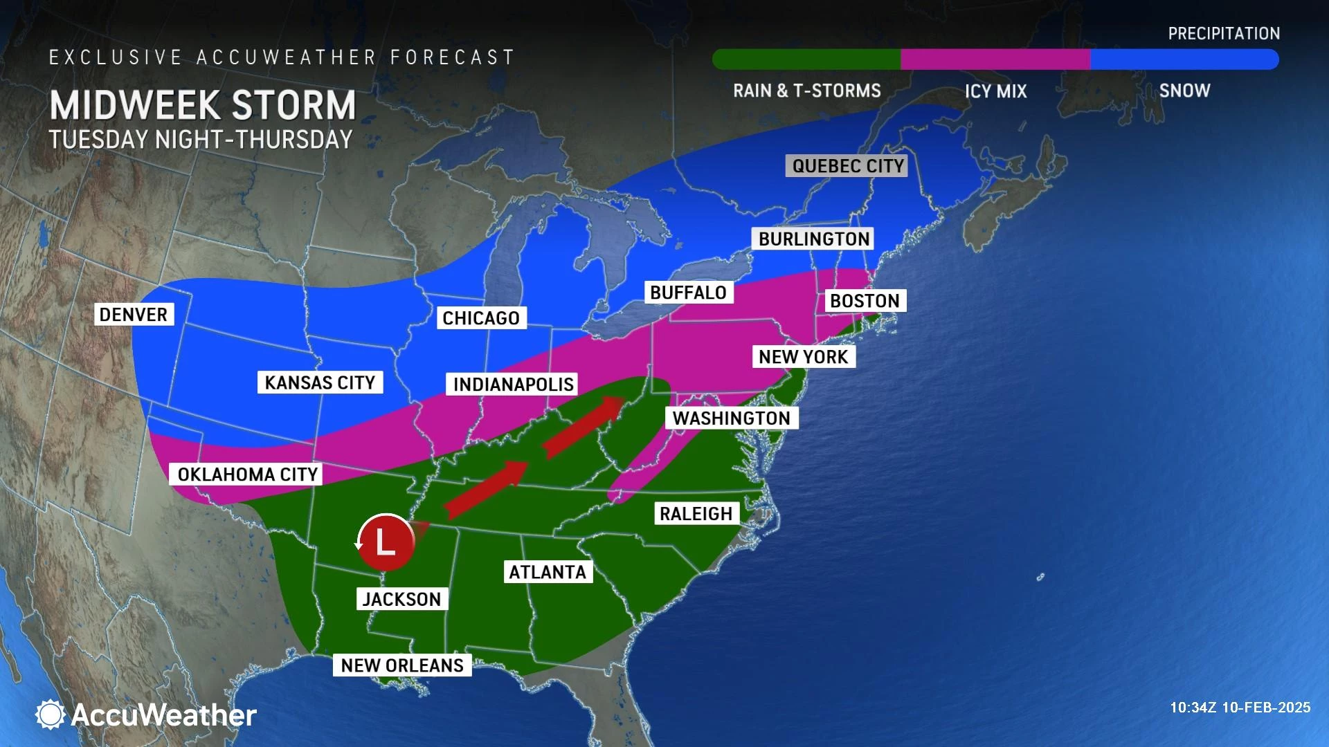
Wednesday-Thursday: Storm #2
After the early morning snow wraps up, we should catch peeks of sun through midday Wednesday. And then our next sloppy storm system rolls in Wednesday night.
This time around, I am hopeful we escape most of the Wednesday evening commute unscathed. By 7 or 8 p.m., we will look for snow to resume across the state.
But with warmer air in play, Wednesday night's storm will not be an all snow event. We can basically break the state in half for this one.
Southern Half of New Jersey... A quick burst of snow — with little to no accumulation — will quickly turn to all rain overnight.
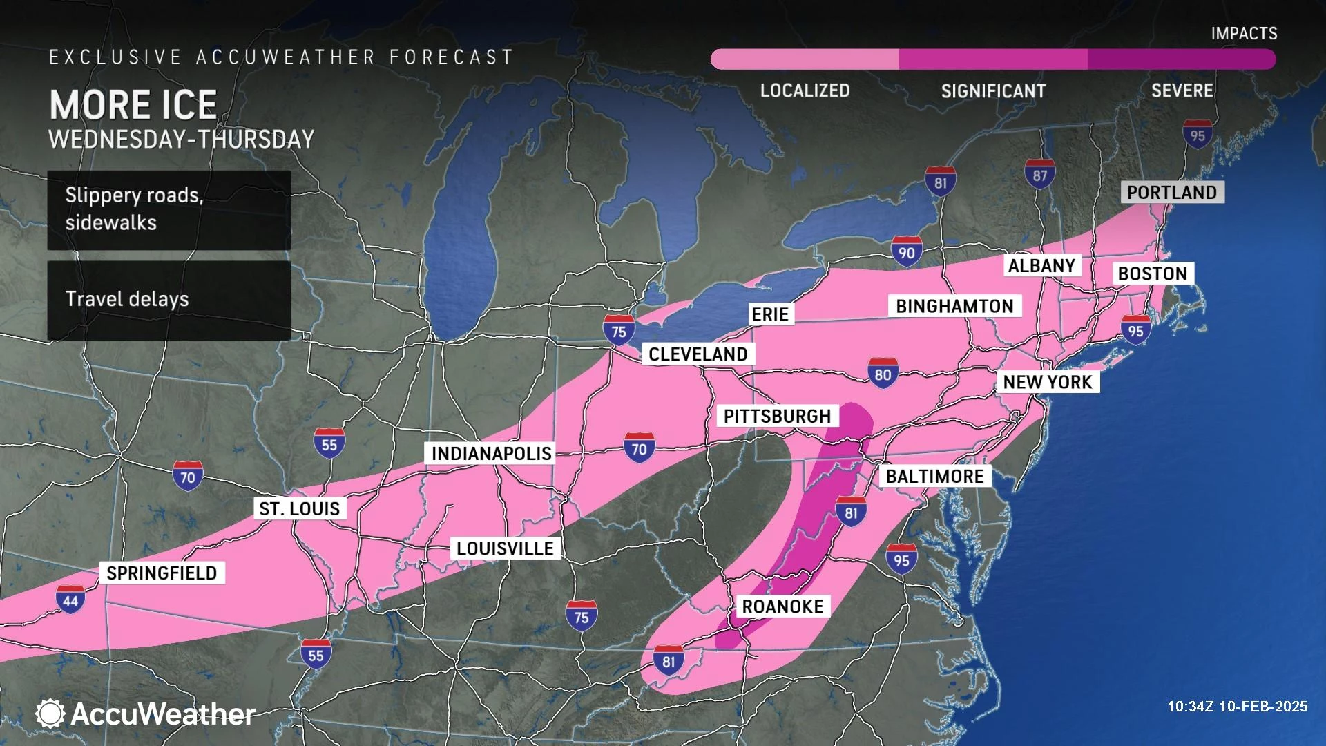
Northern Half of New Jersey... Snow Wednesday evening will progress to an icy mix and then possibly rain. (Models sharply disagree about how far that wintry-to-wet transition gets in North Jersey.) A few inches of snow accumulation are possible in northern New Jersey before that changeover happens. And icing is back on the table, with a glaze of ice accumulation possible due to freezing rain.
I opted not to create my own snow/impacts map for this storm just yet, in order to focus on the more-imminent and likely more-impactful Tuesday night snow storm. But I will — my next weather blog update will get much more specific about this "sloppy seconds" Wednesday night storm.
High temperatures on Thursday may push into the 40s across much of the state, thanks to that warmer air. It will be short-lived though, as a cold front arrives Thursday night.
Friday: Quiet
Friday will be sunny, breezy, and cold. High temperatures will only reach the lower to mid 30s, with wind chills potentially stuck in the 20s.
And that is it. I am happy to say nothing will be falling from the skies of New Jersey on Friday.
Saturday-Sunday: Storm #3
Full disclosure: I do not have much to say about the next storm in line.
Timing for this one looks to be late Saturday afternoon through early Sunday evening. Potentially over 24 hours of inclement weather.
As of the latest model runs, a surge of warmer air — possibly pushing temps into the 50s in South Jersey — would make for an almost all rain event. The European model even pumps in some rich moisture, allowing for upwards of 2 inches of much-needed rainfall.
But here's the thing: That warm air is never a guarantee this time of year. And if it does not pan out, and this turns colder, snowier, and icier, there could be some real problems in the middle of the extended President's Day Weekend.
Again, I am not stressing over the details of Storm #3 at this point. We will continue watching and updating as the week goes on. If there are alarm bells to be run, we will probably start talking about them on Wednesday or (more likely) Thursday.
The Extended Forecast
Will our weather simmer down next week? Yes, the storm train will slow down.
But it will not derail.
Long-range models show additional storm signals around the middle and end of next week. Way too early to tell if they will be wintry or wet. (Or if they will develop at all.) With no sustained warmup in sight, I have a feeling we will be talking about snow chances through at least the rest of February.
All New Jersey connections in 2025 Super Bowl
Gallery Credit: Erin Vogt
Dan Zarrow is Chief Meteorologist for Townsquare Media New Jersey. Follow him on Facebook for the latest forecast and realtime weather updates.
New Jersey's top 10 spots for soup
Gallery Credit: Jill Croce
More From New Jersey 101.5 FM


