

Thanksgiving week weather for NJ: Showers and a big cooldown
Welcome to Thanksgiving Week! As visions of turkey and mashed potatoes dance in your head this week, we have a few little weather hiccups to get through. A few showers will pass through New Jersey over the next couple of days. And then temperatures plummet, just in time for the holiday getaway.
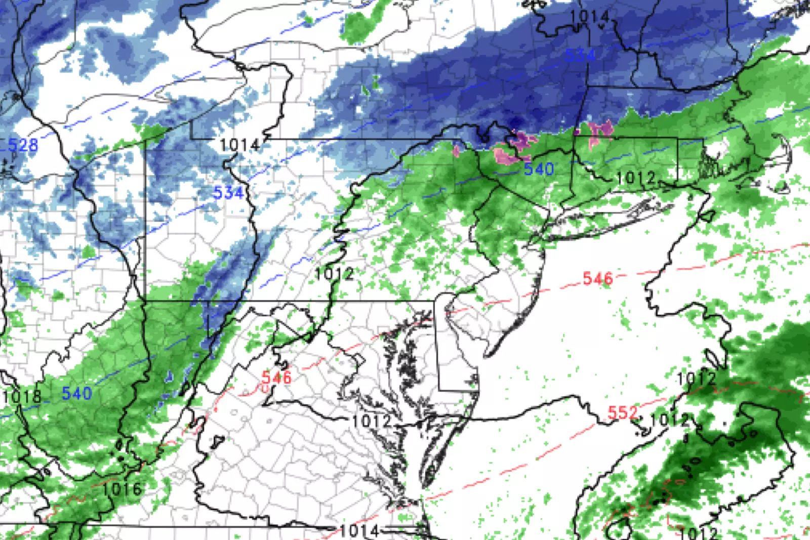
On this Monday morning, a line of showers is just barely clipping northern New Jersey. While the radar shows it to be only rain, I wouldn't rule out a few snowflakes around Sussex County early Monday morning. For most of the state, it's a dry start to a decent weather day.
Skies will feature a mix of sun and clouds Monday (more clouds north, more sun south coast). High temperatures will range from the mid 40s (north) to the mid 50s (south). Normal high temperatures right now are between 53 (north) and 55 (south) degrees. So again, not too bad — just a seasonable November chill in the air.
Our next storm system, a weak clipper system, will impact the Garden State Monday night. This time around, the system's trajectory looks to pass over most of New Jersey. So I've included a chance for showers in the forecast statewide.
It's going to be almost all rain — the threat for wintry weather will be low and limited to far northern New Jersey only. I think a bit of light snow and/or freezing drizzle is possible around the mountaintops. Maybe a half-inch to an inch of fresh snow and/or a light glaze of ice? No significant travel issues are expected. Some patchy fog will be possible overnight as well. Outside of the higher elevation area to the north, I don't see most of the state falling below 40 degrees overnight.
After showers wrap up Tuesday morning, skies should clear to sunshine. It will be a breezy day, with sustained winds about 10 to 20 mph. Temperatures will stay fairly mild (at least, compared to what's coming later this week) near 50 degrees.
A westerly wind will kick up on Wednesday, signaling the big cooldown that's coming. High temperatures on Wednesday should average lower 40s. Add in wind gusts over 30 mph, and it's going to be a blustery (albeit sunny) day.
The "bottom of the barrel" will be Thanksgiving Thursday. Morning lows in the teens and 20s! Afternoon highs barely into the 30s! A brisk wind superimposing a big bite of cold on top of the winterish sunshine.
Black Friday looks pretty similar, with sunshine, lows near 20, and highs in the 30s.
Clouds and temperatures will increase for the weekend. However, the forecast also shows some wet weather coming into view as a pair of storm systems visit New Jersey. For now, I'm seeing rain — heavy at times — for Saturday into Sunday. But this is just a low-confidence preview — we'll have to watch the timing and precipitation type carefully as the week presses on.
Dan Zarrow is Chief Meteorologist for Townsquare Media New Jersey. Follow him on Facebook or Twitter for the latest forecast and realtime weather updates.
More From New Jersey 101.5 FM


