
Stanhope in the dark, high school damaged after possible tornado
STANHOPE — Cleanup continued from Tuesday night's severe thunderstorms and possible tornado hit areas of Sussex County hard — damaging a high school. A repeat performance is possible on Wednesday.
The National Weather Service will investigate what NJ 101.5 Chief Meteorologist Dan Zarrow called a "probable tornado that affected parts of Netcong, Stanhope, Hopatcong, and Mount Arlington around 8:30 pm."
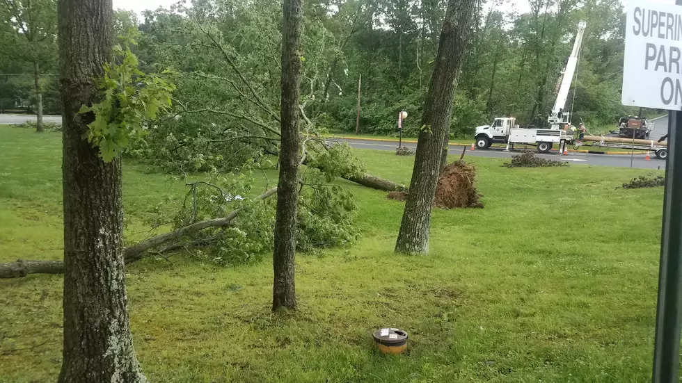
Trucks from JCP&L and tree companies were positioned around Stanhope on Wednesday, where nearly the entire town was without power overnight. Crews will have to remove trees first before crews from the utility can assess the damage and begin restoration, according to JCP&L spokesman Dave Newcomb, who said all available crews began working on Tuesday night.
As of 6:30 a.m., nearly JCP&L 2,500 customers remained without power, according to the utility's outage map.
Newcomb said power is not expected to be restored in Stanhope and Hopatcong until the end of the day. Netcong customers will likely be restored on Wednesday morning.
Classes were canceled for Wednesday at Lenape Valley Regional High School after a possible tornado touchdown that caused damage to the school building and property.
Newcomb said three utility poles at the school were damaged by the storms.
School board president Richard Kuncken and superintendent Paul DiRupo said in a joint statement the area in front of the school where school buses pick up students was damaged along with many light poles and trees, the New Jersey Herald reported.
Dirupo told New Jersey 101.5 there was "massive trees down, wires all over and one of the light poles in faculty parking lot was at a 45 degree angle."
Kuncken told the Herald that the school's track team was holding a banquet at the school when the storm struck, and security moved everyone to the gym. Everyone was allowed to leave by 10 p.m.
Byram resident Marie Raffay told the Herald first-responders told attendees there was only one way to exit the school parking lot because of fallen trees and power lines. She said a tree fell on top of one family's car as people left the school, but no one appeared to be injured.
The National Weather Service's Storm Prediction Center has placed most of New Jersey at an "enhanced" risk for more severe weather on Wednesday.
Zarrow said the atmosphere is "highly charged" but there is one difference between Tuesday's conditions and Wednesday.
"Forecast models and severe weather parameters are less favorable for cellular (and specifically supercellular) storms. That will reduce the risk for tornado and hail slightly," Zarrow wrote in his daily weather blog, stressing that there will still be powerful storms on Wednesday. "However, linear or quasi-linear storms would still be efficient rain producers, in addition to pumping out some potentially damaging winds."
Contact reporter Dan Alexander at Dan.Alexander@townsquaremedia.com or via Twitter @DanAlexanderNJ
More from New Jersey 101.5
More From New Jersey 101.5 FM


