

Spring in the air again Tuesday: Mild temps, showers, thunderstorms
On Monday, several stations across interior central and southern New Jersey hit 66 degrees — full 20 degrees above-normal for early March! At New Brunswick specifically, it was the warmest day since the ridiculous unseasonable warmth on January 11-12. Hopefully you were able to get outside and enjoy the springlike conditions. (Of course, I was stuck inside in meetings all day — wah, wah.) If not, you'll have another chance Tuesday.
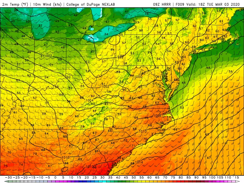
Tuesday morning is starting off dry, after a round of rain showers overnight. It's also quite mild, with temperatures in the 40s from top to bottom across New Jersey. This is closer to our normal high temperatures for this time of year. Highs will once again pop to near 60 degrees, probably peaking around lunchtime. Tuesday won't be quite as bright as Monday, with mostly cloudy skies.
In addition, another batch of rain is aiming for New Jersey Tuesday afternoon. First raindrops will probably push across the Delaware River in the Noon to 2 p.m. time frame. Once the rain starts, temperatures will drop a bit and conditions won't be quite as pleasant. It looks like the steadiest, heaviest rain will impact the northern half of New Jersey, although southern NJ will still see some showers.
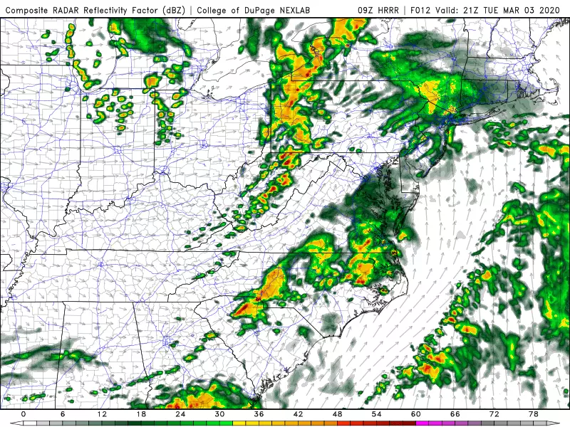
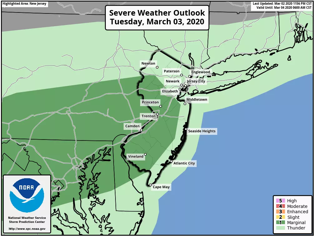
The grand finale of this storm system will arrive late Tuesday evening, around 10 p.m. (give or take). Given the relative warmth and humidity in the air, and the strength of our impending cold front, thunderstorms are probable. Furthermore, I could see some strong thunderstorms in there, potentially spitting out some gusty winds, locally heavy rainfall, and frequent cloud-to-ground lightning.
The rest of Tuesday night will feature clearing skies, as a westerly breeze brings in (slightly) colder air. Overnight lows will dip into the lower 40s or so.
So yes, Wednesday will be cooler than Tuesday. But not by much — our forecast calls for lower to possibly mid 50s Wednesday afternoon. However, we will contend with a nuisance wind, potentially gusting over 30 mph. Skies should be bright and sunny.
Thursday looks even cooler — but with highs near 50 degrees, we're still holding above seasonal norms. Increasing clouds could lead to a late-day rain shower (after about 4 p.m.)
Another storm system will impact New Jersey from Thursday night through Friday, and it might get a little bit complicated. Friday could turn into a pretty wet day, with scattered showers throughout the day. If you go by raw model output, much of that shower activity would fall as snow in northwestern New Jersey. However, with high temperatures in the lower to mid 40s Friday afternoon, I don't really buy the doom and gloom snow forecasts.
Having said that, as temperatures fall Friday night, I do believe a quick flip to snow or wintry mix is possible. It's all about timing and available moisture here. And while I wouldn't completely rule out some light accumulations in a perfect setup, I'm not overly worried about travel issues for Saturday morning at this time. This storm system still fits in the worth watching category. If there's a need to ramp up snow/ice totals and/or produce a snowfall forecast map, we'll nail that down in the next day or two.
Saturday promises to be the coldest day of the week, with highs in the lower 40s. Skies will be sunny, as northwesterly winds fall into the "breezy" category (10 to 20 mph).
Sunday will be the warmer day of the weekend, as temps run into the 50s again (at least).
A quick glance at the long-range forecast does not show any substantial snow chances for New Jersey through next week. Only 16 days until Spring officially springs!
Dan Zarrow is Chief Meteorologist for Townsquare Media New Jersey. Follow him on Facebook or Twitter for the latest forecast and realtime weather updates.
More From New Jersey 101.5 FM


