Heads up, NJ: Gusty thunderstorms, a blustery day, and a frosty morning ahead
The Bottom Line
There will be a lot going on in New Jersey’s weather world over the next 24 to 36 hours. Grab the umbrella, get ready for a wild temperature roller coaster ride, and keep an eye on the sky Friday. Spotty showers Friday morning will give way to breaks of sun in the afternoon. That will help cook the atmosphere, pushing temperatures back into the 70s. As a strong cold front approaches Friday evening, a line of strong to severe thunderstorms will likely sweep from northwest to southeast across the state between about 6 p.m. and 10 p.m. Damaging winds will be the big concern, along with a brief period of heavy rain. After scattered rain lingers through the overnight hours and Saturday morning, sunshine will return. But Saturday will be a windy and colder day, with temperatures barely breaking 50 degrees. Sunday morning looks like New Jersey’s first widespread frost/freeze of the season, as temperatures dip into the 30s across most of the state. Temperatures will moderate into the more seasonable 60s next week.

Weather Hazards
A line of strong to severe thunderstorms Friday evening will likely produce a quick hit of gusty winds and heavy rain. The highest risk for severe weather will be along the western edge of New Jersey. However, the Storm Prediction Center now shows a Slight Risk — level 2 of 5 — for dangerous weather across the entire state.
Saturday’s wind gusts up to 40 mph will make it feel uncomfortably blustery and could be strong enough to cause driving and walking difficulties, bring down small branches, and cause sporadic power outages.
The season’s first widespread frost/freeze is likely Sunday morning, as temperatures dip into the 30s across inland New Jersey.
Climatological Context
October 16 is the 289th day of 2026.
Normal high temperatures range from 65 to 68 degrees, while normal low temperatures range from 46 to 49 degrees.
October is, on average, New Jersey’s sixth warmest, sixth wettest, and seventh snowiest month of the year.
Friday
Friday is going to be an active weather day. Eyes on the sky, folks.
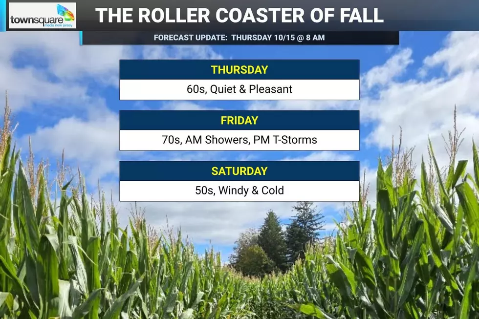
Temperatures are starting comfortably cool around 60 degrees across New Jersey early Friday morning. Eventually, highs will surge back into the mid to upper 70s, possibly coming close to 80 degrees in spots.
But the warmth is not the big weather story.
Friday is a classic warm front-cold front setup. There will be two distinct opportunities for rain, with the second one carrying the potential for some nasty weather.
First comes a round of spotty showers, drizzle, and fog through roughly 10 or 11 a.m. That will make for a damp start in spots, but it should not rain continuously.
Then breaks of sunshine should emerge Friday afternoon. Combined with an increase in humidity, that will help destabilize and “cook” the atmosphere ahead of our approaching cold front.
Starting around dinnertime, you will have to be "weather aware" and stay alert to changing weather conditions. A line of strong thunderstorms is expected to sweep from northwest to southeast across New Jersey between about 6 p.m. and 10 p.m. Powerful wind gusts will be the primary concern. A brief period of heavy rain is likely too, along with plenty of lightning.
Scattered rain will linger behind the main line through the overnight hours, as temperatures fall to around 50 degrees.
Saturday
Saturday will be a very different weather day, introducing our other major weather story: Cold.
Morning showers may linger for a while — even longer than previously expected, especially in South Jersey — as Friday’s storm system finishes pulling away. Then skies will (eventually) clear to sunshine.
But do not let that sunshine fool you.
Saturday will be unseasonably cold by mid-October standards. High temperatures will only reach the lower 50s — upwards of 25 degrees colder than Friday.
And it will be windy too, with top gusts in the 30 to 40 mph range. The wind will add a bite to the cold air. Although it will technically be a few degrees too warm to calculate the "wind chill," this definitely qualifies as "blustery" weather.
So most of Saturday will be dry, but not exactly “pleasant”. This is heavy jacket weather.
Sunday
We hit rock bottom Sunday morning, the season’s first widespread frost/freeze threat.
After Saturday’s cold air settles in and winds finally calm down, temperatures should plunge into the 30s across much of inland New Jersey early Sunday morning.
Frost will be likely in many places away from the immediate coast and urban centers. The coldest locations, especially across northwestern New Jersey, could drop below the freezing mark.
For gardeners and farmers, this may effectively mark the end of the growing season.
After that frosty beginning, the rest of Sunday will be better. Expect sunshine, calmer winds, and cool temperatures. Highs will recover into the mid to upper 50s.
Still chilly, of course. But without Saturday’s howling wind, the afternoon should feel considerably more comfortable.
Monday & Beyond
Monday begins the slow climb back toward more typical October temperatures.
Expect a mix of sun and clouds with highs near 60 degrees Monday afternoon. We should see seasonable 60s by midweek.
The challenge for next week is the potential development of a coastal storm system that could spit some clouds and rain toward the Jersey Shore as the week goes along. I had largely written off this possibly in previous forecasts, but now multiple forecast models show it happening — so I have to pay attention. I'm not sure if we'd call this a "nor'easter" or a "tropical disturbance" or some hybrid system. Or if it'll be a dud, and we'll enjoy quiet weather and sunshine all week. Still, it is worth watching to make sure it does not turn into anything more significant than isolated raindrops.
20 Movie-Inspired Costumes for Halloween 2026
Dan Zarrow is Chief Meteorologist for Townsquare Media New Jersey. Follow him on Facebook for the latest forecast and realtime weather updates.
LET'S GO: 18 Old-School Halloween Things That Would Never Fly Today
Gallery Credit: Stephen Lenz
More From New Jersey 101.5 FM