Last week of August begins with three beautiful weather days for NJ
The Bottom Line
With high pressure settling over the eastern United States Monday, New Jersey enters a period of generally dry and quiet weather for the first half of this week. The chance of a shower Monday is not zero, but it is close — anything that develops or falls from the sky will be isolated and brief. Otherwise, we should enjoy plentiful sunshine, comfortable humidity levels, and seasonably warm temperatures in the 80s by Monday afternoon. Tuesday will bring more of the same lovely late August weather. And Wednesday looks good too, although clouds will increase a bit through the afternoon. Our next chance for widespread showers and thunderstorms looks to be Thursday, although forecast models are undecided at this time whether that will be a “sporadic” thing or a “throughout the day” event. A warmup from the lower 80s to the upper 80s will kick in for the final weekend of August.
Weather Hazards
With a quiet, pleasant forecast in play, New Jersey faces no weather or surf concerns for the first half of this week.
We will have to monitor Thursday's storm chances for severe weather and/or flooding potential — there's nothing imminently concerning there, just worth watching.
Climatological Context
August 24 is the 236th day of 2026.
Normal high temperatures range from 83 to 84 degrees, while normal low temperatures range from 64 to 67 degrees.
August is, on average, New Jersey’s second hottest and second wettest month of the year.
Monday
I literally said it when I walked outside: Ahh, what a nice morning.
Temperatures started Monday around 60 degrees, with a new, crisp, dry air mass in place. Relatively low humidity will be our shining star for the first half of the week, leading to comfortable conditions and generally pleasant weather.
There is one wrinkle for Monday, and that is the chance for some stray showers. First from a decaying band of rain moving in from Pennsylvania in the mid to late morning hours. And then possibly a popup later on. I think you can skip the umbrella though — given the dry air and unfavorable dynamics, any raindrops that develop will be light and brief.
Otherwise, Monday looks lovely. I will call it mostly sunny, with a fresh breeze picking up through the afternoon. Humidity levels will be comfortable, with dew points falling into the 50s. And high temperatures will climb into the lower 80s. That is right around normal for late August.
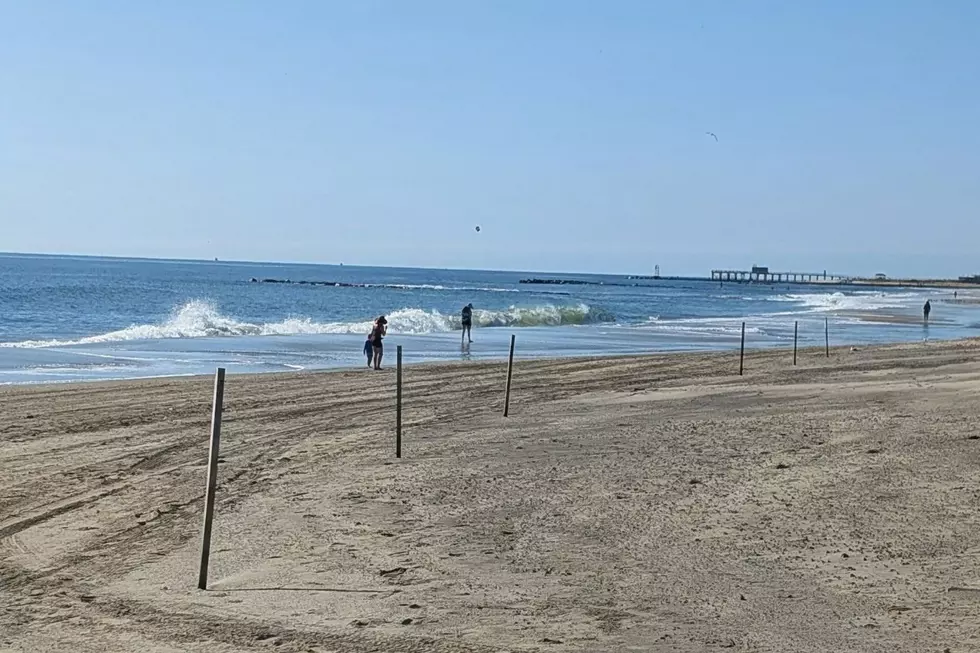
If you are extending the weekend and making Monday a beach day? Good call. The Jersey Shore Report is full of good news: a low risk of rip currents, wave heights of 1 to 2 feet, and ocean temperatures from 76 to 82 degrees. That will be pretty close to the air temperature at the beaches.
Monday night stays quiet, with a few clouds and lows in the lower 60s.
Tuesday
Tuesday brings more of the same beautiful late-August weather.
Expect mostly sunny skies, dry conditions, and highs again in the lower 80s. Humidity will stay comfortable, and our weather stays completely dry.
Wednesday
Wednesday keeps the nice stretch going, although things will start to change a bit.
Expect increasing clouds through the day. However, dry weather should hold on for another day. High temperatures will be back in the lower 80s.
Thursday & Beyond
New Jersey’s next widespread chance of rain comes Thursday, as a warm front lifts through New Jersey.
We will likely see at least one round of showers and thunderstorms during the day on Thursday. Maybe more — forecast models show a wide spread of potential solutions. I do not think it's going to rain all day though — otherwise, expect a mix of clouds and sun, with highs around 80 degrees.
While Thursday's storm system does not look especially ominous or hazardous at the moment, but it does represent the next unsettled turn in the forecast. So it will be worth watching closely.
After that, the final weekend of August should bring a warmup. Temperatures are expected to climb from the lower 80s toward the upper 80s. There may be two or three more bursts of wet weather before September arrives, but the broader message remains pretty friendly overall: fair skies, comfortable air, and plenty of pleasant late-summer weather to enjoy.
Programming Note
As I head off on extended vacation, to spend time with my kids before they go back to school, the CMDZ Weather Blog will be on hiatus for the next two weeks. The 5 Day Forecast and your on-air weathercasts will still be updated with the latest weather information. However, more detailed graphics, daily articles, and social media posts will be on hold until I return after Labor Day.
Of course, if a major storm or other weather event is brewing, I will change my vacation itinerary and coverage plans accordingly.
See you real soon, New Jersey!
Significant or historical events in New Jersey for August (in chronological order)
Gallery Credit: Dan Alexander
Dan Zarrow is Chief Meteorologist for Townsquare Media New Jersey. Follow him on Facebook for the latest forecast and realtime weather updates.
Is Disney's 'Cafe May Cafe' a real taste of New Jersey?
Gallery Credit: Dan Zarrow
More From New Jersey 101.5 FM