

NJ weather: Alternating wet, dry days through the holiday weekend
The Bottom Line
You know, for how easy the forecast was for the first half of the week, figuring out today and this weekend is proving to be very challenging.
Welcome back to active, unsettled weather, New Jersey. There are two important factors in play for Thursday: 1.) A rich plume of moisture, keeping our atmosphere humid and fully charged, and 2.) An approaching cold front.
Thunderstorms have been driving eastward across Pennsylvania since last night. And as of this writing (6:30 a.m.), they are just now pushing over the Delaware River into New Jersey. The best chance of storms during the first half of the day will be the northern half of the state. That storm chance will drift south and east as your Thursday goes along.
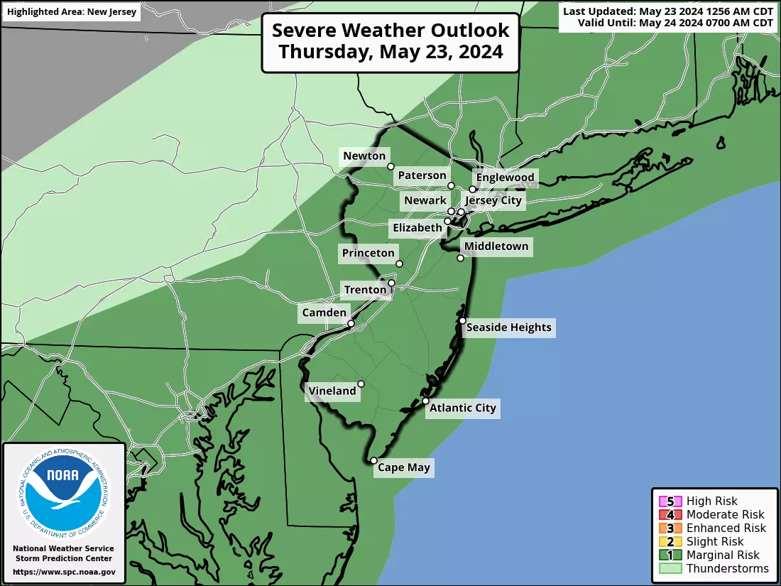
There is a marginal threat of severe weather, mainly wind and torrential rain, given the heat and humidity in the air.
Looking ahead to the big Memorial Day Weekend, there will be good days and iffy days. In fact, they will literally alternate. Friday and Sunday look great. Rain chances are plugged in for Saturday and especially Memorial Day Monday.

Thursday
It's an "eyes on the sky" kind of day, with thunderstorms possible at any time.
It feels like a summery morning, with muggy conditions and temperatures firmly in the 60s. (Even some 70s in urban environments.) Scattered thunderstorms will continue driving in to New Jersey during the morning and midday hours. This will be the stormiest part of the day, especially in the northern half of the state.
Through Thursday afternoon, the best forcing for storms will drift south and east. Will everyone in NJ see a storm? Not necessarily. Is it going to rain all day anywhere in the state? No way.
It is worth noting that the ingredients are present for strong to severe thunderstorms. Specifically, a threat for damaging winds and torrential rain. But the setup is not perfect — again, it is just something we will have to watch.
In between raindrops, it will be mostly cloudy and quite humid. Temperatures will be cooler than Wednesday, but still warmer-than-normal and summerlike. Look for highs on either side of 80 degrees.
The chance of a shower or thunderstorm will stay alive Thursday night, primarily for far southern New Jersey. It is still going to feel sticky overnight, with low temperatures around the lower 60s.
Friday
There is a chance that we wake up to leftover showers along the coast early Friday morning. But the rest of the day looks fantastic.
Skies should clear to at least partial sunshine by Friday afternoon. And humidity levels will drop quite a bit — you should feel the difference, with a refreshing northwesterly breeze.
High temperatures on Friday will still be on the warm side, reaching the lower 80s in the afternoon.
Saturday
Saturday is our next "iffy" weather day. A few forecast model runs have painted a pretty wet day. But I prefer a more optimistic solution.
Saturday will feature increasing clouds. And eventually a few showers and thunderstorms over New Jersey. But honestly, that quick burst of raindrops could hold off until Saturday night.
With an on-shore breeze, temperatures will cool slightly. Current forecast calls for upper 70s to around 80 degrees Saturday afternoon.
Sunday
Sunday makes the flip back to nice weather, as we probably stay dry. Skies will be nice and bright. Sure, there could be an isolated popup shower at some point — but that seems unlikely.
Summerlike warmth returns. High temperatures around 80 to 85 degrees, with humidity on the rise once again. Keep in mind: Because of the sea breeze, beaches will be quite a bit cooler, in the 70s at best.
Monday & Beyond
Monday will be the lousiest day of the weekend. While there is hope for a drier trend to the forecast, periods of rain are still looking likely for at least part of the day. Embedded thunderstorms and downpours are a possibility too. I hesitate to call it a complete washout for now — but the wet forecast will be challenging for all those Memorial Day parades and outdoor ceremonies across the state.
Temperatures on Monday will be in the 70s. Definitely cooler than it has been, but that's actually close to normal for late May.
Tuesday stays mostly cloudy with a shower chance and seasonable highs again in the 70s.
High pressure finally returns on Wednesday, bringing with us brighter skies and more temps in the 70s.
Get fired up at these NJ hot chicken restaurants
Gallery Credit: Erin Vogt
Dan Zarrow is Chief Meteorologist for Townsquare Media New Jersey. Follow him on Facebook for the latest forecast and realtime weather updates.
UPDATED: Memorial Day Parades in New Jersey 2024 (alphabetical)
Gallery Credit: Dan Alexander
More From New Jersey 101.5 FM


