

Dangerous heat and strong thunderstorms return to NJ Friday
Friday will not be a nice weather day, as dangerous heat and humidity return to New Jersey. An Extreme Heat Warning, Heat Advisory, and Air Quality Alert (Code Orange) have been issued. High temperatures today are forecast to reach the mid 90s, with a heat index as high as 108. In addition, all the ingredients will be there for spotty strong thunderstorms, moving from northwest to southeast from late Friday afternoon into the evening hours. Gusty winds, downpours, and lightning will be the big concerns.
The weekend will not be as hot, and humidity will scale back slightly. Saturday actually looks like a nice summer day. Sunday's forecast has trended wetter and steamier. We will be back in the 90s next week.

Friday NJ weather: Dangerous heat, strong thunderstorms
All or part of 14 New Jersey counties — generally along the NJ Turnpike corridor — are under an Extreme Heat Warning from 10 a.m. to 9 p.m. Friday. The rest of the state is under a Heat Advisory.

What's the difference? Honestly, it does not matter. It is going to be hot and humid. And because the human body physically has trouble cooling itself via sweating and evaporation in such sultry conditions, this brand of heat is downright dangerous.
An Air Quality Alert — Code Orange has been issued for New Jersey too. Those especially sensitive to ground-level ozone, including the very old, the very young, and those with preexisting heart and lung issues, should limit outdoor exposure during peak heating and spend as much time in air conditioning as possible.
Friday morning is fine. Temperatures are starting in the lower 70s. A little warmer and stickier than previous mornings this week. But if you have outdoor activities to do, early is the way to go.
Soon enough, thermometers will soar into the mid 90s. Add in surging humidity and the heat index (the "feels like" or "apparent" temperature) will push into the triple digits. My quick math shows a max heat index between 102 and 108 degrees for most of New Jersey. Yuck.

Expect morning sunshine before clouds build in the afternoon. A stiff southwesterly breeze will be more of a "hot blast" than refreshing. Even beaches will be hot and steamy.
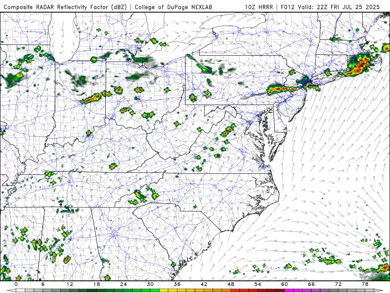
The other big concern for Friday will be thunderstorms.
Storm activity looks to be spotty to scattered. But given the intense heat, deep moisture, and strong lift (from an approaching cold front), any storm that does pop will almost certainly be strong or severe.

—What? Damaging winds, heavy downpours, and cloud-to-ground lightning are the big concerns (likely in that order).
—When? 3 p.m. to 9 p.m. likely peaking around dinnertime.
—Where? Strongest storms will be in northern and central NJ, weakening as they approach southern and coastal NJ.
Once storms exit, the rest of Friday night will be uneventful. Expect scattered clouds and fairly muggy conditions. Low temperatures should return to the lower 70s or so.
Saturday NJ weather: Better weather
A few days ago, the weekend forecast was a bit of a bummer: Stormy and unsettled. But now it's mixed news, with Saturday clearly the better day of the bunch.
Saturday is actually looking good. It will be about 10 degrees cooler than Friday. And humidity levels will slide backward from high to moderate.

Skies will be partly sunny. And I am promoting a dry forecast — although reasonably, an isolated shower could fire up off the sea breeze front, topography, random surface boundary, etc.
High temperatures should be in the seasonable mid 80s.
Sunday NJ weather: Not so great
On the other hand, Sunday's forecast has trended wetter. And more humid again.
Forecast models have now settled on a consensus scenario putting scattered rain over New Jersey from early Sunday morning through about midday. Given that early morning timing and limited "oomph" in the atmosphere, I do not expect anything crazy here in terms of severe weather. Maybe some pockets of heavy rain. (At least one solution has an isolated pocket of over an inch of rainfall next NJ.) Rumbles of thunder are possible too.

Rain will hopefully break apart into Sunday afternoon, allowing us to salvage the second half of the day. Skies will remain mostly cloudy to overcast. And humidity is going to stay really steamy and soupy.
Because of the raindrops and cloud cover, highs on Sunday will probably get stuck in the lower 80s. (Not "near 90" as previously advertised.)
Monday NJ weather: The sun comes out
As skies clear into Monday morning, temperatures will start to soar again. And we are in for another hot stretch of weather in the closing days of July.
Monday's high temperature will reach about 90 degrees. Rain chances are very low.
Tuesday NJ weather: Heating up again
Both Tuesday and Wednesday may flirt with "dangerous heat" territory once again, with high temps potentially in the mid 90s. Whether or not we have to ring those warning/advisory alarm bells will depend on exact temperature humidity levels. It is definitely going to be a sweaty few days.
Eventually a strong cold front will usher in a round of storms, followed by a big cooldown and drydown. At the moment, the GFS model favors a late Wednesday timing while the European shows a Thursday arrival. In either case, the forecast for the start of August still looks incredibly comfortable and pleasant.
The 20 Most Beautiful Towns In New Jersey
Gallery Credit: Lou Russo
Dan Zarrow is Chief Meteorologist for Townsquare Media New Jersey. Follow him on Facebook for the latest forecast and realtime weather updates.
26 of the Dumbest Laws in New Jersey
Gallery Credit: Matt Ryan
More From New Jersey 101.5 FM


