

More heat, more sweat: 10 things to know about NJ’s hottest weekend of 2022
Bottom Line
Yes, it's summer. Yes, it's hot. Yes, it's humid. You don't need me to state the obvious. But some upcoming days will be better than others. And there are some changes and storm chances to know about. So let's do a quick rundown of what to expect, as we dive into what will likely be New Jersey's hottest weekend of the summer.

Friday
New Jersey will benefit from a weak cold front that passed over the state on Thursday, driving in slightly less humid air. (Dew points have dropped from the 70s to the 60s.) You are still going to sweat Friday, with blazing sunshine and high temperatures in the lower to mid 90s. But at least we don't necessarily have to talk about the dreaded heat index for a day.
Saturday
Saturday looks very similar to Friday, although maybe a couple degrees warmer. Morning lows in the 70s. Afternoon highs firmly in the 90s. Mostly sunny skies. Moderate humidity.
Sunday
Heat and humidity will crescendo again to suffocating, overwhelming levels on Sunday. High temperatures will reach about 95 to 100 degrees for most. Some models show another surge of disgusting humidity too, which would easily pushing the heat index above the 100-degree mark. There will be more cloud cover (mostly cloudy) and a stronger southwest breeze (up to 20 mph) on Sunday, compared to Friday and Saturday.
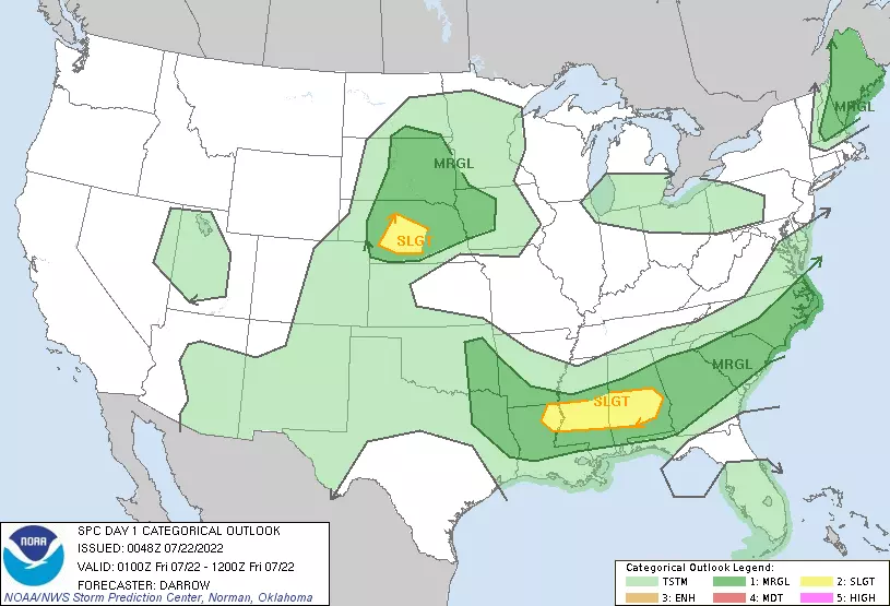
Popup Thunderstorms
On any of the next three days — Friday, Saturday, Sunday — we could see an isolated shower or thunderstorm develop. Best chance would be just before sunset, as temperatures start to cool and the atmosphere destabilizes. Model guidance suggests North Jersey would be the most likely location for a mini storm. Another opportunity for a quick popup would be along the sea breeze front, just inland from the Shore. But again, just an isolated soaker.
"Dangerous" Heat?
When the heat index ("feels like" or "apparent" temperature) approaches 100+ degrees, the risk of heat illness or injury increases significantly. There is a chance that this threshold is reached in spots on Friday or Saturday. It will almost certainly be a widespread occurrence on Sunday and Monday.
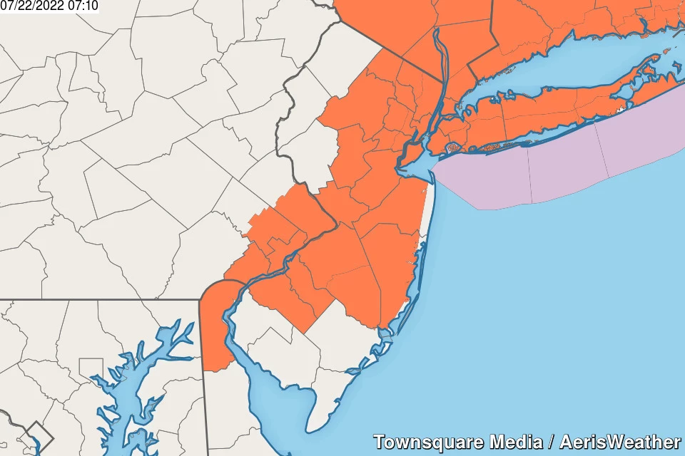
As of this writing, most of New Jersey falls under a Heat Advisory until 8 p.m. Sunday. It includes the NJ Turnpike corridor, plus inland Ocean and Monmouth counties). I suspect the advisory will be expanded again on Sunday, as temperatures and humidity increase further.
Down the Shore
Ahh, the sea breeze. Our saving grace during sultry stretches of summer weather. For an ocean breeze to cool beaches along the Jersey Shore the ambient background wind has to be light enough. Bottom line: Friday and Saturday should be good, with 80s at the beaches. However, Sunday and Monday look toasty. No matter what, barrier islands will be the coolest spots in the state (relatively speaking, at least).
Hundreds
Newark Airport (KEWR) is traditionally, one of the hottest weather stations in the state, due to the urban heat island effect and a dubious thermometer. It has already hit exactly 100 degrees twice in a row this week, on Wednesday and Thursday. I would not be surprised to see a few more triple-digit temperatures around, especially on Sunday. FYI, the record for 100-degree days in a single season was 9, set in 1993. The last time we had more than two 100-degree days at Newark in a season was 4 in 2011.
Cold Front
Temporary relief from the ridiculous heat is in sight early next week. As a slow-moving cold front drags through New Jersey, a period of rain is expected. That will be followed by an intrusion of somewhat cooler, drier air. There is some uncertainty surrounding the timing of the rain. Some models show showers and thunderstorms as early as Monday midday, potentially stretching through as late as midday Tuesday. It does not look like the widespread soaking we need to stave off spiraling drought concerns. But I am concerned about localized downpours and the severe weather potential.
Next Week
Tuesday will be our best shot at not hitting 90 degrees next week. But it's only temporary, as lower 90s return for Wednesday and Thursday. Another front, another cooldown, and another batch of rain is in the forecast for late next week, in the Thursday-Friday time frame.
Stay cool, stay hydrated, and have a great weekend!
Dan Zarrow is Chief Meteorologist for Townsquare Media New Jersey. Follow him on Facebook or Twitter for the latest forecast and realtime weather updates.
Tips on How You Can Survive a Heat Wave
Gallery Credit: Tiffany
LOOK: The most extreme temperatures in the history of every state
Gallery Credit: Anuradha Varanasi
More From New Jersey 101.5 FM


