

Monday NJ weather: Summerlike warmth, humidity, and thunderstorms
After a spectacular Saturday and a more sultry Sunday, our big warmup is set to both peak and end Monday. Summertime heat and humidity could lead to our first 90-degree day of 2019. In addition, that summertime heat and humidity could fuel some powerful thunderstorms later on.
We're beginning the day with our latest batch of rain exiting the state. Looking at the latest radar loop, I can't completely rule out a few showers clipping NW NJ through Monday morning. For the most part, we'll see hazy sunshine throughout the day, with a stiff southwesterly breeze (10 to 20 mph).
High temperatures will pop to about 85 degrees for most of New Jersey Monday afternoon. As I mentioned, 90 is within the margin of error for inland South Jersey. On the other hand, the coast — especially barrier islands and the Delaware Bay shore — will be much cooler, near 70 degrees.
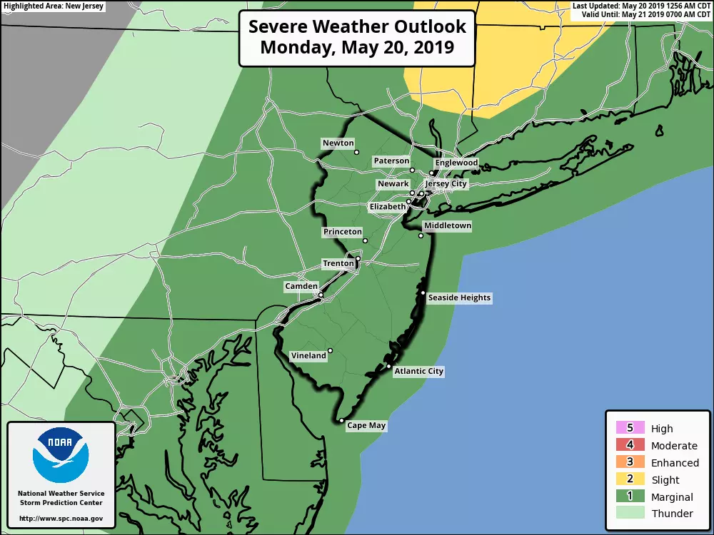
Starting around 3 p.m. Monday, we'll have to watch the western sky for one or two rounds of strong to severe thunderstorms. According to the latest model guidance, these storms are not quite a guarantee. However, given the strength of our approaching cold front, and the heat (energy) and humidity (moisture) in the air, I'm leaning toward a stormy end to the day.
The rain will be brief in any given spot, lasting no more than an hour or two. But torrential downpours, gusty winds, and frequent lightning could make your evening commute rather challenging.
After sunset, between 8 p.m. and 10 p.m. Monday, any showers and storms should pulse down and/or exit the Garden State. Overnight, skies will clear out as cooler, drier air returns. Low temperatures will dip into the mid to upper 50s.
And then Tuesday will be a very different weather day. High temperatures will be limited to the lower 70s. The dry air will be refreshing, and the sunshine will be nice. The gusty northwesterly wind though, not so nice. Occasional gusts over 30 mph will be possible throughout the day.
As the wind dies down Tuesday night, it might get pretty chilly around here. I could see some 40s in the coolest spots early Wednesday morning.
The rest of Wednesday looks quite pleasant. Mostly sunny and mid 70s — I'll take it!
There will be a couple of shower chances on Thursday, both early and late. In the middle, you'll find sunshine mixed with clouds and above-normal high temps in the upper 70s.
Models get a little helter-skelter for Friday and beyond, particularly when it comes to temperatures. But I like what I see so far for the Memorial Day Weekend! Friday looks good, Saturday cools down a little, Sunday and Monday heat up again. Things could get a bit rainy/stormy starting on Sunday — that's the big issue we're going to have to watch.
Dan Zarrow is Chief Meteorologist for Townsquare Media New Jersey. Follow him on Facebook or Twitter for the latest forecast and realtime weather updates.
More From New Jersey 101.5 FM


