

Heads up, NJ: Warming up then storming up Monday
The Bottom Line
I keep telling you: March is a volatile weather month. This weekend is a perfect example. Saturday was warm and summerlike, with temperatures as high as 86 degrees (Howell and Wall). Sunday turned much colder (for most of New Jersey), with the cold spot in the state only reaching 41 degrees (High Point).
Monday is going to be a classic spring day, as temperatures warm up again. The big thing to watch will be a round of widespread thunderstorms into Monday evening. Given the rising warmth and humidity, those storms could get pretty nasty. Gusty winds and heavy rain will be the biggest concerns. Hail and an isolated tornado are on the table too.
Next up is a cooldown, as daily high temperatures are knocked back to the 50s for Tuesday and Wednesday. Warmth returns later this week, but so do scattered rain chances.

Monday
Monday will be an active weather day. (What's that saying about March going out like a lamb? Total baloney this year!) A warm front is leading to morning fog and afternoon warmth. And then an approaching cold front will drive strong thunderstorms across the state into Monday evening.
Patchy dense fog is reducing visibility to a quarter-mile in spots to start Monday morning, especially through the middle of New Jersey. Pea soup may slow you down a bit
There are three ways to get rid of fog: A wind kicks up causing the fog to mix out, dew points drop due to drier air moving in, or temperatures rise. That last one will be the case today. Once temperatures bump up a couple degrees around mid-morning (9 or 10 a.m.), visibility will improve quickly.
The rest of the day will be mostly cloudy, breezy, and fairly warm. Monday's temperatures will be warmer than Sunday's for most of the state — the only exception is SW NJ where it was warm all weekend. Look for highs ranging from the 60s (north and coast) to the 70s (inland central and south).
A spot shower is realistically possible at any time Monday morning or afternoon. But the big chance of rain will hold off until the late afternoon and evening hours.
Monday Evening
Starting around 5 p.m., a round of nasty thunderstorms will push from west to east across New Jersey. Sparked by an approaching cold front, these storms will "feed" off the relative warmth and humidity that builds in our atmosphere throughout the day.
I expect the entire state to experience stormy, wet weather Monday evening. There are two big severe weather concerns.
The first concern is one we have been very familiar with lately: Gusty winds, potentially over 60 mph. Initial storms that crash into western New Jersey in the late afternoon and early evening time frame could even take the form of discrete thunderstorm cells. Such a scenario would raise alarm bells for tornadoes too. (Note: The highest tornado risk will be south of NJ, but the chance for an isolated spin-up is worth mentioning here.)
The second concern is heavy rain, which will peak later in the evening. The most widespread batch of downpours will probably occur around 9 or 10 p.m. About an inch of total rainfall is expected. And I will even say 2+ inches of rain is possible in spots where it really pours.
After Midnight, rain should start to dial back. I expect all of New Jersey to dry out well before daybreak Tuesday. Overnight low temperatures will dip into the 40s.
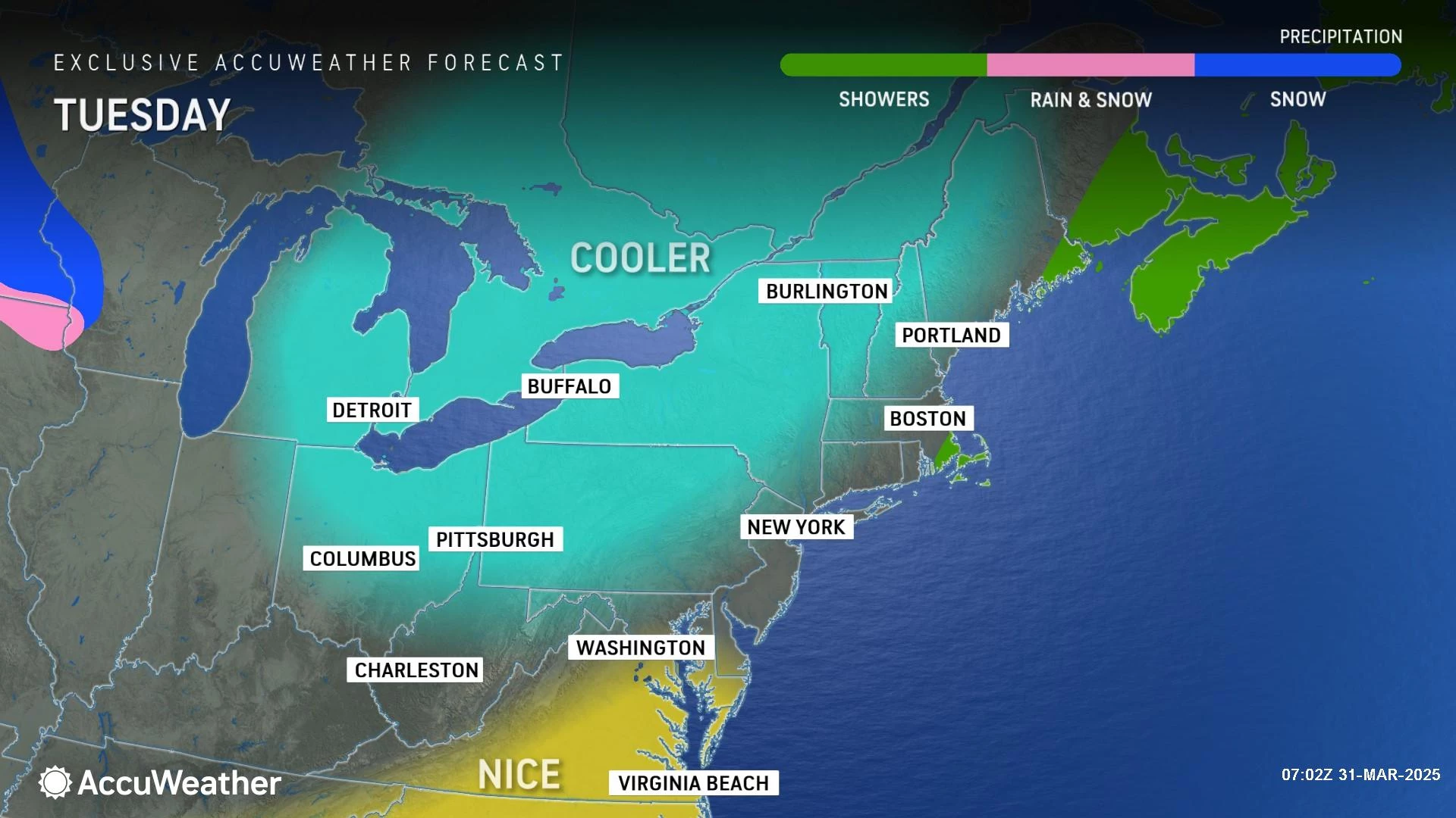
Tuesday
Welcome to April! Tuesday will be a bright and sunny day, with a fresh northwesterly breeze.
Of course, it will be cooler too. Latest model guidance puts Tuesday afternoon high temperatures around 50 to 55 degrees. That is just a hair below normal for early April.
Wednesday
We will be stuck on the cool side Wednesday too. An early morning frost/freeze is possible away from urban and coastal areas. And then high temperatures will only make it to around 50 degrees Wednesday afternoon.
Expect a mix of clouds and sun throughout the day, with a noticeable on-shore breeze.
There is a chance of a shower clipping North Jersey Wednesday evening. That seems very limited in geography, and would only amount to a few hundredths of an inch of rainfall.
Thursday
Thanks to a southwest "blast furnace" wind, highs on Thursday will spike right back into the 70s across most of the state.
Clouds will likely win the sky throughout the day Thursday. But I am keeping a dry forecast for now.
Friday & Beyond
The forecast gets murky for Friday and the first weekend of April, with scattered showers and general "blah" conditions taking hold.
Friday looks OK for the most part, with some showers in the morning and then mostly cloudy skies. High temperatures will still be on the warm side, on either side of 70 degrees.
Temperatures slowly descend throughout the day Saturday, with overcast skies and an onshore (northeast) breeze. Spotty to scattered rain is likely too — nothing heavy, and not a total washout, but definitely feeling raw and damp.
Sunday could go either way at this point — the GFS model favors a continuation of Saturday's dreary and damp weather, while the Euro favors at least a partial warmup back to 70. I would love to salvage a piece of ths weekend with decent weather — we will see how things shake out.
The long-range forecast trends dry and cool for most of next week.
11 reasons why storm chasing in NJ is a very, very bad idea
Gallery Credit: Dan Zarrow
Dan Zarrow is Chief Meteorologist for Townsquare Media New Jersey. Follow him on Facebook for the latest forecast and realtime weather updates.
Dan Zarrow's Top 10 Weather and Climate Stories of 2024
Gallery Credit: Dan Zarrow
More From New Jersey 101.5 FM


