
Go away, Henri: When will rain finally end across NJ Monday?
The Bottom Line
It's. Still. Raining. And flooding is still a significant concern for the northern half of the state.
It is going to be another challenging day. But the end of Henri is in sight. As the storm completes its slow U-turn over New York and Connecticut, it will finally shoot off to the east and out of our hair.
Monday
As of early this morning, Tropical Depression Henri is centered just northeast of New Jersey, still pumping moisture and rain into the Garden State. The National Hurricane Center has issued their 30th and final advisory for the storm, handing off forecasting duties to the Weather Prediction Center. (That happens when a storm is expected to become extra-tropical, and no longer poses significant wind or surge issues.)
We face one or two additional waves of steady, if not heavy, rain on Monday. Even southern New Jersey, which stayed mainly dry on Sunday, will see wet weather.
By around midday Monday (11 a.m.), the threat of steady rain will fade. And then, as a slot of dry air works in, sunshine will increase through Monday afternoon (especially to the south and west). However, that doesn't mean Henri is done yet — scattered showers, downpours, and thunderstorms are expected through the afternoon and evening hours too. New Jersey's final final raindrops probably won't fall until about sunset Monday (8 p.m.)
Additional rainfall should stay below an inch for most of New Jersey. There will be spots that receive more, due to heavier intensity rainfall and/or training storm cells. Of course, any raindrops will be bad news for those communities that saw terrible flooding through the weekend. Numerous NJ rivers, streams, and creeks are running way above flood stage, with Flood Warnings in effect for the foreseeable future.
Other than the rain and (eventually) brighter sky, it will be breezy Monday. High temperatures will range from the upper 70s in rain-soaked North Jersey to the mid 80s in sunnier South Jersey. There could be some localized minor coastal flooding at high tide. And a high risk of dangerous rip currents continues for one more day along the Jersey Shore.
Skies will become mainly clear as we dry out Monday night. Patchy fog is possible, especially in those areas that received a lot of rain. (Oh, that really narrows it down.) It will be somewhat muggy, with a low temperature around 70 degrees.
Tuesday
Goodbye Henri, hello heat wave. First of all, I'm happy to say that Tuesday will be completely dry. And skies will be mostly sunny.
But temperatures are going to start to cook again, with a 4-day streak of 90+ degree temperatures.
I'll put forecast highs in the upper 80s to around 90 on Tuesday, with a light westerly wind. If you like it hot, it will be a nice summer day.
Wednesday
Sunny, hot, and humid. Highs around 90. Hopefully we'll get a nice sea breeze, making for a nice beach day. Plus, it's not really crazy heat and humidity (i.e. not "dangerous"), but you will definitely sweat.
Thursday & Beyond
Thursday will stay steamy, with highs mainly in the lower 90s. Skies will be partly sunny. And it won't take much of a spark to cause a few popup showers and thunderstorms, either early or late.
Friday will be the final day of hot weather, with highs in the lower 90s. A cold front will eventually drag in cooler, drier air. It will also drive in a round of showers and thunderstorms. At the moment, I'm thinking the best chance of rain would be late Friday afternoon through early Saturday morning. (But that's subject to change, based on the speed and position of that backdoor front.)
Model consensus is for a cooler, drier weekend, with highs close to 80 degrees. The Euro model pops in some rain chances for both Saturday and Sunday, adding to the low confidence. We'll see how things play out - I can't believe we're already talking about the penultimate weekend of the summer season.
After two tropical systems in one week — Fred and Henri — the Atlantic Ocean has calmed down a bit. There is one tropical wave way out near Africa to watch. The climatological peak of the hurricane season is still more than 2 weeks away, so we still have a long way to go.
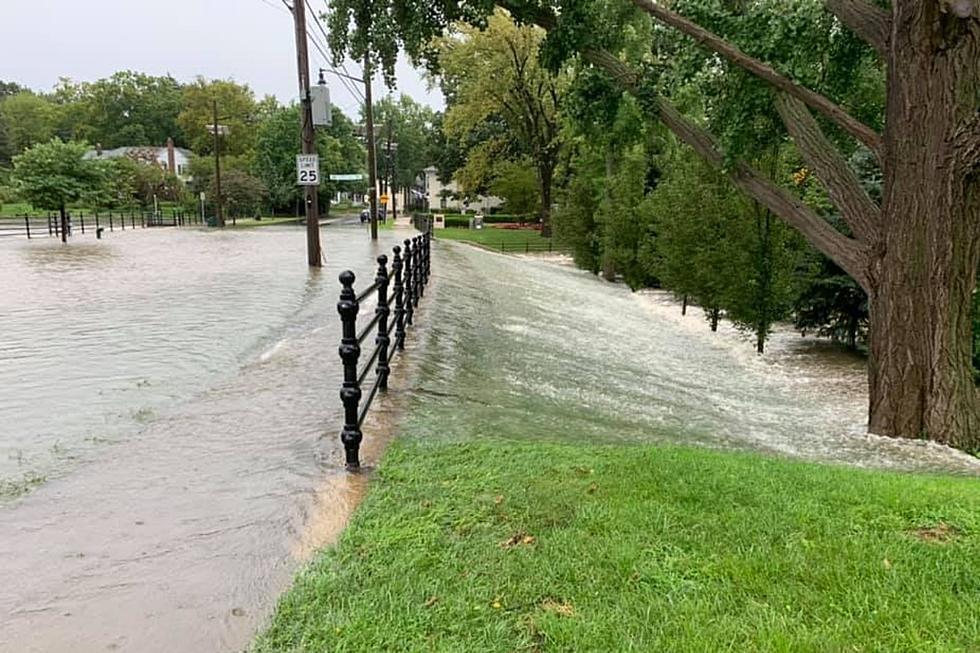
Flooding in Middlesex County, NJ on Aug. 23, 2021
Gallery Credit: Edwin J. Torres, Office of the Governor
Dan Zarrow is Chief Meteorologist for Townsquare Media New Jersey. Follow him on Facebook or Twitter for the latest forecast and realtime weather updates.
Remembering Tropical Storm Irene's impact on NJ, 13 years later
Gallery Credit: Dan Zarrow
BEEP BEEP BEEP: These are the 13 types of Wireless Emergency Alerts auto-pushed to your phone
Gallery Credit: Dan Zarrow
More From New Jersey 101.5 FM


