

Thursday NJ weather: Remnants of Sally to drive in some rain
The Bottom Line
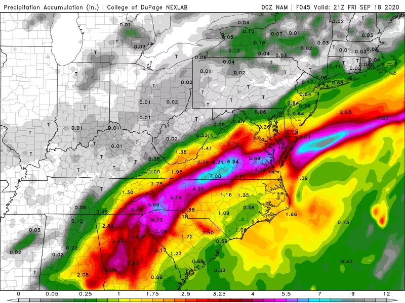
Our primary weathermaker over the next 24 hours is an approaching cold front, which will carry tropical moisture from the remnants of Sally, producing a chance of rain. Soak it in — this will be our last substantial rain chance for quite a while.
Thursday
We're starting Thursday with temperatures about 10 degrees warmer than Wednesday, mainly in the 50s. And despite mostly cloudy to overcast skies, it will be the warmest day of the week, with highs in the mid 70s. We still have smoke from the western U.S. wildfires hovering about 3 miles overhead. But it is becoming thinner, and will be less noticeable with the cloud cover. Still no air quality concerns for New Jersey.
As of 5 a.m. Thursday morning, Tropical Depression Sally is centered over eastern Alabama. By late Thursday night, New Jersey will end up on the very northern edge of that storm system. It's enough to spawn our one and only rain chance of the week.
It looks like showers will bubble up into the southern half of New Jersey starting early Thursday afternoon. That rainfall may become steadier for a time across southern and maybe central New Jersey Thursday night. (At least one model solution even paints patches of heavy rain in South Jersey overnight.)
But we're not talking about anything dramatic here. The threat for torrential downpours is very limited. Widespread flash flooding is not expected. Nor is severe weather (wind, hail, tornado). Even thunder and lightning will be rare. The southern tip of the state could pick up an inch-plus of total rainfall. To the north, hardly anything.
Friday
Final showers should exit the coast by late Friday morning. And then skies will slowly clear Friday afternoon. You'll notice a stiff breeze out of the north at 20 mph — that's the effects of the aforementioned cold front. So we'll be cooling down too — high temperatures will only reach the mid 60s. That's about 10 degrees below normal for mid-September.
Saturday
The final weekend of summer is looking dry and fall-like. Saturday's going to start cold, with widespread 40s likely in the early morning. And it'll stay cool, with highs only reaching the lower to mid 60s — likely our coolest day of the season so far. Bright sunshine should win the day in northern and central New Jersey, while skies will be partly sunny to the south and along the coast.
Sunday
Sunny. Dry. Cool. Mid 60s. That is all.
Monday & Beyond
What a boring forecast through the rest of September. There will be some swings in temperatures. And we have to keep a vigilant eye on the hyperactive tropics. But things look generally dry and pleasantly cool.
Monday looks similar to Sunday, with sunshine and mid 60s. Tuesday, the first day of fall, will be a little bit warmer in the lower 70s. And then mid 70s on Wednesday. Sounds good to me!
Dan Zarrow is Chief Meteorologist for Townsquare Media New Jersey. Follow him on Facebook or Twitter for the latest forecast and realtime weather updates.
More From New Jersey 101.5 FM


