

NJ weather: Nice Thursday, not nice at all Friday and Saturday
The Bottom Line
Most of our attention is on our next storm system, a slow-mover that will bring some pretty nasty weather to New Jersey on Friday. And Saturday. And Mother's Day Sunday too. Lots of rain and wind on the way.
This latest forecast contains a few important changes:
1.) Increased cloud cover expected on Thursday. (Although still a very nice day.)
2.) Attempting to dial in the timing of first raindrops on Friday. (Pretty much all day.)
3.) Ringing alarm bells for potential flooding, due to 2+ inches of rain. (Although that will be spread over an extended stretch of time.)
4.) Also nailing down the wind gust estimate, near 40 mph.
5.) Rain looks to linger into at least part of Mother's Day Sunday too. (Especially along the southern coast.)
6.) I am becoming increasingly confident that next week's "big warmup" is not going to happen. (At least not immediately.)
Thursday
A nice, dry day. No weather issues at all.
We're tucked into a thin blanket of clouds, keeping thermometers from dropping too far overnight. We're mainly in the upper 50s as of this writing (6 a.m.)
High temperatures will push to about 65 to 70 degrees. Close to normal for early May. With less of an on-shore component to the wind, even coastal communities should hit 60s. (Barrier islands the lone exception.)
We'll stay dry through the morning, afternoon, and early evening hours.
Clouds will increase Thursday night. And we could see spotty rain showers creep in after about 10 p.m. However, the really soggy weather is yet to come...
Friday
Becoming increasingly wet.
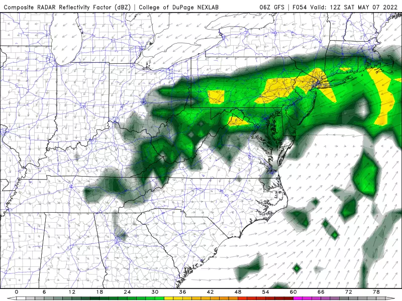
There are still a few model solutions on the table regarding the start time of steady rain on Friday. Most guidance points to wet weather starting mid-morning Friday. All show rain taking over the state by Friday early afternoon.
And then rainfall will become steadier and heavier through Friday night.
High temperatures on Friday will be limited to the mid 50s. Winds will be reasonable, becoming breezy at night.
Saturday
Pretty nasty.
Periods of steady or heavy rain will continue all day — it may very well be a "total washout" for most of the state.
It is going to become quite windy too, tapping into a low-level jet. And temperatures will be miserably cool, only hitting 50 degrees at best. (Something like 20 degrees below seasonal normals.)
So unfortunately, it looks like your Saturday outdoor plans are toast.
Overall, I am concerned about the following four weather hazards from this storm system:
1.) Heavy rain, in excess of 2-3+ inches, may lead to flash or river flooding. The rain will be spread out over 2-3 days. But downpours on saturated ground can still result in "big puddles".
2.) Gusty winds may reach 30-40 mph. That's enough to cause sporadic power outages and blow around garbage cans or light lawn furniture.
3.) The wind will blow from the northeast — an on-shore wind. Therefore, coastal flooding will be a concern for the Jersey Shore, starting with Saturday afternoon's high tide cycle. Latest guidance shows "widespread minor" category flooding, with a foot or two of surge.
4.) The risk of thunder and lightning and/or severe thunderstorms is not zero. Best chance would be in South Jersey. But because of the cool air and limited instability, I'm not overly worried about a severe weather outbreak — it's just something to watch.
Sunday (Mother's Day)
Some improvements, but far from a perfect day.
Widespread rain will probably linger statewide through about 8 a.m. Sunday. And then, as our storm system departs to the east, it may still spit rain showers toward southern and eastern New Jersey through Sunday afternoon.
Most of the state should dry out a bit. Skies will remain mostly cloudy, and winds will come down to the "breezy" category. High temperatures will only reach the mid to upper 50s. Still way below normal for this time of year.
Monday & Beyond
As I have discussed in previous forecasts, we are all craving warmer, more May-like weather right about now. I am hopeful we will see such a pattern shift by late next week, with a return to 70s and 80s.
But for the first half of next week, I fear that slow-moving storm system will just meander right off our coastline. Close enough to spit clouds, showers, and an on-shore wind direction our way.
Dan Zarrow is Chief Meteorologist for Townsquare Media New Jersey. Follow him on Facebook or Twitter for the latest forecast and realtime weather updates.
9 things New Jersey would rather ban than plastic bags
Gallery Credit: Kylie Moore
Voting for the 2022 class of the New Jersey Hall of Fame
More From New Jersey 101.5 FM


