

Mainly beautiful weather for NJ, no heat or storms until late week
Low humidity in the middle of summer is still a wonderful thing, giving Tuesday a September-ish feel. However, there is a new wrinkle in the forecast, as a few light showers could clip New Jersey's coast throughout the day. Most of the state will bask in sunshine and beautiful weather — but the day will not be perfect because of those limited raindrops. Wednesday and Thursday will be pleasant and dry, although temperatures and humidity will be on the rise. By Friday, we may have to start ringing alarm bells for dangerous heat and powerful thunderstorms once again.

Tuesday NJ weather: Mainly beautiful and comfortable
I loved walking outside Tuesday morning. Dew points are in the 50s, so the air is dry and comfortable. Temperatures are mainly in the 60s to start the day. (With some 50s to the northwest and 70s along the immediate coast.)
For the most part — for the majority of New Jersey — Tuesday will be another beautiful weather day. We keep the low humidity going for one more day. And sunshine will continue to win the sky.
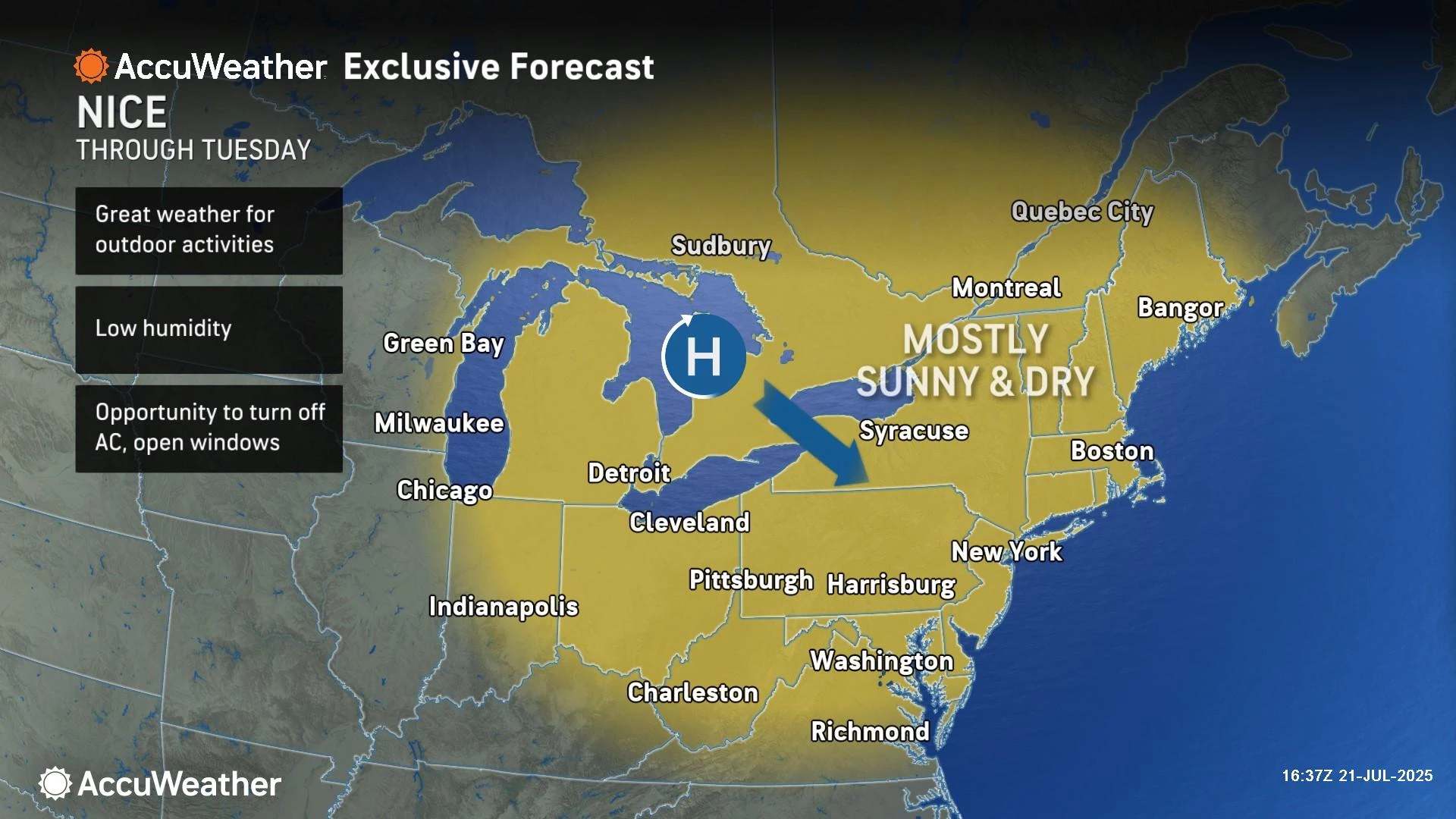
High temperatures will reach about 80 degrees, give or take. That is a bit below normal for this time of year, giving the day a "September-ish" feel to it.
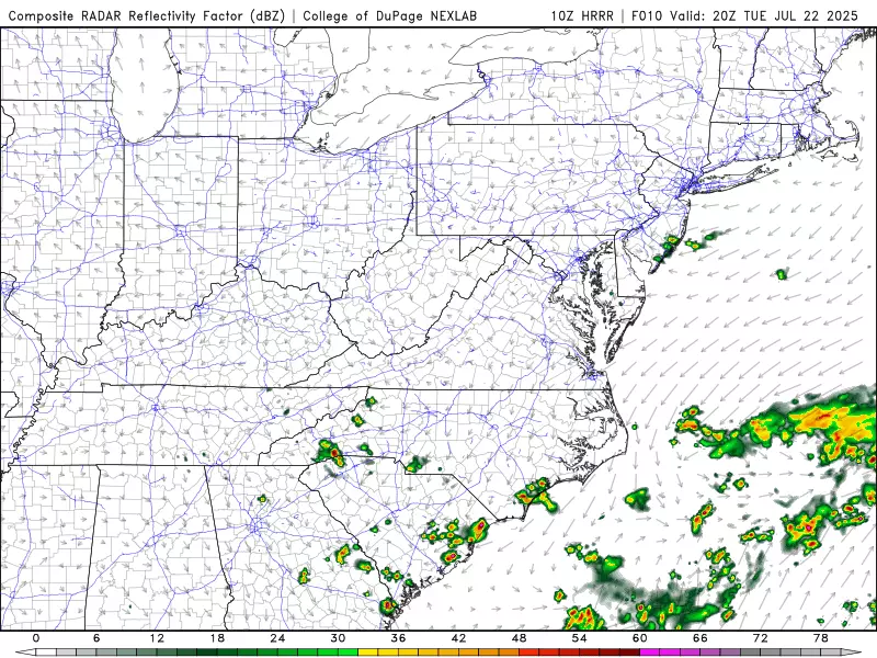
There is one wrinkle here. One hesitation in calling it a "perfectly" pleasant day. It looks like a few light rain showers will clip the Jersey Shore as the day goes on, as a weak storm system spins off the coast. Key word: Light. And this should be very limited. It is a possibility I briefly mentioned in my weather blog on Monday, but now almost all forecast model guidance is pointing in that direction. I hate to mention raindrops on an otherwise gorgeous day, but that is the way things are trending.
Tuesday night will stay quiet and comfortable, with mainly clear skies. Lows will average mid 60s. Another very nice night.
Wednesday NJ weather: Slightly warmer and stickier
Even though temperatures and humidity will trend upward through midweek, our weather will stay incredibly pleasant and problem-free for another two days.
Wednesday will be partly sunny — still nice and bright, but with a few extra clouds building in. I do not see any chance for rain this time around.
Dew points will bump into the 60s, making the air a bit stickier. Not sultry or tropical just yet.
High temperatures will reach into the lower to mid 80s. I would call that warm, but not quite hot.

Thursday NJ weather: Typical hot summer weather
By Thursday, we'll be back to "normal" summertime temperatures. Morning lows near 70. Afternoon highs approaching 90.
In fact, Thursday should be a textbook pleasant late July day. Look for sunshine, a light south-southwest breeze, and seasonable high temperatures around 85 to 90 degrees. Again, no chance of rain to talk about.

Friday NJ weather: Alarm bells for heat and thunderstorms
Friday is a very different story. Both heat and thunderstorm potential come back into play to end the workweek.
Friday's high temperatures will surge into the mid 90s. As dew points increase into the 70s, the heat index ("feels like" or "apparent" temperature) will likely push above 100 degrees. That is back in "dangerous heat" territory.
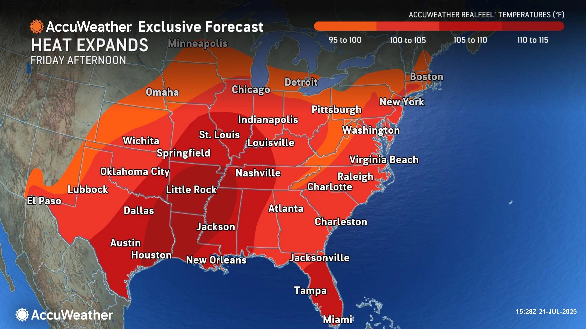
In addition, a few thunderstorm cells are modeled to pop up just before sunset Friday evening. These storms will likely be isolated to spotty — meaning not everyone will see a storm. But any thunderstorms that do form could produce locally heavy rain, gusty winds, and wicked lightning. A story we know all too well this summer.
Saturday NJ weather: More steamy, stormy weather
It's still a little early to talk details for next weekend, but a trend is emerging. And it's really not surprising. Hot and unsettled.
We will probably see more clouds than sun overall. I think we fall out of the "extreme heat" category, as high temperatures by default end up close to 90 degrees. Exact numbers will depend on cloud cover, wind direction (land vs. sea breeze), and rain.
At the moment, I'm seeing spotty showers and thunderstorms on Saturday, becoming a bit more numerous and more widespread on Sunday. You will almost certainly find pockets of dry weather throughout each day this weekend. It's just a matter of when. And whether we will face any dangerous conditions.
NJ DOT's Electronic Sign Safety Messages Summer 2025
Gallery Credit: Dan Alexander
Dan Zarrow is Chief Meteorologist for Townsquare Media New Jersey. Follow him on Facebook for the latest forecast and realtime weather updates.
2025 National Night Out events in New Jersey
Gallery Credit: Dan Alexander
More From New Jersey 101.5 FM


