Monday NJ weather: Ferociously hot for two more days
The Bottom Line
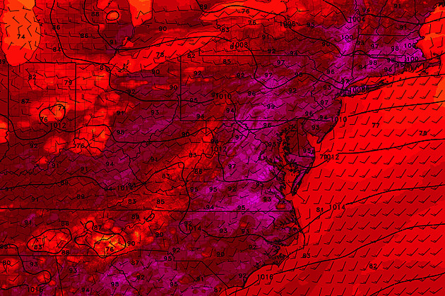
Sunday was Newark Airport's 18th 90-degree day of the year, and the 13th in July alone. (17 and 12 at ACY.) The heat ramps up Monday, which looks like one of the hottest days of the year. Tuesday will be ferociously hot too (and more humid), before a cold front delivers thunderstorms and then more reasonable temperatures for the second half of the week.
Monday
Temperatures start this Monday morning averaging 70 degrees from top to bottom across the state. Not terrible, especially with pockets of inland/rural NJ in the 60s. High temperatures are expected to reach the mid to upper 90s. Even the beaches will come close to 90 degrees.
So yes, it will be a ferociously hot summer day. But there's something missing here — tropical humidity. There's a good chance dew points will end up in the 60s Monday — certainly sticky, but not like the incredibly steamy days we've had over the last two weeks. That why most of the state is not under a heat warning or advisory. Having said that, a Heat Advisory has been posted for the New York metro area (Bergen, Essex, Hudson, Passaic, and Union counties) from 10 a.m. Monday to 8 p.m. Tuesday.
You'll notice some clouds early on, with plenty of blazing sunshine through the afternoon. And a stiff westerly breeze will kick up too. That land breeze will likely overcome the sea breeze, keeping beaches hot and buggy.
One of the most dangerous and uncomfortable parts of any heat wave is when we don't cool down at night. Everything — people, animals, plants, and buildings — needs a "reset" from the heat overnight. Well, Monday night looks like one of the warmest nights of the summer. Urban and coastal areas will feel it the most, and may not fall below 80. Statewide, we'll mainly see mid to upper 70s. Not cool or refreshing at all. (Normal lows for late July are in the upper 60s.)
Tuesday
A bit more humid, and still quite hot. Highs will reach the lower to mid 90s, with the heat index ("feels like" or "apparent" temperature) creeping toward 100. Sweltering sunshine will meet gradually thickening clouds.
As a cold front approaches from the west, we'll eventually see some showers and thunderstorms come into view. Those storms look to be scattered, so not everyone gets wet. And the thunderstorms look to come in two batches — first in the afternoon across the northern third of New Jersey, then closer to Tuesday evening for central and southern NJ. (That means if you're spending hot Tuesday at the beach or pool, there's a good chance you'll stay storm-free through dinnertime-ish.)
Those storms will be capable of producing locally heavy rainfall. There is a low risk of severe wind and hail too.
Wednesday
Ahhh, the effects of the cold front settle in. It will not be as hot nor as humid, as things dial back to more "reasonable" summer weather. Temperatures will still top out near 90 degrees — but with dew points potentially in the 50s, it will be almost comfortable. Skies will progress from clouds to sun. And I've opted for a dry forecast. Not bad!
Thursday
More of the same. Highs near 90. Relatively low humidity. Probably storm-free. Clouds on the increase.
Friday
The GFS model has settled on a solution that puts a pretty potent storm system south of New Jersey on Friday. That would lead persistent bands of rain. Such a damp, grey forecast will keep temperatures way down. Highs only in the 70s — maybe?
It's important to note that the Euro model keeps that storm system and associated rain well south of New Jersey. In that case, we'd see partial sunshine and very warm temperatures.
Which scenario will play out for Friday? We'll have better resolution in the next day or two.
The Extended Forecast
August starts on Saturday, and it looks like we'll begin the new month with yet another surge of heat and humidity. Mostly sunny and 90 on Saturday. Partly sunny and 90s on Sunday. A familiar story. And not necessarily bad news for summertime in New Jersey, especially if we can dodge super-high humidity and nasty storms.
Dan Zarrow is Chief Meteorologist for Townsquare Media New Jersey. Follow him on Facebook or Twitter for the latest forecast and realtime weather updates.
More From New Jersey 101.5 FM


