
Flash Flood Watch: Soaking thunderstorms, uncomfortable humidity
SEVERE THUNDERSTORM WARNING in effect until 2:45 p.m. for northwestern Cumberland, northwestern Gloucester and Salem counties. Severe thunderstorms were moving east with 60 mph wind gusts and penny size hail.
Wednesday was Newark Airport's 9th 90+ degree day of 2019. That's right about average for this point in the season — the record high (through July 10) was 21 days in 2010, and the record low was 2 days in 1972. We have done pretty well avoiding intense heat so far this summer. But humidity? Well, that's a different matter.
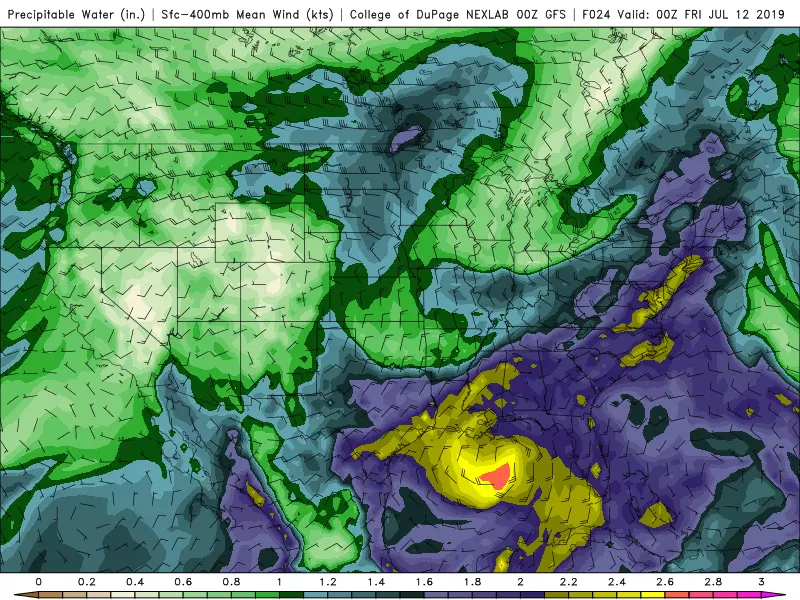
Thursday's weather story begins way down south in the Gulf of Mexico. A tropical disturbance — currently named Potential Tropical Cyclone Two — is bringing some incredibly heavy rain and severe flooding to the Louisiana and Mississippi coast. The deep moisture from that system will stretch all the way up the Atlantic seaboard to New Jersey, which will have two impacts on our Thursday forecast: 1.) increased humidity, and 2.) enhanced rainfall.
It is going to get very uncomfortable Thursday, as dew points soar into the 70s. While the day will start with some hazy sunshine, clouds will increase steadily. High temperatures will be slightly cooler than the past few days, in the mid 80s. (But because of the high humidity, you're definitely going to sweat!)
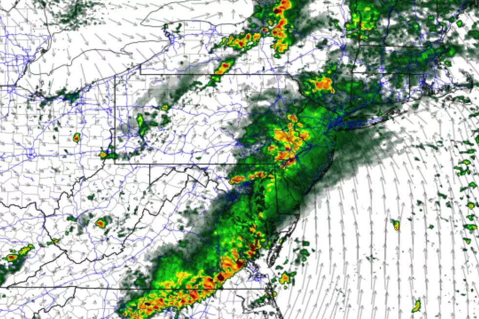
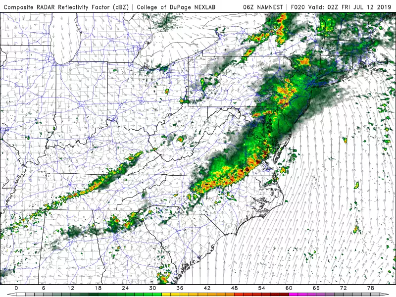
An approaching cold front will begin to spark some thunderstorms Thursday afternoon. Initial rain should be limited to northern and western New Jersey — that means southern and coastal New Jersey will remain mostly dry during the daytime hours.
By Thursday evening, we'll likely see rain spread throughout the entire state.
Rain will not exit New Jersey until early Friday morning.
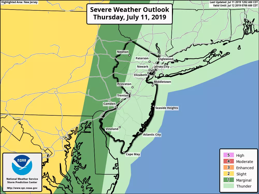
There is a chance for severe weather from these storms, especially at onset during the heat of the afternoon. However, it's not a "slam dunk" situation, so only western New Jersey finds itself in a marginal (low) risk of damaging winds.
The rain potential, however, is concerning. 1 to 2 inches of rain, falling over a short period of time, will be more than enough to cause some flooding and ponding issues.
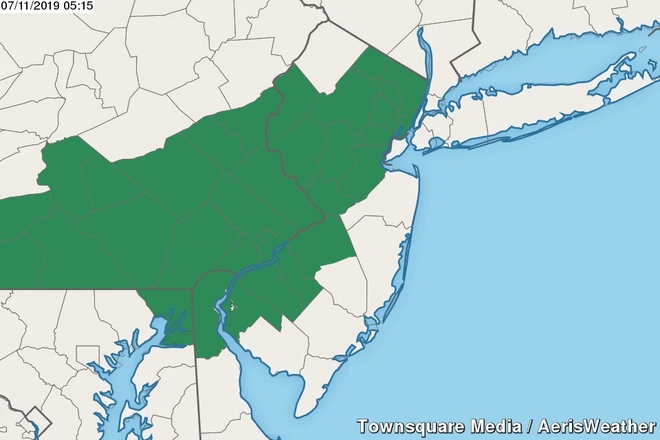
A Flash Flood Watch has been issued for the 15 counties of the state most likely and most vulnerable to potential flooding:
—From 2 p.m. Thursday to 1 a.m. Friday... NW Burlington, Camden, Gloucester, Hunterdon, Mercer, Middlesex, Morris, Salem, Somerset, and Warren.
—From 4 p.m. Thursday to 2 a.m. Friday... Bergen, Essex, Hudson, Passaic, and Union.
Overnight low temperatures will only fall into the lower 70s — still pretty steamy.
As you wake up Friday morning, you'll be greeted by lingering clouds and maybe even a leftover shower. Then skies become mostly sunny, a fresh northwest breeze will kick up, and humidity levels will gradually lower through Friday afternoon.
Don't let that whole "cold front" thing fool you — Friday will actually be warmer than Thursday, with highs pushing back into the upper 80s to around 90 degrees.
The forecast for the upcoming weekend still looks good, especially if you like it hot! The chance for a spot shower or storm is not quite zero, but I'm strongly leaning toward dry weather. Saturday looks sunny with highs around 90 degrees. (Closer to 80 along the Jersey Shore.) A few extra clouds will dot the sky on Sunday (let's call it partly sunny), with inland highs again close to the 90-degree mark. Humidity levels will be reasonable..
For next week, Monday looks great, before heat and humidity potentially surge again for Tuesday and Wednesday. Could we suffer a few days of truly "dangerous" heat midweek? Could we see direct impacts from the remnants of Potential Tropical Cyclone Two late-week? Stay tuned!
Dan Zarrow is Chief Meteorologist for Townsquare Media New Jersey. Follow him on Facebook or Twitter for the latest forecast and realtime weather updates.
More From New Jersey 101.5 FM


